Fishes Snake River
River · Greater Yellowstone · Wyoming
Snake River Fishing Guides
The Jackson Hole float, running under the Tetons from Jackson Lake Dam to Astoria and beyond, with native Snake River fine-spotted cutthroat that eat dry flies most of the summer.
Map of the Snake River
29 numbered points: 11 access points, 5 campsites, 1 bait & fly shop, 3 parks and conservation areas, 1 agency office, 2 regulation section limits, 2 hazards, 1 USGS gauge, 3 points of interest. Tap a marker for details. Reviewed Sep 15, 2026.
- Access / boat ramp (11)
- Campsite (5)
- Bait, tackle & fly shop (1)
- Park / conservation area (3)
- Agency / conservation office (1)
- Regulation section limit (2)
- Dam / hazard (2)
- USGS gauge (1)
- Point of interest (3)
Map data © OpenStreetMap contributors. Points are curated from OpenStreetMap and state agency sources; confirm access and hours before you go.
Print it. Bag it. Bring it.Phones die, screens crack, and most of this water has no signal. Print this map, fold it into a zip-top bag or dry bag with your license, and you have a backup your electronics can’t give you. Every marker is numbered so you can say exactly where you are.
Open the printable mapAll 29 points on this map
| # | Point | Type | Lat, Lon | Notes |
|---|---|---|---|---|
| 1 | Jackson Lake Dam Boat Launch Grand Teton NP · below Jackson Lake Dam | Access / boat ramp | 43.85825, -110.58562 | Upstream limit of the float. The ramp sits immediately below the dam; flows on the whole reach are set by Bureau of Reclamation releases here. |
| 2 | Cattleman's Bridge Landing Grand Teton NP · Pacific Creek Road | Access / boat ramp | 43.85641, -110.55329 | Short first reach down to Pacific Creek. The OSM bridge node 17 m away is the same site. |
| 3 | Pacific Creek Landing Grand Teton NP · slipway | Access / boat ramp | 43.84574, -110.51785 | Standard put-in for the Pacific Creek to Deadman's Bar run. |
| 4 | Grand Teton National Park — Moran Entrance Entrance station · US 26/89/191 | Agency / conservation office | 43.84394, -110.51219 | Park pass sold here; the boating permit for the Snake inside the park is separate. |
| 5 | Snake River Overlook Grand Teton NP · US 26/89/191 turnout | Point of interest | 43.75390, -110.62409 | The classic view down the braided river to the Tetons; a roadside turnout, not an access. |
| 6 | Schwabacher Landing Grand Teton NP · Schwabacher Road | Access / boat ramp | 43.71151, -110.67059 | Mapped in OpenStreetMap only as a trailhead, not a ramp; the landing is at the end of Schwabacher Road. |
| 7 | Menor's Ferry Historic District Grand Teton NP · historic crossing | Point of interest | 43.65881, -110.71329 | The original Snake River ferry crossing at Moose, beside the modern landing. OSM spells it "Menors". |
| 8 | Dornans, Moose Store, deli, fuel and cabins | Point of interest | 43.65681, -110.71209 | The only services at Moose Landing — grocery, deli and fuel within 100 m of the ramp. |
| 9 | Moose Landing Grand Teton NP · slipway | Access / boat ramp | 43.65619, -110.71405 | Main park landing and the usual take-out from Deadman's Bar. Two OSM nodes 3 m apart merged. |
| 10 | USGS 13013650 — Snake River at Moose USGS streamgage | USGS gauge | 43.65406, -110.71547 | Reference gauge for the whole Jackson Hole reach. |
| 11 | Laurance S. Rockefeller Preserve Grand Teton NP · preserve | Park / conservation area | 43.62636, -110.77416 | Foot access and interpretive centre on the west bank; no boat ramp. |
| 12 | Westbank Anglers Wilson · fly shop | Bait, tackle & fly shop | 43.53278, -110.83779 | Full fly shop and guide service on the west bank at Wilson. |
| 13 | Fireside RV Park Wilson · private RV park | Campsite | 43.52017, -110.83845 | |
| 14 | Rendezvous Park Teton County · riverside park | Park / conservation area | 43.50239, -110.84308 | Known locally as R Park; ponds and river frontage just above the Wilson bridge. |
| 15 | Wilson Boat Ramp Teton County · Wilson bridge | Access / boat ramp | 43.50017, -110.84083 | The Wilson bridge ramp, and the usual take-out for floats out of Moose. |
| 16 | WGFD Area 1 — section limit at Wilson Bridge (WY 22) Boundary between two Area 1 sections | Regulation section limit | 43.50017, -110.84083 | Wyoming Game and Fish Area 1 divides the Snake at this bridge: the reach above runs up to the gauging station below Jackson Lake dam, the reach below runs to Palisades Reservoir. Limits are published by WGFD. |
| 17 | Emily Stevens Park Wilson · town park | Park / conservation area | 43.49958, -110.83612 | |
| 18 | Pritchard Boat Ramp Below Hoback Junction | Access / boat ramp | 43.29161, -110.79080 | Last ramp above the canyon whitewater. |
| 19 | Elbow Boating Site Bridger-Teton NF · US 26/89 | Access / boat ramp | 43.21366, -110.78840 | Boating site and ramp merged from two OSM features 15 m apart. |
| 20 | East Table Creek Campground Bridger-Teton NF | Campsite | 43.21171, -110.80728 | The group site 40 m away is part of the same campground and is not listed separately. |
| 21 | East Table Boating Site Bridger-Teton NF · US 26/89 | Access / boat ramp | 43.21128, -110.81082 | |
| 22 | West Table Boating Site Bridger-Teton NF · US 26/89 | Access / boat ramp | 43.20530, -110.82328 | Standard put-in for the Snake River Canyon whitewater run. |
| 23 | Station Creek Campground Bridger-Teton NF | Campsite | 43.20462, -110.83380 | |
| 24 | Wolf Creek Campground Bridger-Teton NF | Campsite | 43.19866, -110.89881 | |
| 25 | Big Kahuna Snake River Canyon · rapid | Dam / hazard | 43.19503, -110.91615 | Big wave immediately above Lunch Counter; the pair are the canyon's best-known water. |
| 26 | Lunch Counter Snake River Canyon · rapid | Dam / hazard | 43.19654, -110.91871 | The canyon's signature wave, just below Big Kahuna. |
| 27 | Sheep Gulch Boating Site Bridger-Teton NF · US 26/89 | Access / boat ramp | 43.18541, -110.95685 | Standard take-out for the canyon run. |
| 28 | WGFD Area 1 — section lower limit at Sheep Gulch boat ramp Lower limit of the Teton County park reach | Regulation section limit | 43.18541, -110.95685 | Wyoming Game and Fish Area 1 runs one section from the Grand Teton National Park boundary down to this ramp. Limits are published by WGFD. |
| 29 | Greys River Cove RV Park Alpine · private RV park | Campsite | 43.16446, -111.01544 | Near the Snake's arm of Palisades Reservoir, the downstream limit of the reach. |
Guides on the Snake River
Claimed profiles take booking requests. Unclaimed profiles are built from public records so the river is never empty; the guide can claim or remove one any time.
About the Snake River
The Snake River through Jackson Hole is the postcard float of American fly fishing and, more usefully, one of the few large western rivers where a native trout still dominates. The Snake River fine-spotted cutthroat is aggressive, opportunistic and willing to eat a large dry fly all summer, which is why so many guided days here are spent throwing chubbies and foam attractors from a drift boat rather than nymphing.
The river changes character in sections. From Jackson Lake Dam to Pacific Creek it is a controlled tailwater with clear water and heavy summer float traffic, much of it scenic rather than fishing. Pacific Creek to Deadmans Bar is braided, fast and full of logjams, a reach where guides earn their fee at the oars. Deadmans Bar to Moose is the classic run under the Teton front. Below Moose the river opens through the South Park water and then into the Snake River Canyon toward Astoria and Alpine, where whitewater and fishing overlap.
The Moose gauge is the one everybody watches. Dam releases from Jackson Lake drive it, and it changes fast when the Bureau of Reclamation adjusts flows for downstream irrigation. Roughly 2,500 to 5,000 cfs makes for comfortable, well-defined fishing water; much above that and the braids get pushy and the fish move to the banks; much below and the channels get thin and rocky. Because the river braids, a channel that floated fine last week can be blocked by new wood this week.
Jackson is the base for nearly all of it. Boat traffic in July and August is heavy, permits and launch etiquette matter, and the weather can turn from summer to winter in an afternoon. Grand Teton National Park regulations apply on the upper reaches.
This water needs a real photo
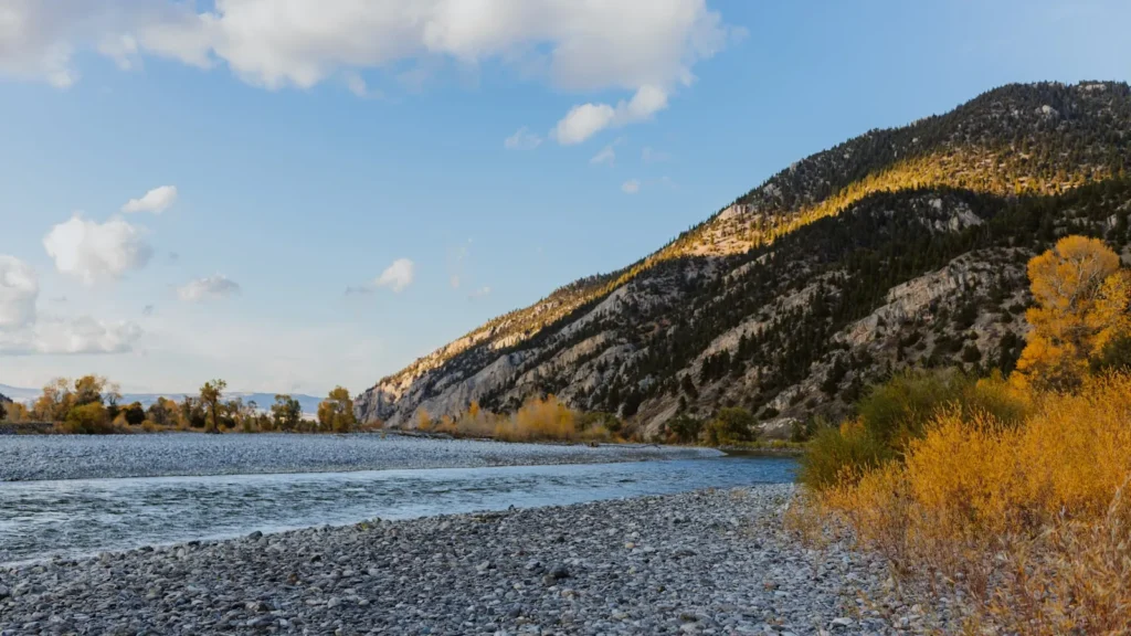
The photo at the top of this page is not Snake River.
It is a regional stand-in, honestly captioned but generic — we will not put a name to a river we cannot prove. Send us a photograph you took here and it replaces the stand-in, with your credit on it.
Pioneer badgeUnclaimed
Add a photo of this water
Landscape, not fish — the water itself. Reviewed by hand before it appears. The first one published here earns the Pioneer badge.
Fished this water? Add a photo
Reviewed by hand before it appears. Pick the water, not the spot — we never publish exact locations.
Access
Jackson Lake Dam: top of the river, park access with a ramp.
Pacific Creek Landing: park boat launch, start of the braided water.
Deadmans Bar: park ramp, the put-in for the classic Teton float.
Moose Landing: park ramp at the gauge and Craig Thomas Visitor Center, the standard takeout.
Wilson Bridge and South Park Bridge: county accesses on the valley floor below the park.
Astoria and West Table: canyon accesses used by both fishing and whitewater outfitters.
Grand Teton National Park requires boat permits and an inspection for aquatic invasive species.
Seasons
April and May: early season on the lower river, high and cold up top, runoff building.
June: runoff peaks; most guided fishing moves to the tailwater reach below Jackson Lake Dam.
July through September: the main season, big dry flies, cutthroat looking up, heaviest float traffic in July and August.
October: the best month for many guides, low clear water, hopper leftovers and streamers, first snow on the Tetons.
From the water
No logged trips yet. Be the first to put this water on your map.
Log this water
Fished it or cleaned it? Log in or create a free account to log a trip with photos and earn the waterway badge.
Questions
What is the current flow on the Snake River?
As of Oct 19, 2:00 am, the USGS gauge SNAKE RIVER AT MOOSE, WY reads 1,010 cfs, the 48th percentile for this date. Conditions update every 15 minutes.
What species can you catch on the Snake River?
Anglers target Brown Trout, Lake Trout, Mountain Whitefish, Rainbow Trout, Snake River Fine-Spotted Cutthroat Trout on the Snake River in Wyoming.
Are there fishing guides on the Snake River?
GuidedFloats lists 5 guides and outfitters on the Snake River. Claimed profiles accept booking requests; unclaimed profiles are built from public records and link to the business.
Where can you access the Snake River?
Jackson Lake Dam: top of the river, park access with a ramp. Pacific Creek Landing: park boat launch, start of the braided water. Deadmans Bar: park ramp, the put-in for the classic Teton float. Moose Landing: park ramp at the gauge and Craig Thomas Visitor Center, the standard takeout. Wilson Bridge and South Park Bridge: county accesses on the valley floor below the park. Astoria and West Table: canyon accesses used by both fishing and whitewater outfitters. Grand Teton National Park requires boat permits and an inspection for aquatic invasive species.
When is the best time to fish the Snake River?
April and May: early season on the lower river, high and cold up top, runoff building. June: runoff peaks; most guided fishing moves to the tailwater reach below Jackson Lake Dam. July through September: the main season, big dry flies, cutthroat looking up, heaviest float traffic in July and August. October: the best month for many guides, low clear water, hopper leftovers and streamers, first snow on the Tetons.
Where are the fishing regulations for the Snake River?
Regulations change by season and section. Read the current rules on the Wyoming agency site: https://wgfd.wyo.gov/Regulations/Fish/Fishing-Regulation