Beta

GuidedFloats is in beta. The full site launches March 1, 2027. The mobile app follows.

Guides: claim before March 1, 2027 and your first full season of Premium is free. Claim your founding spot →

HomeWatersColorado › Taylor River
River · Taylor Park and the Taylor Canyon in Gunnison County, central Colorado, running down to Almont and the Gunnison River · Colorado

Taylor River Fishing Guides

A high Gunnison County trout river above and below Taylor Park Reservoir, with meadow water in the park and a famous canyon reach running down to Almont.
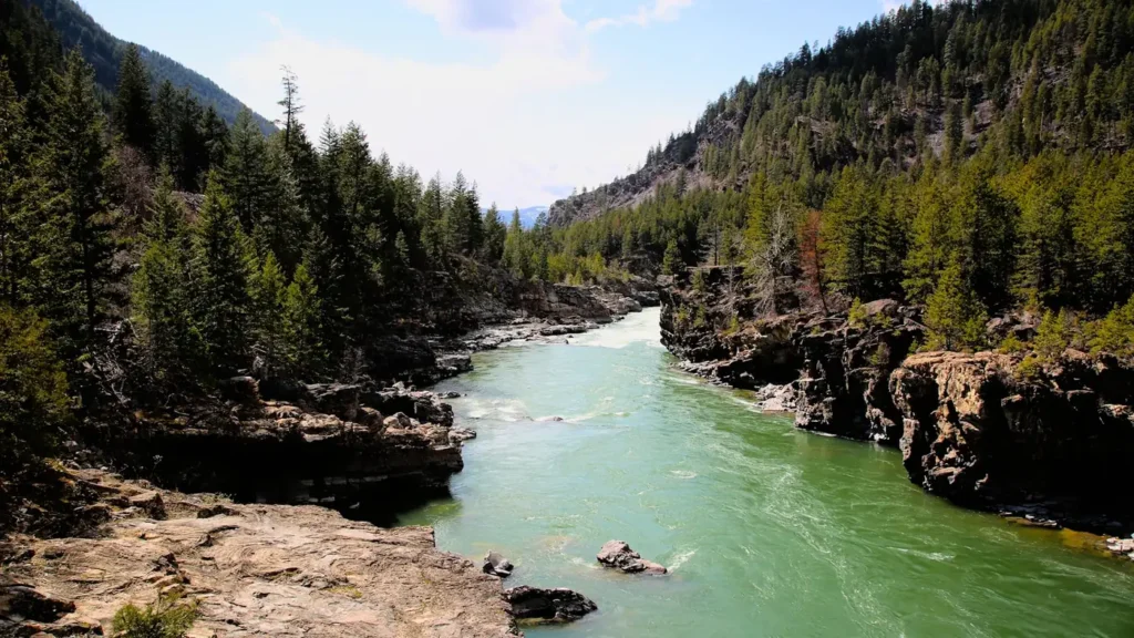
A mountain river running clear through conifer forest in the Rockies

Map of the Taylor River

10 numbered points: 1 access point, 7 campsites, 1 hazard, 1 USGS gauge. Tap a marker for details. Reviewed Sep 8, 2026.

Printable version →
  • Access / boat ramp (1)
  • Campsite (7)
  • Dam / hazard (1)
  • USGS gauge (1)
Map data © OpenStreetMap contributors. Points are curated from OpenStreetMap and state agency sources; confirm access and hours before you go.

Print it. Bag it. Bring it.Phones die, screens crack, and most of this water has no signal. Print this map, fold it into a zip-top bag or dry bag with your license, and you have a backup your electronics can’t give you. Every marker is numbered so you can say exactly where you are.

Open the printable map
All 10 points on this map
#PointTypeLat, LonNotes
1USGS 09107000 — Taylor River at Taylor Park
USGS streamgage · above the reservoir
USGS gauge38.86027, -106.56670This gauge sits in Taylor Park above the reservoir, so it reads the inflow rather than the tailwater release.
2Taylor Park Dam
Bureau of Reclamation
Dam / hazard38.81840, -106.60573The head of the tailwater; the catch-and-release water starts immediately below.
3Lottis Creek Campground
USFS · Gunnison National Forest
Campsite38.77605, -106.62497Forest Service campground on the Taylor River Road.
4Cold Spring Campground
USFS · Taylor River Road
Campsite38.76739, -106.64342Forest Service campground on the river.
5Lodgepole Campground
USFS · Taylor River Road
Campsite38.76141, -106.66223Forest Service campground on the river.
6Rosy Lane Campground
USFS · Taylor River Road
Campsite38.73090, -106.74709Forest Service campground on the river.
7North Bank Campground
USFS · Taylor River Road
Campsite38.72961, -106.75868Forest Service campground on the river.
8One Mile Campground
USFS · One Mile Campground Road
Campsite38.72875, -106.75740Forest Service campground a mile above Almont.
9Granite Campground
USFS · Taylor River Road
Campsite38.72631, -106.76764Forest Service campground; OSM maps the tent loop and the parking separately at the same site.
10Boat ramp on Endner Lane, Almont
Unnamed slipway · OSM 'Endner Lane'
Access / boat ramp38.66524, -106.84365Mapped ramp at Almont, where the Taylor and the East join to make the Gunnison.

Guides on the Taylor River

Claimed profiles take booking requests. Unclaimed profiles are built from public records so the river is never empty; the guide can claim or remove one any time.

About the Taylor River

The Taylor drains the high country east of Crested Butte and it exists in two distinct halves. Above Taylor Park Reservoir, where this gauge is located, the river runs through the broad open meadows of Taylor Park at over nine thousand feet, a classic western meadow stream with undercut banks, willow-lined bends and a mixed population of browns, rainbows, cutthroat and brook trout. Below the reservoir the river drops into the Taylor Canyon and becomes the reach most anglers picture: cold, clear, heavily fished and known for very large fish in the water immediately below the dam.

The upper meadow water is the quieter half and the one this station describes. It fishes best from midsummer through early autumn, when the high country is finally accessible and the meadows produce good hatches of mayflies and caddis along with strong terrestrial fishing in August. The water is small enough to fish with a short rod and light tippet, and it rewards anglers willing to walk between the road crossings. Kokanee salmon run out of the reservoir in the fall and are a notable late-season feature of this system.

Elevation controls everything here. The park is snowbound for a long winter and access roads over Cottonwood Pass and up the canyon are seasonal, so the practical fishing year is short and concentrated. Runoff arrives late and can hold the river high into early summer. Below the reservoir the river behaves as a managed release rather than a freestone, which is why conditions on the canyon reach and conditions here can differ sharply on the same day. Regulations differ by section as well, with special rules on the water immediately below the dam, so check the current rules for the exact stretch before fishing.

This water needs a real photo

The photo at the top of this page is not Taylor River.

It is a regional stand-in, honestly captioned but generic — we will not put a name to a river we cannot prove. Send us a photograph you took here and it replaces the stand-in, with your credit on it.

Add a photo of this water See the badges

Pioneer badgeUnclaimed

Add a photo of this water

Landscape, not fish — the water itself. Reviewed by hand before it appears. The first one published here earns the Pioneer badge.

Never published. It is how the badge is held for you until member accounts open.

Posting to Taylor River.

JPG, PNG or WebP, up to 12 MB. Landscape orientation looks best at the top of the page. We resize it and strip the location data out of the file.

The name printed under the photo and on your badge. Leave blank to stay anonymous.

Reader photo license v1.0 — the short version:

  • You grant Guided Floats, LLC a non-exclusive, royalty-free license to publish, resize and crop your photo on guidedfloats.com and in GuidedFloats’ own social posts and apps. You keep the copyright and can use the photo anywhere else.
  • You confirm that you took the photo yourself, that publishing it does not infringe anyone else’s rights, and that anyone recognisable in it (or a parent or guardian, if they are under 18) is happy for it to appear here.
  • Credit is printed beside the photo wherever it appears on the site, using the credit name you give us. Leave it blank and we use your name; write “Anonymous” for no name. Your email address is never published.
  • Withdrawing is one email to hello@guidedfloats.com naming the photo. It comes off the site within 7 days.
Read the full license

Version 1.0, dated 6 September 2026. Applies to every photograph submitted to GuidedFloats through the contact form, a species page, or the community board.

1. What you give us

By ticking the box on the form you grant Guided Floats, LLC (“GuidedFloats”, “we”) a non-exclusive, worldwide, royalty-free license to store, copy, resize, crop and display your photograph on guidedfloats.com, in GuidedFloats’ own social media accounts and mobile apps, and in material that promotes the site itself, in connection with the fish, water or community feature you sent it in for. The license lasts until you withdraw it (section 4).

You keep the copyright. The license is not exclusive, so you can use the photo anywhere else and license it to anyone else. We will not sell your photo, license it on to anyone else on its own, or use it in paid advertising for a third party.

2. What you confirm

You confirm that you took the photograph yourself (or otherwise own the rights to it), that you have the right to grant this license, and that publishing the photo does not infringe anyone else’s copyright, privacy or other rights.

If any person is recognisable in the photo, you confirm that they have agreed to its being published here, and that a parent or guardian has agreed on behalf of anyone under 18. Please do not send photographs of other people’s catches, screenshots, or pictures copied from other websites or social media.

3. Credit

We print the credit name you give us beside the photo wherever it appears on the site, and record it as the photo’s creator in the page’s structured data. If you leave the credit blank we use the name you gave us on the form. Write “Anonymous” if you prefer no name at all. Your email address, phone number and the exact spot the photo was taken are never published.

4. Withdrawing the license

You can withdraw the license at any time by emailing hello@guidedfloats.com, or by using the contact form, and telling us which photo you mean. We will remove the photo from guidedfloats.com within 7 days of receiving your message and stop using it in anything new. Copies that are already outside our control — search-engine caches, social posts that have already gone out, printed material already produced — may take longer to disappear or may not be recallable, and we are not responsible for those.

5. What we may do

We choose which photos to publish and may decline any submission without giving a reason. We may crop, resize, sharpen or colour-correct a photo for display, and we may remove a photo at any time. We will not alter a photo in a way that misrepresents the fish, the water or you.

6. Your details

We keep your name, email address, the credit name, the water and date you gave us, and the network address the submission came from, with the submission record, as our evidence of this license. We hold that record for as long as the photo is published and for the retention period described in our privacy policy. Location data that your camera or phone embedded in the file is removed before the photo is published.

7. Versions

The version of this license you accepted is stored with your submission and printed with the photo. A later version does not apply to a photo you have already sent unless you agree to it.

Fished this water? Add a photo

Reviewed by hand before it appears. Pick the water, not the spot — we never publish exact locations.

Never published. We use it only if we need to ask about the photo.

Posting to Taylor River.

JPG, PNG or WebP, up to 12 MB. We resize it and strip the location data out of the file.

The name shown under the photo. Leave blank to stay anonymous.

Reader photo license v1.0 — the short version:

  • You grant Guided Floats, LLC a non-exclusive, royalty-free license to publish, resize and crop your photo on guidedfloats.com and in GuidedFloats’ own social posts and apps. You keep the copyright and can use the photo anywhere else.
  • You confirm that you took the photo yourself, that publishing it does not infringe anyone else’s rights, and that anyone recognisable in it (or a parent or guardian, if they are under 18) is happy for it to appear here.
  • Credit is printed beside the photo wherever it appears on the site, using the credit name you give us. Leave it blank and we use your name; write “Anonymous” for no name. Your email address is never published.
  • Withdrawing is one email to hello@guidedfloats.com naming the photo. It comes off the site within 7 days.
Read the full license

Version 1.0, dated 6 September 2026. Applies to every photograph submitted to GuidedFloats through the contact form, a species page, or the community board.

1. What you give us

By ticking the box on the form you grant Guided Floats, LLC (“GuidedFloats”, “we”) a non-exclusive, worldwide, royalty-free license to store, copy, resize, crop and display your photograph on guidedfloats.com, in GuidedFloats’ own social media accounts and mobile apps, and in material that promotes the site itself, in connection with the fish, water or community feature you sent it in for. The license lasts until you withdraw it (section 4).

You keep the copyright. The license is not exclusive, so you can use the photo anywhere else and license it to anyone else. We will not sell your photo, license it on to anyone else on its own, or use it in paid advertising for a third party.

2. What you confirm

You confirm that you took the photograph yourself (or otherwise own the rights to it), that you have the right to grant this license, and that publishing the photo does not infringe anyone else’s copyright, privacy or other rights.

If any person is recognisable in the photo, you confirm that they have agreed to its being published here, and that a parent or guardian has agreed on behalf of anyone under 18. Please do not send photographs of other people’s catches, screenshots, or pictures copied from other websites or social media.

3. Credit

We print the credit name you give us beside the photo wherever it appears on the site, and record it as the photo’s creator in the page’s structured data. If you leave the credit blank we use the name you gave us on the form. Write “Anonymous” if you prefer no name at all. Your email address, phone number and the exact spot the photo was taken are never published.

4. Withdrawing the license

You can withdraw the license at any time by emailing hello@guidedfloats.com, or by using the contact form, and telling us which photo you mean. We will remove the photo from guidedfloats.com within 7 days of receiving your message and stop using it in anything new. Copies that are already outside our control — search-engine caches, social posts that have already gone out, printed material already produced — may take longer to disappear or may not be recallable, and we are not responsible for those.

5. What we may do

We choose which photos to publish and may decline any submission without giving a reason. We may crop, resize, sharpen or colour-correct a photo for display, and we may remove a photo at any time. We will not alter a photo in a way that misrepresents the fish, the water or you.

6. Your details

We keep your name, email address, the credit name, the water and date you gave us, and the network address the submission came from, with the submission record, as our evidence of this license. We hold that record for as long as the photo is published and for the retention period described in our privacy policy. Location data that your camera or phone embedded in the file is removed before the photo is published.

7. Versions

The version of this license you accepted is stored with your submission and printed with the photo. A later version does not apply to a photo you have already sent unless you agree to it.

Access

Taylor Park meadow pull-offs on Forest Service Road 742 - the main access to the upper river near the gauge.
Taylor Park Trading Post area - central parking and services in the park.
Dinner Station Campground - developed upper river access with camping.
Lottis Creek Campground in the canyon - developed access below the reservoir.
Taylor River Road pull-offs below the dam - numerous roadside spots on the canyon reach.
Harmels and Almont area access - lower canyon water near the Gunnison confluence.
Almont at the East River confluence - the bottom of the Taylor and the start of the Gunnison.

Seasons

Spring: still snowbound in the park through much of the season, with access opening late and runoff building.
Summer: the prime window, good mayfly and caddis hatches in the meadows and strong terrestrial fishing by August.
Fall: cool, clear and excellent, with kokanee running out of the reservoir and brown trout coloring up.
Winter: the park is effectively closed by snow, while the canyon below the dam stays fishable on mild days.

From the water

No logged trips yet. Be the first to put this water on your map.

Log this water

Fished it or cleaned it? Log in or create a free account to log a trip with photos and earn the waterway badge.

Questions

What is the current flow on the Taylor River?

As of Sep 17, 6:00 am, the USGS gauge TAYLOR RIVER AT TAYLOR PARK, CO. reads 37 cfs, with water temperature 52 F. Conditions update every 15 minutes.

What species can you catch on the Taylor River?

Anglers target Brook Trout, Brown Trout, Cutthroat Trout, Kokanee Salmon, Mountain Whitefish, Rainbow Trout on the Taylor River in Colorado.

Are there fishing guides on the Taylor River?

GuidedFloats lists 2 guides and outfitters on the Taylor River. Claimed profiles accept booking requests; unclaimed profiles are built from public records and link to the business.

Where can you access the Taylor River?

Taylor Park meadow pull-offs on Forest Service Road 742 - the main access to the upper river near the gauge. Taylor Park Trading Post area - central parking and services in the park. Dinner Station Campground - developed upper river access with camping. Lottis Creek Campground in the canyon - developed access below the reservoir. Taylor River Road pull-offs below the dam - numerous roadside spots on the canyon reach. Harmels and Almont area access - lower canyon water near the Gunnison confluence. Almont at the East River confluence - the bottom of the Taylor and the start of the Gunnison.

When is the best time to fish the Taylor River?

Spring: still snowbound in the park through much of the season, with access opening late and runoff building. Summer: the prime window, good mayfly and caddis hatches in the meadows and strong terrestrial fishing by August. Fall: cool, clear and excellent, with kokanee running out of the reservoir and brown trout coloring up. Winter: the park is effectively closed by snow, while the canyon below the dam stays fishable on mild days.

Where are the fishing regulations for the Taylor River?

Regulations change by season and section. Read the current rules on the Colorado agency site: https://cpw.state.co.us/rules-and-regulations