Willowemoc Creek Fishing Guides
The birthplace of American dry-fly fishing, a classic Catskill freestone creek meeting the Beaverkill at Junction Pool in Roscoe with wild browns and famous hatches.
Map of the Willowemoc Creek
25 numbered points: 11 access points, 1 campsite, 4 bait & fly shops, 3 bridges, 1 park or conservation area, 2 regulation section limits, 1 USGS gauge, 2 points of interest. Tap a marker for details. Reviewed Sep 21, 2026.
- Access / boat ramp (11)
- Campsite (1)
- Bait, tackle & fly shop (4)
- Bridge crossing (3)
- Park / conservation area (1)
- Regulation section limit (2)
- USGS gauge (1)
- Point of interest (2)
Print it. Bag it. Bring it.Phones die, screens crack, and most of this water has no signal. Print this map, fold it into a zip-top bag or dry bag with your license, and you have a backup your electronics can’t give you. Every marker is numbered so you can say exactly where you are.
Open the printable mapAll 25 points on this map
| # | Point | Type | Lat, Lon | Notes |
|---|---|---|---|---|
| 1 | Upper stocked-extended reach, upper limit Fir Brook confluence | Regulation section limit | 41.92496, -74.65468 | DEC's upper stocked-extended reach runs from the downstream end of the Willowemoc Wild Forest upstream to the Fir Brook confluence. This marker is the Fir Brook end; the forest boundary is not mapped, so the other limit is not shown. |
| 2 | Willowemoc Campground Willowemoc | Campsite | 41.92383, -74.65591 | Campground on the creek in the headwaters, just below the Fir Brook mouth. |
| 3 | Public fishing rights parking, Willowemoc Road NYSDEC, Willowemoc hamlet | Access / boat ramp | 41.91806, -74.67033 | NYSDEC public fishing rights parking. The state publishes the location of every lot but no name for it, so this point is named for the road it sits on. |
| 4 | Public fishing rights parking, Willowemoc Road (DeBruce) NYSDEC, DeBruce | Access / boat ramp | 41.91191, -74.69509 | NYSDEC public fishing rights parking. The state publishes the location of every lot but no name for it, so this point is named for the road it sits on. |
| 5 | Willowemoc Covered Bridge Conklin Hill Road | Bridge crossing | 41.90671, -74.69944 | Covered bridge on Conklin Hill Road above DeBruce; a DEC angler parking area sits at the crossing. |
| 6 | Public fishing rights parking below DeBruce NYSDEC, Willowemoc Road | Access / boat ramp | 41.91264, -74.70692 | NYSDEC public fishing rights parking. The state publishes the location of every lot but no name for it, so this point is named for the road it sits on. |
| 7 | Public fishing rights parking, DeBruce Road NYSDEC, Parkston | Access / boat ramp | 41.90184, -74.78047 | NYSDEC public fishing rights parking. The state publishes the location of every lot but no name for it, so this point is named for the road it sits on. |
| 8 | Public fishing rights parking, DeBruce Road (lower) NYSDEC, Parkston | Access / boat ramp | 41.90314, -74.80071 | NYSDEC public fishing rights parking. The state publishes the location of every lot but no name for it, so this point is named for the road it sits on. |
| 9 | USGS gauge 01419500, Willowemoc Creek near Livingston Manor DeBruce Road | USGS gauge | 41.90353, -74.81275 | The creek's reference gauge. A public fishing rights parking area sits at the gauge. |
| 10 | Public fishing rights parking at the Quickway crossing NYSDEC, DeBruce Road | Access / boat ramp | 41.90658, -74.81895 | NYSDEC public fishing rights parking. The state publishes the location of every lot but no name for it, so this point is named for the road it sits on. It sits beside the NY 17 crossing. |
| 11 | Dette Flies 13 Main Street, Livingston Manor | Bait, tackle & fly shop | 41.90215, -74.82513 | Fly shop and fly tyers, open daily. Placed from the shop's own published address; it moved here from Roscoe, so older listings are stale. |
| 12 | Main Street bridge, Livingston Manor Livingston Manor | Bridge crossing | 41.90043, -74.82853 | The village crossing, with the shops and the diner a block away. |
| 13 | Livingston Manor Covered Bridge Park Van Tran Flat covered bridge, Covered Bridge Road | Park / conservation area | 41.91392, -74.83148 | Town park on the creek at the Van Tran Flat covered bridge, with parking, swimming water and a long run below the bridge. |
| 14 | Public fishing rights parking, Old Route 17 NYSDEC, Deckertown | Access / boat ramp | 41.92644, -74.84002 | NYSDEC public fishing rights parking. The state publishes the location of every lot but no name for it, so this point is named for the road it sits on. |
| 15 | Catskill Fly Fishing Center and Museum 1031 Old Route 17, Livingston Manor | Point of interest | 41.92687, -74.84275 | The museum of American fly fishing, with casting ponds and public creek frontage. Placed from its published street address; it is not mapped in OpenStreetMap. |
| 16 | Public fishing rights parking, Old Route 17 (Hazel) NYSDEC, Hazel | Access / boat ramp | 41.92840, -74.84871 | NYSDEC public fishing rights parking. The state publishes the location of every lot but no name for it, so this point is named for the road it sits on. |
| 17 | Public fishing rights parking, Hazel Road NYSDEC, Deckertown | Access / boat ramp | 41.92362, -74.85838 | NYSDEC public fishing rights parking. The state publishes the location of every lot but no name for it, so this point is named for the road it sits on. |
| 18 | Public fishing rights parking, Wegman Road NYSDEC, Hazel | Access / boat ramp | 41.92698, -74.86829 | NYSDEC public fishing rights parking. The state publishes the location of every lot but no name for it, so this point is named for the road it sits on. |
| 19 | Willowemoc Creek Fishing Access Hazel Road bridge | Access / boat ramp | 41.92597, -74.87547 | The one access on the creek that carries a name in OpenStreetMap. DEC public fishing rights parking is at the Hazel Road bridge here. |
| 20 | Catch-and-release reach, lower limit Second NY 17 Quickway bridge east of Roscoe | Regulation section limit | 41.92625, -74.88642 | DEC's catch-and-release reach runs from the second Route 17 Quickway bridge east of Roscoe upstream 3.5 mi to 1,200 ft above Elm Hollow Brook. Only this end is shown: Elm Hollow Brook is not in OpenStreetMap. |
| 21 | Stewart Avenue bridge, Roscoe Roscoe | Bridge crossing | 41.93024, -74.91488 | The village crossing, with the fly shops on the street above it. |
| 22 | Beaverkill Angler 64 Stewart Avenue, Roscoe | Bait, tackle & fly shop | 41.93271, -74.91290 | Fly shop in Roscoe, a short walk from Junction Pool. |
| 23 | Trout Town Flies 66 Stewart Avenue, Roscoe | Bait, tackle & fly shop | 41.93289, -74.91323 | Fly shop in Roscoe, open daily in season. |
| 24 | Baxter House River Outfitters 47 Stewart Avenue, Roscoe | Bait, tackle & fly shop | 41.93234, -74.91359 | Fly shop and guide service in Roscoe. |
| 25 | Junction Pool Beaver Kill confluence at Roscoe | Point of interest | 41.93517, -74.92102 | The mouth of the creek, where it joins the Beaver Kill at Roscoe. The point is the mapped confluence; the name is anglers' usage rather than an official one. |
Guides on the Willowemoc Creek
Claimed profiles take booking requests. Unclaimed profiles are built from public records so the river is never empty; the guide can claim or remove one any time.
Order on this page: premium and outfitter plans first (labelled Premium placement), then claimed free profiles, then unclaimed — one published price, no bidding for position. How placement works
About the Willowemoc Creek
The Willowemoc is where American dry-fly fishing was worked out, and it is still fished in much the same spirit. It rises in the Willowemoc Wild Forest, runs west past Livingston Manor through a mix of hemlock shade and open meadow, and joins the Beaverkill at Junction Pool in Roscoe, the town that calls itself Trout Town USA. Theodore Gordon fished this water and tied the flies that started the American school, and the Catskill Fly Fishing Center sits on the bank a short drive above the junction.
The creek fishes as a wild brown trout stream with stocked fish mixed in on the lower reaches and native brook trout up in the small headwater branches. Rainbows are present through the middle water. The hatches are the reason to come and the reason people plan trips a year out: Hendricksons in April, the March Browns and Green Drakes through May and into June, and reliable evening caddis all summer where the water stays cold. The classic no-kill stretch above Livingston Manor is the most heavily fished water and also the most productive.
The gauge near Livingston Manor reports discharge, stage and water temperature, and the temperature reading is the important one here. This is a freestone creek without a dam to hold it cold, so by mid-summer the lower water can push into the range where fighting a trout kills it, and responsible anglers move up into the shaded headwaters or fish the Delaware system instead. Access is unusually good for the Northeast, with substantial public fishing rights easements marked along the bank and parking pull-offs on the road that follows the valley. Weekends in the heart of the hatch season are genuinely crowded, so anglers who can fish midweek will find far more water to themselves.
This water needs a real photo
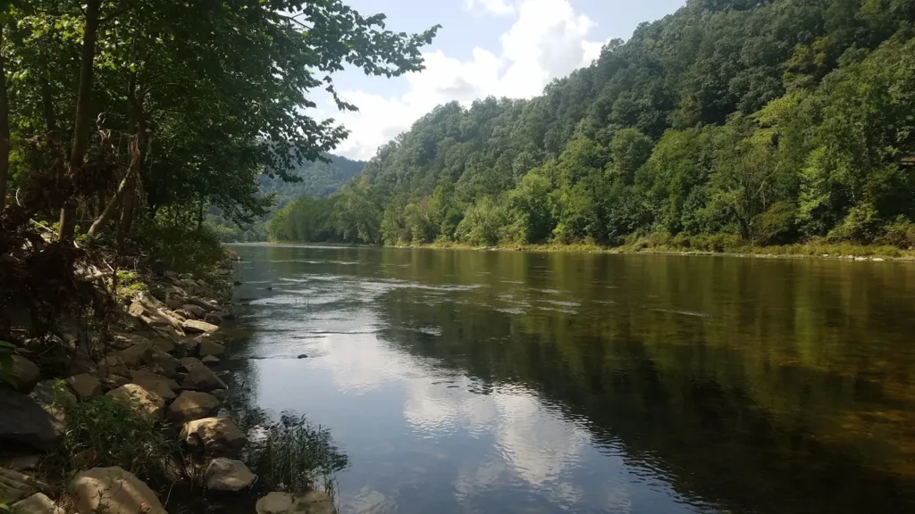
The photo at the top of this page is not Willowemoc Creek.
It is a regional stand-in, honestly captioned but generic — we will not put a name to a river we cannot prove. Send us a photograph you took here and it replaces the stand-in, with your credit on it.
Add a photo of this water
Landscape, not fish — the water itself. Reviewed by hand before it appears. The first one published here earns the Pioneer badge.
Fished this water? Add a photo
Reviewed by hand before it appears. Pick the water, not the spot — we never publish exact locations.
Access
Junction Pool at Roscoe - the confluence with the Beaverkill and the most famous pool on the system.
The no-kill stretch above Livingston Manor - marked catch-and-release water with easement access.
Catskill Fly Fishing Center and Museum - public bank access and the local hatch information.
Covered Bridge Campsite near Livingston Manor - developed access on the middle creek.
Old Route 17 pull-offs between Livingston Manor and Roscoe - roadside access to the lower water.
Willowemoc Wild Forest - walk-in access to the small cold headwater branches.
DeBruce area easements - public fishing rights on the upper creek above the hatchery.
Seasons
Spring: high, cold water and the Hendrickson and March Brown hatches that define the season.
Summer: low and warm on the lower creek - fish the headwaters early and watch the temperature gauge.
Fall: cooling water, good streamer fishing and spawning browns moving up out of the Beaverkill.
Winter: cold and mostly closed to fishing, with limited season on the lower water only.
From the water
No logged trips yet. Be the first to put this water on your map.
Log this water
Fished it or cleaned it? Log in or create a free account to log a trip with photos and earn the waterway badge.
Questions
What is the current flow on the Willowemoc Creek?
As of Nov 2, 7:15 am, the USGS gauge WILLOWEMOC CREEK NR LIVINGSTON MANOR NY reads 39 cfs, with water temperature 42.4 F. Conditions update every 15 minutes.
What species can you catch on the Willowemoc Creek?
Anglers target Brook Trout, Brown Trout, Fallfish, Rainbow Trout, Rock Bass, Smallmouth Bass on the Willowemoc Creek in New York.
Are there fishing guides on the Willowemoc Creek?
GuidedFloats lists 2 guides and outfitters on the Willowemoc Creek. Claimed profiles accept booking requests; unclaimed profiles are built from public records and link to the business.
Where can you access the Willowemoc Creek?
Junction Pool at Roscoe - the confluence with the Beaverkill and the most famous pool on the system. The no-kill stretch above Livingston Manor - marked catch-and-release water with easement access. Catskill Fly Fishing Center and Museum - public bank access and the local hatch information. Covered Bridge Campsite near Livingston Manor - developed access on the middle creek. Old Route 17 pull-offs between Livingston Manor and Roscoe - roadside access to the lower water. Willowemoc Wild Forest - walk-in access to the small cold headwater branches. DeBruce area easements - public fishing rights...
When is the best time to fish the Willowemoc Creek?
Spring: high, cold water and the Hendrickson and March Brown hatches that define the season. Summer: low and warm on the lower creek - fish the headwaters early and watch the temperature gauge. Fall: cooling water, good streamer fishing and spawning browns moving up out of the Beaverkill. Winter: cold and mostly closed to fishing, with limited season on the lower water only.
Where are the fishing regulations for the Willowemoc Creek?
Regulations change by season and section. Read the current rules on the New York agency site: https://dec.ny.gov/things-to-do/freshwater-fishing/regulations