Neversink River Fishing Guides
Theodore Gordon's home river, a steep and intimate Catskill trout stream above Neversink Reservoir with wild browns, brook trout and difficult, rewarding water.
Map of the Neversink River
40 numbered points: 11 access points, 2 campsites, 9 bridges, 9 parks and conservation areas, 3 regulation section limits, 5 hazards, 1 USGS gauge. Tap a marker for details. Reviewed Sep 21, 2026.
- Access / boat ramp (11)
- Campsite (2)
- Bridge crossing (9)
- Park / conservation area (9)
- Regulation section limit (3)
- Dam / hazard (5)
- USGS gauge (1)
Print it. Bag it. Bring it.Phones die, screens crack, and most of this water has no signal. Print this map, fold it into a zip-top bag or dry bag with your license, and you have a backup your electronics can’t give you. Every marker is numbered so you can say exactly where you are.
Open the printable mapAll 40 points on this map
| # | Point | Type | Lat, Lon | Notes |
|---|---|---|---|---|
| 1 | Bungalow Brook Unit NYC DEP Watershed Recreation Unit | Park / conservation area | 41.91343, -74.56846 | DEP watershed land on the upper Neversink at Claryville. A free NYC DEP Access Permit is required on every DEP unit; the unit map linked here shows the parking and the fishable frontage. |
| 2 | Hunter Road bridge Upper Neversink, Claryville | Bridge crossing | 41.89274, -74.58725 | One of only two mapped crossings on the wild headwater reach above Neversink Reservoir. Roadside look at the water; the banks either side are private or DEP. |
| 3 | USGS gauge 01435000 - Neversink River near Claryville Upper Neversink, above the reservoir | USGS gauge | 41.88990, -74.58980 | The upper-river gauge. DEC also lists gauges at Neversink below the dam, at Bridgeville above the Unique Area and at Godeffroy below it - read the one nearest your reach. |
| 4 | Big Bend Drive bridge Upper Neversink | Bridge crossing | 41.88026, -74.61912 | The lower of the two mapped headwater crossings, above the reservoir backwater. |
| 5 | Schumway Road Unit NYC DEP Watershed Recreation Unit | Park / conservation area | 41.86895, -74.62801 | DEP watershed land on the upper Neversink above the reservoir. DEP Access Permit required; the unit map shows the boundary and the parking. |
| 6 | West Neversink Unit NYC DEP Watershed Recreation Unit | Park / conservation area | 41.86737, -74.65046 | DEP unit on the west side of the upper valley. Permit required. The unit centre sits back from the channel - use the DEP map for the walk in. |
| 7 | Chandler Cove Unit NYC DEP Watershed Recreation Unit | Park / conservation area | 41.84032, -74.67327 | DEP unit on the Neversink Reservoir shore. Permit required, and reservoir rowboat rules differ from stream access - check the unit map. |
| 8 | Lindholm Road Unit NYC DEP Watershed Recreation Unit | Park / conservation area | 41.82153, -74.65403 | DEP unit at the south end of Neversink Reservoir, above the dam. Permit required. |
| 9 | Myers Road Unit NYC DEP Watershed Recreation Unit | Park / conservation area | 41.82830, -74.63229 | DEP unit on the east shore beside the dam. Permit required. |
| 10 | Neversink Dam NYC DEP - bottom-release dam | Dam / hazard | 41.82228, -74.64229 | The dam that divides the wild headwaters from the tailwater. It releases from the bottom of the reservoir, which is why the lower river stays cold in summer. No passage; the NY 55 crossing sits just below it. |
| 11 | Public fishing rights parking - Hasbrouck NYSDEC public fishing rights | Access / boat ramp | 41.78189, -74.60877 | State publishes the lot and the water it serves but no name for it; the reverse geocode returns only the hamlet of Hasbrouck. Top of the PFR ladder on the tailwater. |
| 12 | Public fishing rights parking - Hasbrouck Drive NYSDEC public fishing rights, Woodbourne | Access / boat ramp | 41.77628, -74.60705 | PFR lot off Hasbrouck Drive. PFR is an easement on private land - fish the bank, do not cross fields or park in driveways. |
| 13 | State Highway 42 bridge NY 42 and NY 52, Woodbourne | Bridge crossing | 41.75992, -74.59959 | The main highway crossing on the upper tailwater and the only feature in a five-kilometre reach between PFR lots. |
| 14 | Neversink River Fishing Access NYSDEC fishing access parcel | Access / boat ramp | 41.74936, -74.60653 | State fishing access parcel between Woodbourne and Fallsburg. The coordinate is the parcel centre and sits about 0.9 km from the mapped channel - check DEC's Trout Stream Fishing Map for the parking spot itself. |
| 15 | Public fishing rights parking - Riverside Drive NYSDEC public fishing rights, Fallsburg | Access / boat ramp | 41.74087, -74.59999 | PFR lot on Riverside Drive. The state publishes the location and no name. |
| 16 | Public fishing rights parking - State Highway 42 NYSDEC public fishing rights, Woodbourne | Access / boat ramp | 41.73457, -74.60337 | PFR lot on NY 42 immediately above the falls at Fallsburg. |
| 17 | Unnamed falls at Fallsburg Ledge drop on the main stem | Dam / hazard | 41.73079, -74.60393 | A mapped waterfall sitting squarely on the centreline between Woodbourne and South Fallsburg. OSM carries no name for it and none is published; treat it as a portage or a hard stop. |
| 18 | Public fishing rights parking - Main Street NYSDEC public fishing rights, South Fallsburg | Access / boat ramp | 41.71678, -74.61302 | PFR lot on Main Street in South Fallsburg, below the falls. |
| 19 | Public fishing rights parking - Avon Lodge Road NYSDEC public fishing rights, Fallsburg | Access / boat ramp | 41.69264, -74.59961 | PFR lot on Avon Lodge Road. |
| 20 | Grey Road bridge Fallsburg | Bridge crossing | 41.67750, -74.59850 | The only mapped crossing in the five kilometres between the Avon Lodge Road lot and Bridgeville. An adjacent Old Grey Road Bridge way is the same structure and is not listed twice. |
| 21 | Public fishing rights parking - NY 17 NYSDEC public fishing rights, Bridgeville | Access / boat ramp | 41.63654, -74.61767 | PFR lot beside the NY 17 corridor at Bridgeville, at the top of the Stocked-Extended reach's lower end. |
| 22 | Bridgeville Road bridge CR 173, Bridgeville | Bridge crossing | 41.63420, -74.61882 | Named anchor for the lower limit of the upper Stocked-Extended reach, which DEC places one mile below this crossing. |
| 23 | Stocked-Extended reach - lower limit One mile below Bridgeville Road | Regulation section limit | 41.62362, -74.61828 | DEC's upper lower-Neversink reach runs from the mouth of Wynkoop Brook down to a point one mile below Bridgeville Road. Placed by walking 1.61 km down the chained centreline from the mapped CR 173 bridge. Rules on DEC's page, not here. |
| 24 | Public fishing rights parking - Katrina Falls Road NYSDEC, Rock Hill | Access / boat ramp | 41.58600, -74.62141 | State lot off Katrina Falls Road at the north end of the gorge country. A second state lot 200 m away on the Blue Trail is the same access and is not listed twice. The river is a walk below the lot. |
| 25 | Denton Falls Neversink Gorge | Dam / hazard | 41.56711, -74.63226 | Named falls on the centreline inside the gorge. No road access and no cell service here - DEC warns that the gorge is a hike in over rough ground. |
| 26 | High Falls Neversink Gorge | Dam / hazard | 41.55335, -74.64806 | The second named drop in the gorge, about 2.4 km below Denton Falls. |
| 27 | Neversink River Unique Area NYSDEC Unique Area - the gorge | Park / conservation area | 41.54956, -74.64734 | State land through the gorge and the reach DEC manages as catch and release. Remote, no road access, no cell service; anglers hike in over rough terrain. The coordinate is the parcel centre. |
| 28 | Public fishing rights parking - Eden Road NYSDEC, Oakland Valley | Access / boat ramp | 41.51937, -74.64966 | State lot on Eden Road at the south end of the gorge, the usual way in from the Orange County side. |
| 29 | Oakland Valley Road bridge CR 49, Oakland Valley | Bridge crossing | 41.50469, -74.64781 | The first crossing below the gorge - there is no mapped crossing at all in the eighteen kilometres above it. |
| 30 | Sullivan and Orange county line Boundary between two DEC reaches | Regulation section limit | 41.49740, -74.64596 | The catch-and-release Unique Area reach ends here and the lower Stocked-Extended reach begins. Placed where the mapped Sullivan County boundary crosses the chained centreline. Read the rules on DEC's page. |
| 31 | Oakland Valley Road bridge CR 7, Oakland Valley | Bridge crossing | 41.48819, -74.62698 | Second Oakland Valley Road crossing, three kilometres below the first and carrying a different county route number. |
| 32 | Oakland Valley Campground Private campground on the river | Campsite | 41.47851, -74.62232 | Riverside campground at Oakland Valley, the only mapped camping between the gorge and Cuddebackville. |
| 33 | Cuddebackville Dam Old D and H Canal dam | Dam / hazard | 41.46895, -74.61230 | Low dam on the main stem at Cuddebackville. Scout before committing to it. |
| 34 | Public fishing rights parking - Neversink Fishing Access NYSDEC public fishing rights, Myers Grove | Access / boat ramp | 41.45120, -74.59937 | State lot at Myers Grove in Orange County, on a drive the county names Neversink Fishing Access. Lowest PFR lot on the river. |
| 35 | Stocked-Extended reach - lower limit at Guymard Turnpike Godeffroy | Regulation section limit | 41.43985, -74.60322 | The lower Stocked-Extended reach runs from the county line down to the Guymard Turnpike crossing. Placed on the centreline beside the mapped Guymard Turnpike bridge, whose way centre lies 0.19 km off the channel. Rules on DEC's page. |
| 36 | Deerpark - New York City NW KOA Private campground, Cuddebackville | Campsite | 41.44204, -74.60761 | KOA on the east bank below Cuddebackville, about 0.4 km off the channel. |
| 37 | Neversink Preserve The Nature Conservancy | Park / conservation area | 41.43363, -74.61534 | TNC floodplain preserve on the lower river, with trails to the bank. The coordinate is the preserve centre. |
| 38 | Neversink Drive bridge CR 80, Deerpark | Bridge crossing | 41.40674, -74.63412 | The only mapped crossing in the seven kilometres below the preserve. |
| 39 | Huckleberry Ridge State Forest NYSDEC state forest | Park / conservation area | 41.38902, -74.63851 | State forest on the west side of the lower valley above Port Jervis. The coordinate is the parcel centre, about 0.7 km back from the water. |
| 40 | East Main Street bridge US 6, Port Jervis | Bridge crossing | 41.36112, -74.68520 | Last crossing before the Neversink meets the Delaware at Port Jervis. Three Southern Tier Line rail decks sit just above it and are the same crossing point. |
Guides on the Neversink River
Claimed profiles take booking requests. Unclaimed profiles are built from public records so the river is never empty; the guide can claim or remove one any time.
Order on this page: premium and outfitter plans first (labelled Premium placement), then claimed free profiles, then unclaimed — one published price, no bidding for position. How placement works
About the Neversink River
The Neversink is the most storied small river in the Catskills and the one most closely tied to a single angler. Theodore Gordon lived and fished on this water, and the modern American dry fly was largely developed here in the years around 1900. The river rises on the flanks of Slide Mountain, the highest peak in the range, and its two branches come together at Claryville before running south into Neversink Reservoir and continuing on toward the Delaware at Port Jervis.
The reach this gauge reads is the upper river above the reservoir, and it is the wild water. Brown trout dominate, brook trout hold in the colder branches and the shaded plunge pools, and the fish run smaller than on the big Delaware tailwaters but they are almost entirely wild. It is technical, close-quarters fishing on a steep boulder-and-ledge gradient with a great deal of pocket water, and anglers who like short accurate casts in tight cover do very well here. The famous Gordon Quill hatch and the spring Hendricksons still come off on the same schedule.
This station reports discharge, stage and water temperature along with a full water-quality package, so it is one of the more informative gauges in the Catskills. Read the temperature in summer, because the upper river is freestone and warms quickly in a dry August. The other thing to understand before driving up is access. New York City owns the reservoir and a great deal of surrounding land, a city access permit is required on much of it, and the private land in the Claryville valley is genuinely and firmly posted. Sort the permits out before the trip. Guides working this valley usually combine the upper Neversink with a day on the Delaware system, which gives a trip a cold-water fallback when August runs warm.
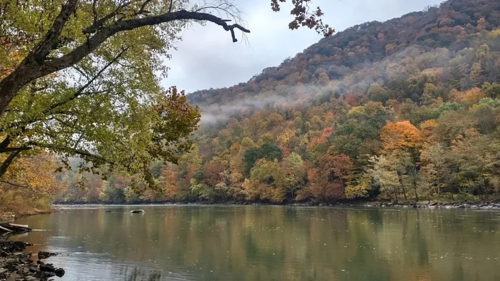
This water needs a real photo
The photo at the top of this page is not Neversink River.
It is a regional stand-in, honestly captioned but generic — we will not put a name to a river we cannot prove. Send us a photograph you took here and it replaces the stand-in, with your credit on it.
Add a photo of this water
Landscape, not fish — the water itself. Reviewed by hand before it appears. The first one published here earns the Pioneer badge.
Fished this water? Add a photo
Reviewed by hand before it appears. Pick the water, not the spot — we never publish exact locations.
Access
Claryville - the junction of the East and West branches and the main upper access.
Neversink Gorge Unique Area - walk-in wild trout water below the reservoir, a long hike in.
The Denning road pull-offs - roadside access to the upper East Branch.
Frost Valley area on the West Branch - limited public access above the confluence.
Neversink Reservoir shoreline - New York City access permit required, no exceptions.
Bridgeville and the Route 17 corridor - access to the lower river below the gorge.
Oakland Valley and Cuddebackville - lower-river access toward the Delaware confluence.
Seasons
Spring: high, cold and strong, with the Hendrickson and Quill Gordon hatches at their best.
Summer: low and clear on the upper river - fish early, fish the pockets, and watch the temperature.
Fall: cool water, good streamer and terrestrial fishing and very little company on the stream.
Winter: cold, icy and largely unfishable on the upper reaches, with the season closed on most water.
From the water
No logged trips yet. Be the first to put this water on your map.
Log this water
Fished it or cleaned it? Log in or create a free account to log a trip with photos and earn the waterway badge.
Questions
What is the current flow on the Neversink River?
As of Nov 2, 6:15 am, the USGS gauge NEVERSINK RIVER NEAR CLARYVILLE NY reads 110 cfs, with water temperature 43.9 F. Conditions update every 15 minutes.
What species can you catch on the Neversink River?
Anglers target Brook Trout, Brown Trout, Fallfish, Rainbow Trout, Rock Bass, Smallmouth Bass on the Neversink River in New York.
Are there fishing guides on the Neversink River?
GuidedFloats lists 2 guides and outfitters on the Neversink River. Claimed profiles accept booking requests; unclaimed profiles are built from public records and link to the business.
Where can you access the Neversink River?
Claryville - the junction of the East and West branches and the main upper access. Neversink Gorge Unique Area - walk-in wild trout water below the reservoir, a long hike in. The Denning road pull-offs - roadside access to the upper East Branch. Frost Valley area on the West Branch - limited public access above the confluence. Neversink Reservoir shoreline - New York City access permit required, no exceptions. Bridgeville and the Route 17 corridor - access to the lower river below the gorge. Oakland Valley and Cuddebackville - lower-river access toward the Delaware confluence.
When is the best time to fish the Neversink River?
Spring: high, cold and strong, with the Hendrickson and Quill Gordon hatches at their best. Summer: low and clear on the upper river - fish early, fish the pockets, and watch the temperature. Fall: cool water, good streamer and terrestrial fishing and very little company on the stream. Winter: cold, icy and largely unfishable on the upper reaches, with the season closed on most water.
Where are the fishing regulations for the Neversink River?
Regulations change by season and section. Read the current rules on the New York agency site: https://dec.ny.gov/things-to-do/freshwater-fishing/regulations