Gibbon River Fishing Guides
A small Yellowstone river of meadow pools and canyon pocket water that joins the Firehole to form the Madison.
Map of the Gibbon River
24 numbered points: 9 access points, 6 campsites, 2 bridges, 1 regulation section limit, 3 hazards, 2 springs, 1 USGS gauge. Tap a marker for details. Reviewed Sep 23, 2026.
- Access / boat ramp (9)
- Campsite (6)
- Bridge crossing (2)
- Regulation section limit (1)
- Dam / hazard (3)
- Spring (2)
- USGS gauge (1)
Print it. Bag it. Bring it.Phones die, screens crack, and most of this water has no signal. Print this map, fold it into a zip-top bag or dry bag with your license, and you have a backup your electronics can’t give you. Every marker is numbered so you can say exactly where you are.
Open the printable mapAll 24 points on this map
| # | Point | Type | Lat, Lon | Notes |
|---|---|---|---|---|
| 1 | Grebe Lake Outlet Yellowstone NP backcountry site | Campsite | 44.75365, -110.56435 | Designated site at the outlet of Grebe Lake, the Gibbon's source. Four designated sites ring the lake; this is the one on the outlet. Permit required. |
| 2 | Wolf Lake Yellowstone NP backcountry site | Campsite | 44.74549, -110.58104 | Designated backcountry site; a park backcountry permit is required and sites are reserved. Walk-in only. |
| 3 | Wolf Lake Outlet Yellowstone NP backcountry site | Campsite | 44.74340, -110.58588 | Designated backcountry site; a park backcountry permit is required and sites are reserved. Walk-in only. |
| 4 | Ice Lake East Yellowstone NP backcountry site | Campsite | 44.72204, -110.62032 | Designated site on Ice Lake, 220 m off the Gibbon. Ice Lake has four sites; the other three sit 780 m to 1.04 km off the river. Permit required. |
| 5 | Virginia Cascades Picnic Area NPS picnic area | Access / boat ramp | 44.71441, -110.63458 | Picnic area on the one-way Virginia Cascade Drive, above the cascade. |
| 6 | Virginia Cascades Waterfall on the Gibbon | Dam / hazard | 44.71308, -110.64776 | A 60-foot fall on the upper river beside the one-way drive. Not wadeable. |
| 7 | Norris Meadows Picnic Area NPS picnic area | Access / boat ramp | 44.73102, -110.68931 | Picnic area on the meadow reach above Norris; slow, silty water and undercut banks. |
| 8 | Norris Campground NPS campground | Campsite | 44.73824, -110.69319 | The developed campground above the Norris bridge, 180 m from the river. |
| 9 | Grand Loop Road bridge at the Norris Campground entrance Regulation section limit | Regulation section limit | 44.73815, -110.69880 | Upstream end of the reach the park gives an extended season. The park's web page calls it the bridge at the campground entrance; the 2026 booklet calls it the bridge near the Museum of the National Park Ranger. |
| 10 | Gibbon River Rapids Rapids | Dam / hazard | 44.71196, -110.73687 | Mapped rapids on the reach below Norris. |
| 11 | Chocolate Pot Thermal feature on the bank | Spring | 44.71010, -110.74124 | An iron-stained hot spring cone right on the Gibbon's bank below Norris; mapped in OSM as two adjacent nodes, one point here. |
| 12 | Gibbon Meadows Picnic Area NPS picnic area | Access / boat ramp | 44.70608, -110.74572 | Picnic area on the Gibbon Meadows reach. |
| 13 | Artists Paintpots parking NPS parking | Access / boat ramp | 44.69642, -110.74133 | Roadside lot for the Artists Paintpots trail, 260 m from the river; the nearest parking on this reach. |
| 14 | Grand Loop Road bridge above Beryl Spring Road crossing | Bridge crossing | 44.68405, -110.74438 | Crossing between Artists Paintpots and Beryl Spring. Grand Loop Road crosses the Gibbon five times; a third crossing 1.4 km downstream of here is left off the sheet as the least distinctive of the three in the canyon. |
| 15 | Beryl Spring Thermal feature on the bank | Spring | 44.67869, -110.74654 | A large boiling spring on the roadside at the river, with a road bridge 20 m away; one point here. |
| 16 | Caldera Rim Picnic Area NPS picnic area | Access / boat ramp | 44.65947, -110.74979 | Picnic area on the canyon reach above Gibbon Falls. |
| 17 | Iron Springs Picnic Area NPS picnic area | Access / boat ramp | 44.65970, -110.76794 | Picnic area on the canyon reach above Gibbon Falls. |
| 18 | Grand Loop Road bridge above Gibbon Falls Road crossing | Bridge crossing | 44.65752, -110.76946 | The last crossing upstream of the falls; a wade-in point for the reach above the lip. |
| 19 | Gibbon Falls Waterfall on the Gibbon | Dam / hazard | 44.65402, -110.77075 | An 84-foot fall, and the park's dividing point on this river: the water below it is managed differently from the water above. Do not wade near the lip. |
| 20 | Gibbon Falls Picnic Area NPS picnic area | Access / boat ramp | 44.64853, -110.77367 | Picnic area just below the falls. |
| 21 | Tuff Cliffs Picnic Area NPS picnic area | Access / boat ramp | 44.65062, -110.82944 | Picnic area on the lower canyon reach. |
| 22 | Madison Junction Picnic Area NPS picnic area | Access / boat ramp | 44.64356, -110.86042 | Picnic area at the Firehole confluence, where the Gibbon ends and the Madison begins. |
| 23 | Gibbon River at Madison Junction USGS 06037100 | USGS gauge | 44.64080, -110.86106 | Real-time flow at the mouth. The OSM monitoring-station node sits on the roster coordinate. A Tantalus Creek station 12 km upstream is on a tributary, not this river, and is not shown. |
| 24 | Madison Campground NPS campground, Madison Junction | Campsite | 44.64445, -110.86614 | The developed campground at the mouth; reservable. Serves the lower Gibbon, the lower Firehole and the upper Madison. |
Guides on the Gibbon River
Claimed profiles take booking requests. Unclaimed profiles are built from public records so the river is never empty; the guide can claim or remove one any time.
Order on this page: premium and outfitter plans first (labelled Premium placement), then claimed free profiles, then unclaimed — one published price, no bidding for position. How placement works
About the Gibbon River
The Gibbon River drains a hundred and twenty-five square miles of the Yellowstone plateau before it meets the Firehole at Madison Junction, and the two together become the Madison River. It is a small river by any measure, and it changes character several times over a short distance, which is what makes it interesting to fish. The upper reaches run through Gibbon Meadows and Elk Park as slow, undercut meadow water. Below that it drops through a canyon of broken pocket water and falls, and the last mile before the junction flattens out again.
Each of those reaches fishes differently and holds different fish. The meadows hold brown trout and rainbows that behave like spring creek fish, spooky in the low clear water of late summer and best approached with a long leader from a crouch. The canyon is brook trout and small rainbow water, fished with a short line and an attractor dry, and it is forgiving in a way the meadows are not. Arctic grayling are present in the upper river, one of the few places in the lower forty-eight where they can be caught in moving water.
The autumn run is the reason many anglers know the Gibbon at all. Brown trout and rainbows push up out of Hebgen Lake and the Madison in September and October, and they run well into the lower Gibbon. Those fish are considerably larger than the resident trout, and the lower river gets busy when they arrive.
Access is easy because the Grand Loop Road follows the river for most of its length. That also means the water near the road sees steady pressure through the summer. Walking even a short distance from a pullout changes the fishing noticeably, and the meadow reaches reward anyone willing to work upstream quietly.
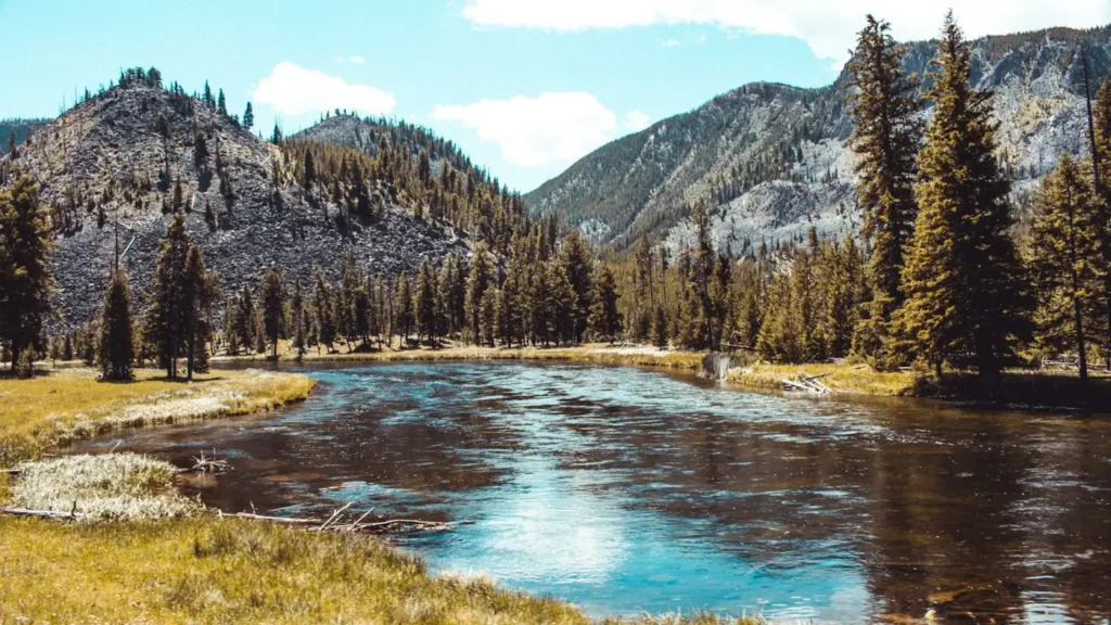
This water needs a real photo
The photo at the top of this page is not Gibbon River.
It is a regional stand-in, honestly captioned but generic — we will not put a name to a river we cannot prove. Send us a photograph you took here and it replaces the stand-in, with your credit on it.
Add a photo of this water
Landscape, not fish — the water itself. Reviewed by hand before it appears. The first one published here earns the Pioneer badge.
Fished this water? Add a photo
Reviewed by hand before it appears. Pick the water, not the spot — we never publish exact locations.
Access
Madison Junction - the gauge reach at the confluence with the Firehole, with campground and road access.
Gibbon Falls - the canyon water above and below the falls, reached from the road pullouts.
Gibbon Meadows - slow undercut meadow water with a pullout and an open walk to the bank.
Elk Park - the upper meadow reach, quieter than Gibbon Meadows and reached on foot.
Norris Junction - the top of the fishable river near the Norris Geyser Basin.
Grand Loop Road pullouts - repeated roadside access through the canyon reach.
Terrace Springs - the lowest thermal input above the junction, a short walk from the road.
Seasons
Spring: high and cold from snowmelt, with the meadows fishing first as the water drops.
Summer: good dry fly fishing in the canyon, with the meadows demanding a careful approach.
Fall: the run of brown trout and rainbows out of the Madison makes this the peak season.
Winter: closed to fishing within the park for the season.
From the water
No logged trips yet. Be the first to put this water on your map.
Log this water
Fished it or cleaned it? Log in or create a free account to log a trip with photos and earn the waterway badge.
Questions
What is the current flow on the Gibbon River?
As of Nov 2, 7:00 am, the USGS gauge Gibbon River at Madison Jct, YNP reads 90 cfs, with water temperature 49.1 F. Conditions update every 15 minutes.
What species can you catch on the Gibbon River?
Anglers target Arctic Grayling, Brook Trout, Brown Trout, Mountain Whitefish, Rainbow Trout on the Gibbon River in Wyoming.
Are there fishing guides on the Gibbon River?
GuidedFloats lists 2 guides and outfitters on the Gibbon River. Claimed profiles accept booking requests; unclaimed profiles are built from public records and link to the business.
Where can you access the Gibbon River?
Madison Junction - the gauge reach at the confluence with the Firehole, with campground and road access. Gibbon Falls - the canyon water above and below the falls, reached from the road pullouts. Gibbon Meadows - slow undercut meadow water with a pullout and an open walk to the bank. Elk Park - the upper meadow reach, quieter than Gibbon Meadows and reached on foot. Norris Junction - the top of the fishable river near the Norris Geyser Basin. Grand Loop Road pullouts - repeated roadside access through the canyon reach. Terrace Springs - the lowest thermal input above the junction, a short walk...
When is the best time to fish the Gibbon River?
Spring: high and cold from snowmelt, with the meadows fishing first as the water drops. Summer: good dry fly fishing in the canyon, with the meadows demanding a careful approach. Fall: the run of brown trout and rainbows out of the Madison makes this the peak season. Winter: closed to fishing within the park for the season.
Where are the fishing regulations for the Gibbon River?
Regulations change by season and section. Read the current rules on the Wyoming agency site: https://wgfd.wyo.gov/regulations