Steele Bayou Fishing Guides
The Delta backwater bayou above Vicksburg, crappie and catfish water in the cypress and willow between the Yazoo and the levee.
Guides on the Steele Bayou
Claimed profiles take booking requests. Unclaimed profiles are built from public records so the river is never empty; the guide can claim or remove one any time.
No guides listed yet
Guide or outfit this water? Create your profile. Listing is free, the commission is 10% or 7% with a premium profile, and premium profiles list first on this water.
About the Steele Bayou
Steele Bayou runs down the eastern edge of the Mississippi Delta and joins the Yazoo River system above Vicksburg, and the reach near Redwood is the heart of what local anglers simply call the backwater. This is genuine Delta bayou country, broad and slow, lined with cypress and willow, with oxbows and connected sloughs opening off the main channel in every direction. The gauge at the Highway 465 crossing sits in the middle of that country.
Crappie are the fishery that defines it. White and black crappie stack in the standing timber and around the brush that every high-water year rearranges, and the spring run into the shallows draws boats from across the state. Most of the fishing is vertical, jigging a small plastic beside a cypress trunk or a submerged top, and knowing the water well matters more here than tackle does. Bluegill, redear sunfish and warmouth fill the same shallow cover through summer.
Catfish are the other mainstay. Channel and blue catfish work the deeper channel, flathead catfish live in the log jams, and cut bait fished in the holes produces heavy fish through the hot months. Largemouth bass hold along the cypress knees and the willow edges, and white bass show up in numbers when the connected rivers push water through. Gar, bowfin and drum are common and unavoidable.
Water level governs everything in this system. The backwater is controlled in part by a floodgate structure downstream, and when the Mississippi is high the whole basin can back up for weeks at a time. Anglers here watch river stages rather than rainfall. Navigation is a matter of local knowledge, because stumps and submerged timber shift with every flood and the channel is not always where the map suggests.
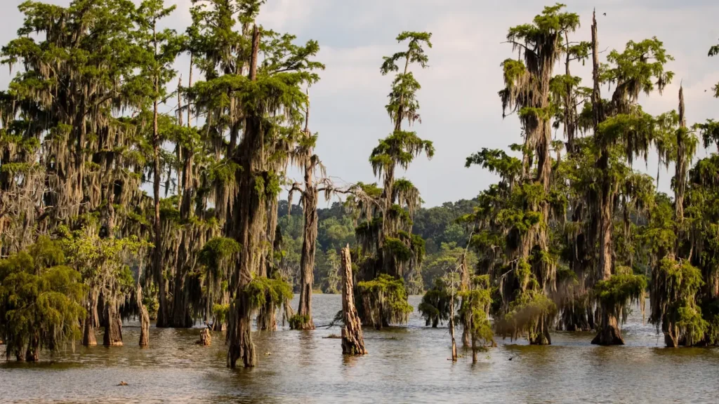
This water needs a real photo
The photo at the top of this page is not Steele Bayou.
It is a regional stand-in, honestly captioned but generic — we will not put a name to a river we cannot prove. Send us a photograph you took here and it replaces the stand-in, with your credit on it.
Add a photo of this water
Landscape, not fish — the water itself. Reviewed by hand before it appears. The first one published here earns the Pioneer badge.
Fished this water? Add a photo
Reviewed by hand before it appears. Pick the water, not the spot — we never publish exact locations.
Access
Highway 465 crossing - the gauge reach near Redwood, with a road crossing and launch.
Redwood - the nearest community, with a small ramp and local supplies.
Muddy Bayou - a connected slough reaching the eastern backwater.
Eagle Lake - the large oxbow to the west, with developed ramps and lodging.
Steele Bayou control structure - the downstream floodgate at the Yazoo confluence.
Vicksburg - the nearest city, with full supplies, guides and lodging.
Delta National Forest - public bottomland ground east of the bayou with access roads.
Seasons
Spring: the peak, with crappie moving shallow into the timber and bass on the cypress.
Summer: catfish in the deeper channel and bream in the shade as the backwater falls.
Fall: falling water concentrates crappie and the bite is steady in the cooler weeks.
Winter: slow, with crappie and catfish holding deep and access tied to river stage.
From the water
No logged trips yet. Be the first to put this water on your map.
Log this water
Fished it or cleaned it? Log in or create a free account to log a trip with photos and earn the waterway badge.
Questions
What species can you catch on the Steele Bayou?
Anglers target Black Crappie, Blue Catfish, Bluegill, Bowfin, Channel Catfish, Flathead Catfish, Freshwater Drum, Largemouth Bass, Longnose Gar, Redear Sunfish, Spotted Gar, Warmouth, White Bass, White Crappie on the Steele Bayou in Mississippi.
Where can you access the Steele Bayou?
Highway 465 crossing - the gauge reach near Redwood, with a road crossing and launch. Redwood - the nearest community, with a small ramp and local supplies. Muddy Bayou - a connected slough reaching the eastern backwater. Eagle Lake - the large oxbow to the west, with developed ramps and lodging. Steele Bayou control structure - the downstream floodgate at the Yazoo confluence. Vicksburg - the nearest city, with full supplies, guides and lodging. Delta National Forest - public bottomland ground east of the bayou with access roads.
When is the best time to fish the Steele Bayou?
Spring: the peak, with crappie moving shallow into the timber and bass on the cypress. Summer: catfish in the deeper channel and bream in the shade as the backwater falls. Fall: falling water concentrates crappie and the bite is steady in the cooler weeks. Winter: slow, with crappie and catfish holding deep and access tied to river stage.
Where are the fishing regulations for the Steele Bayou?
Regulations change by season and section. Read the current rules on the Mississippi agency site: https://www.mdwfp.com/enforcement-education/general-fishing-rules-regulations