Bayou Meto Fishing Guides
The Grand Prairie bayou that feeds Arkansas's great flooded green timber, fishing hard for bass and crappie between duck seasons.
Guides on the Bayou Meto
Claimed profiles take booking requests. Unclaimed profiles are built from public records so the river is never empty; the guide can claim or remove one any time.
No guides listed yet
Guide or outfit this water? Create your profile. Listing is free, the commission is 10% or 7% with a premium profile, and premium profiles list first on this water.
About the Bayou Meto
Bayou Meto runs southeast out of the Grand Prairie country near Lonoke and eventually reaches the Arkansas River, and along the way it passes through one of the best known pieces of public bottomland in the South. Bayou Meto Wildlife Management Area covers roughly thirty-three thousand acres of flooded green timber, and while it is famous nationally as duck country, the same water holds a serious warmwater fishery for most of the year. The gauge near Lonoke sits on the upper bayou above the management area.
The fishing follows the water. When the bayou is up and the timber is flooded, largemouth bass spread out through the oaks and the fishing becomes a matter of covering a great deal of water with a spinnerbait or a soft plastic worked slowly around the trunks. When it drops back into the channel, bass, crappie and catfish concentrate in the deeper bends and the fishing gets far more predictable. Crappie are the local favorite, and they stack around any laydown or brush pile the current has assembled.
Catfish are the other constant. Channel and blue catfish work the main channel holes and flathead catfish hold in the log jams, and the bayou has a long reputation for producing heavy fish on cut bait through the summer. Bluegill, redear sunfish and warmouth fill the shallow margins, and bowfin and gar are plentiful enough to be a routine part of the day.
Anyone planning a trip should check the waterfowl calendar first. The management area’s water levels are managed for ducks, and access rules change with the season. Outside of the flooded months the bayou is straightforward small-boat water, with the usual Delta hazards of stumps, shifting timber and low bridges.
This water needs a real photo
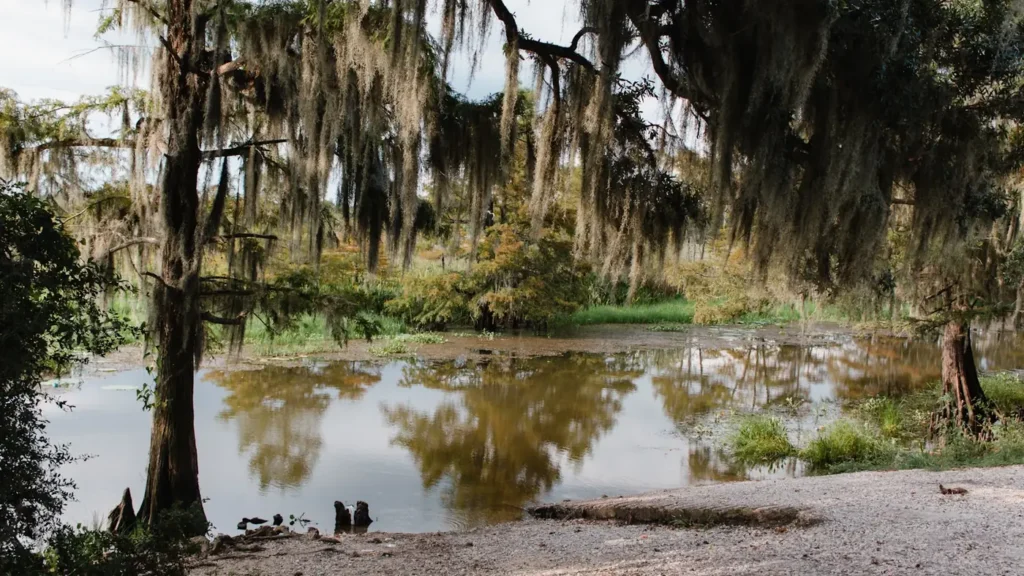
The photo at the top of this page is not Bayou Meto.
It is a regional stand-in, honestly captioned but generic — we will not put a name to a river we cannot prove. Send us a photograph you took here and it replaces the stand-in, with your credit on it.
Add a photo of this water
Landscape, not fish — the water itself. Reviewed by hand before it appears. The first one published here earns the Pioneer badge.
Fished this water? Add a photo
Reviewed by hand before it appears. Pick the water, not the spot — we never publish exact locations.
Access
Lonoke - the gauge reach at the upper end, with highway crossings and bank access.
Bayou Meto WMA - the main public access, with numerous gravel roads and ramps.
Halowell Reservoir - a managed impoundment within the WMA with a developed launch.
Highway 165 crossing - road access to the middle bayou below the prairie.
Stuttgart - the nearest town of size for supplies and lodging.
Arkansas River confluence - the downstream end, reached by boat from river landings.
Wrightsville - the upper bayou above Lonoke with county road crossings.
Seasons
Spring: the peak season, with crappie in the brush and bass spread through any flooded timber.
Summer: catfish in the channel holes and bream along the shaded banks as the water drops.
Fall: fishing sharpens as water falls, but check waterfowl management rules before going.
Winter: access is limited by waterfowl season and flooding, with catfish the steadiest target.
From the water
No logged trips yet. Be the first to put this water on your map.
Log this water
Fished it or cleaned it? Log in or create a free account to log a trip with photos and earn the waterway badge.
Questions
What is the current flow on the Bayou Meto?
As of Sep 17, 5:45 am, the USGS gauge Bayou Meto near Lonoke, AR reads 1 cfs, with water temperature 81.1 F. Conditions update every 15 minutes.
What species can you catch on the Bayou Meto?
Anglers target Black Crappie, Blue Catfish, Bluegill, Bowfin, Channel Catfish, Flathead Catfish, Freshwater Drum, Largemouth Bass, Longnose Gar, Redear Sunfish, Spotted Gar, Warmouth, White Crappie on the Bayou Meto in Arkansas.
Where can you access the Bayou Meto?
Lonoke - the gauge reach at the upper end, with highway crossings and bank access. Bayou Meto WMA - the main public access, with numerous gravel roads and ramps. Halowell Reservoir - a managed impoundment within the WMA with a developed launch. Highway 165 crossing - road access to the middle bayou below the prairie. Stuttgart - the nearest town of size for supplies and lodging. Arkansas River confluence - the downstream end, reached by boat from river landings. Wrightsville - the upper bayou above Lonoke with county road crossings.
When is the best time to fish the Bayou Meto?
Spring: the peak season, with crappie in the brush and bass spread through any flooded timber. Summer: catfish in the channel holes and bream along the shaded banks as the water drops. Fall: fishing sharpens as water falls, but check waterfowl management rules before going. Winter: access is limited by waterfowl season and flooding, with catfish the steadiest target.
Where are the fishing regulations for the Bayou Meto?
Regulations change by season and section. Read the current rules on the Arkansas agency site: https://www.agfc.com/regulations/general-fishing-regulations/