Illinois Bayou Fishing Guides
An Ozark stream despite the name, running clear over gravel out of the Boston Mountains into the upper end of Lake Dardanelle.
Map of the Illinois Bayou
12 numbered points: 2 access points, 5 bridges, 2 parks and conservation areas, 1 agency office, 1 USGS gauge, 1 point of interest. Tap a marker for details. Reviewed Oct 22, 2026.
- Access / boat ramp (2)
- Bridge crossing (5)
- Park / conservation area (2)
- Agency / conservation office (1)
- USGS gauge (1)
- Point of interest (1)
Print it. Bag it. Bring it.Phones die, screens crack, and most of this water has no signal. Print this map, fold it into a zip-top bag or dry bag with your license, and you have a backup your electronics can’t give you. Every marker is numbered so you can say exactly where you are.
Open the printable mapAll 12 points on this map
| # | Point | Type | Lat, Lon | Notes |
|---|---|---|---|---|
| 1 | AR 27 bridge - upper crossing AR 27, at Bayou Bluff | Bridge crossing | 35.52864, -92.94164 | Chain-km 0.0, 0.07 km off the centreline. The top of the mapped main stem, immediately below the junction of the North, Middle and East forks. OSM carries no name on the span; it is placed and labelled from ref=AR 27. |
| 2 | Bayou Bluff Recreation Area Ozark National Forest, on the bank | Park / conservation area | 35.52348, -92.94410 | Chain-km 0.6, 0.14 km off the centreline. Forest Service recreation area at the AR 27 crossing, operator tagged US Department of Agriculture - Forest Service. The first developed ground on the main stem below the forks. |
| 3 | AR 27 bridge - second crossing AR 27 | Bridge crossing | 35.50263, -92.97192 | Chain-km 6.9, 0.07 km off the centreline. Second of the two AR 27 spans on the forest reach; unnamed in OSM and labelled from its ref. Useful as the only other fixed landmark in the first 19 km. |
| 4 | USGS 07257500 - Illinois Bayou near Scottsville Reference gauge for this water page | USGS gauge | 35.46639, -93.04111 | Chain-km 19.1. Real-time flow, and the station the water page itself links. Coordinate taken from the site roster rather than typed by hand; it sits on the centreline at an unnamed tertiary road crossing 19 km below the forks. |
| 5 | AR 7 bridge at Dover AR 7, north edge of Dover | Bridge crossing | 35.41098, -93.13332 | Chain-km 33.9, 0.07 km off the centreline. Tagged State Route 7 North in OSM with ref=AR 7. The main highway crossing of the bayou and the practical dividing line between the forest float above and the backwater below. |
| 6 | Pleasant View Road bridge Pleasant View Road, north Russellville | Bridge crossing | 35.32040, -93.14486 | Chain-km 51.1, 0.06 km off the centreline. Named span on the channel in the backwater reach; a second Pleasant View Road bridge 0.23 km out is the same crossing and was not shipped twice. |
| 7 | Interstate 40 bridge I 40 | Bridge crossing | 35.30915, -93.15004 | Chain-km 52.6, 0.09 km off the centreline. The interstate crossing of the lower bayou, unnamed in OSM and labelled from ref=I 40. Two parallel carriageway spans and a proposed third were merged into this one point. |
| 8 | Bass Mafia Tackle Outdoors Tackle shop, Russellville | Point of interest | 35.29202, -93.15990 | Chain-km 53.5 but 1.67 km off the water, in Russellville - the only shop=fishing in the corridor that carries a name. The nearest tackle over the counter to the lower bayou and the Ouita ramps; the forest reach 30 km upstream has none. |
| 9 | Ouita Boat Launch Lake Dardanelle State Park, Ouita area | Access / boat ramp | 35.30626, -93.16504 | Chain-km 53.8, 0.38 km off the centreline. Two slipway lanes and a parking area tagged separately in OSM and shipped here as the one facility they are. The upper of the two Ouita-area ramps on the bayou arm. |
| 10 | Illinois Bayou Park On the bayou, west Russellville | Park / conservation area | 35.31948, -93.17759 | Chain-km 55.3, 0.50 km off the centreline. The one green space in the Russellville reach that OSM names for the bayou itself, which is what separated it from the city parks dropped nearby. |
| 11 | Ouita Launch Ramp At the US 64 crossing | Access / boat ramp | 35.31867, -93.18672 | Chain-km 56.5, 0.21 km off the centreline, where the bayou opens into Lake Dardanelle. A named ramp with a slipway node 16 m away and an unnamed service slipway 0.3 km upstream - one facility, one point. US 64 crosses here. |
| 12 | Lake Dardanelle State Park Visitor Center Arkansas State Parks | Agency / conservation office | 35.28307, -93.20312 | Chain-km 62.4, 0.53 km off the centreline, near the mouth. The staffed agency point for this water; the park's own polygon centroid 0.85 km out was dropped in its favour as the less precise of the two. |
Guides on the Illinois Bayou
Claimed profiles take booking requests. Unclaimed profiles are built from public records so the river is never empty; the guide can claim or remove one any time.
No guides listed yet
Guide or outfit this water? Create your profile. Listing is free, the commission is 10% or 7% with a premium profile, and premium profiles list first on this water.
About the Illinois Bayou
Illinois Bayou is a bayou in name only. It drains the southern face of the Boston Mountains in Pope County and runs south through the Ozark foothills to the upper end of Lake Dardanelle near Russellville, and along most of that course it behaves like an Ozark creek rather than a Delta bayou. The water runs clear over gravel and bedrock, the banks are bluff and hardwood rather than cypress, and the fish community reflects it. The gauge near Scottsville sits on the middle reach above the lake backwater.
Smallmouth bass are the reason most anglers fish it. The upper and middle reaches hold a good population of stream smallmouth that take topwater and small crankbaits through the warm months, and they fight considerably harder than their size suggests in the swift water. Ozark bass and rock bass share the same riffles and pools, longear sunfish and bluegill are everywhere, and spotted and largemouth bass become more common as the stream slows toward the lake.
The lower end is a different fishery entirely. Where Illinois Bayou enters the Dardanelle backwater it widens and deepens, and crappie, channel and flathead catfish and walleye move up out of the lake seasonally. That transition reach gets the most boat traffic; the upper stream is float and wade water best suited to a kayak or canoe.
Flow is the constant variable. The four forks above the gauge drain steep ground, and the bayou rises fast after a Boston Mountain rain and drops nearly as fast. Spring floats are the most reliable, and by late summer much of the upper stream is reduced to a chain of pools connected by thin riffles, which concentrates the smallmouth but makes for a good deal of dragging.
This water needs a real photo
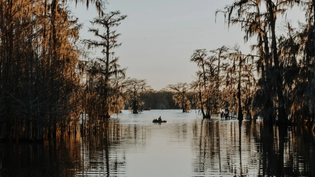
The photo at the top of this page is not Illinois Bayou.
It is a regional stand-in, honestly captioned but generic — we will not put a name to a river we cannot prove. Send us a photograph you took here and it replaces the stand-in, with your credit on it.
Add a photo of this water
Landscape, not fish — the water itself. Reviewed by hand before it appears. The first one published here earns the Pioneer badge.
Fished this water? Add a photo
Reviewed by hand before it appears. Pick the water, not the spot — we never publish exact locations.
Access
Scottsville - the gauge reach, with a county road crossing and gravel bar access.
Highway 27 crossing - the common upper put-in for a float through the middle reach.
Lake Dardanelle backwater - the lower end, with ramps reaching the slack water.
Russellville - the nearest town of size, with supplies, lodging and guides.
Ozark National Forest - public ground on the upper forks with walk-in access.
Hickey Crossing - a mid-stream gravel crossing used as a take-out.
East Fork confluence - the upper limit of dependable float water.
Seasons
Spring: the best float conditions of the year, with smallmouth active as the water warms.
Summer: low clear water, topwater at dawn and dusk, and a good deal of walking between pools.
Fall: cooling water brings the smallmouth back on and the crappie move in the lower reach.
Winter: slow in the stream, with the Dardanelle backwater holding the better winter fishing.
From the water
No logged trips yet. Be the first to put this water on your map.
Log this water
Fished it or cleaned it? Log in or create a free account to log a trip with photos and earn the waterway badge.
Questions
What is the current flow on the Illinois Bayou?
As of Nov 2, 6:30 am, the USGS gauge Illinois Bayou near Scottsville, AR reads 24 cfs. Conditions update every 15 minutes.
What species can you catch on the Illinois Bayou?
Anglers target Black Crappie, Bluegill, Channel Catfish, Flathead Catfish, Largemouth Bass, Longear Sunfish, Ozark Bass, Rock Bass, Smallmouth Bass, Spotted Bass, Walleye, White Crappie on the Illinois Bayou in Arkansas.
Where can you access the Illinois Bayou?
Scottsville - the gauge reach, with a county road crossing and gravel bar access. Highway 27 crossing - the common upper put-in for a float through the middle reach. Lake Dardanelle backwater - the lower end, with ramps reaching the slack water. Russellville - the nearest town of size, with supplies, lodging and guides. Ozark National Forest - public ground on the upper forks with walk-in access. Hickey Crossing - a mid-stream gravel crossing used as a take-out. East Fork confluence - the upper limit of dependable float water.
When is the best time to fish the Illinois Bayou?
Spring: the best float conditions of the year, with smallmouth active as the water warms. Summer: low clear water, topwater at dawn and dusk, and a good deal of walking between pools. Fall: cooling water brings the smallmouth back on and the crappie move in the lower reach. Winter: slow in the stream, with the Dardanelle backwater holding the better winter fishing.
Where are the fishing regulations for the Illinois Bayou?
Regulations change by season and section. Read the current rules on the Arkansas agency site: https://www.agfc.com/regulations/general-fishing-regulations/