Fishes French Broad River
River · Blue Ridge · North Carolina
French Broad River Fishing Guides
One of the oldest rivers in the world, flowing north through Asheville with a strong smallmouth and musky fishery and cold trout water in the headwaters above Rosman.
Map of the French Broad River
66 numbered points: 24 access points, 7 campsites, 5 bait & fly shops, 3 outfitters, 11 parks and conservation areas, 1 agency office, 2 regulation section limits, 6 hazards, 7 USGS gauges. Tap a marker for details. Reviewed Sep 25, 2026.
- Access / boat ramp (24)
- Campsite (7)
- Bait, tackle & fly shop (5)
- Outfitter / canoe rental (3)
- Park / conservation area (11)
- Agency / conservation office (1)
- Regulation section limit (2)
- Dam / hazard (6)
- USGS gauge (7)
Map data © OpenStreetMap contributors. Points are curated from OpenStreetMap and state agency sources; confirm access and hours before you go.
Print it. Bag it. Bring it.Phones die, screens crack, and most of this water has no signal. Print this map, fold it into a zip-top bag or dry bag with your license, and you have a backup your electronics can’t give you. Every marker is numbered so you can say exactly where you are.
Open the printable mapAll 66 points on this map
| # | Point | Type | Lat, Lon | Notes |
|---|---|---|---|---|
| 1 | Hatchery Supported Trout Water — upper limit NCWRC · Transylvania County | Regulation section limit | 35.14281, -82.83899 | Upper end of the NCWRC Hatchery Supported designation on the French Broad mainstem: the confluence of the North Fork and West Fork French Broad. See the NCWRC regulations for what applies. |
| 2 | Headwaters Outfitters 25 Parkway Rd, Rosman · fly shop & livery | Outfitter / canoe rental | 35.14373, -82.83943 | Fly shop, guide service and canoe/kayak/tube livery at the forks where the French Broad begins. |
| 3 | Champion Park Access Rosman · Champion Park | Access / boat ramp | 35.14548, -82.82656 | First developed river access below the forks, in the town of Rosman. |
| 4 | USGS 03439000 — French Broad River at Rosman USGS streamflow gauge | USGS gauge | 35.14333, -82.82472 | Uppermost real-time gauge on the mainstem; the reading that tells you whether the headwaters reach is floatable. |
| 5 | Lonnies Landing Rosman | Access / boat ramp | 35.14215, -82.81795 | Small landing just downstream of Rosman. |
| 6 | Island Ford Access Island Ford Rd (S.R. 1110) | Access / boat ramp | 35.17787, -82.75510 | NCWRC access area on Island Ford Road; also the downstream limit of the Hatchery Supported section above. |
| 7 | Hatchery Supported Trout Water — lower limit NCWRC · Transylvania County | Regulation section limit | 35.17787, -82.75510 | Lower end of the NCWRC Hatchery Supported designation: the Island Ford Rd (S.R. 1110) access area. Below here the mainstem carries no mountain-trout designation. |
| 8 | DD Bullwinkel's Downtown Brevard · outdoor store | Bait, tackle & fly shop | 35.23321, -82.73346 | Brevard outdoor store carrying tackle and fishing gear, about a mile off the river. |
| 9 | Hap Simpson River Access Transylvania County park | Access / boat ramp | 35.21763, -82.72006 | County river park and put-in below Brevard. |
| 10 | Pisgah Forest Access Pisgah Forest | Access / boat ramp | 35.25116, -82.69936 | Access at Pisgah Forest, just below the Davidson River confluence. |
| 11 | Penrose River Access Penrose | Access / boat ramp | 35.26945, -82.63614 | Quiet put-in on the flatwater between Brevard and Blantyre. |
| 12 | Blantyre River Access Blantyre | Access / boat ramp | 35.29926, -82.62340 | Access beside the Blantyre gauge. |
| 13 | USGS 03443000 — French Broad River at Blantyre USGS streamflow gauge | USGS gauge | 35.29917, -82.62389 | The reference gauge for the upper valley float between Brevard and Etowah. |
| 14 | Etowah School Road Stream Access Etowah School Rd | Access / boat ramp | 35.29680, -82.58149 | Bank and wade access on the Etowah flats. |
| 15 | Horse Shoe River Access Horse Shoe | Access / boat ramp | 35.32888, -82.57551 | Popular put-in for the Horse Shoe bend float. |
| 16 | Westfeldt River Park Access Henderson County · Westfeldt River Park | Access / boat ramp | 35.42195, -82.54194 | County river park with a ramp; common take-out above Mills River. |
| 17 | USGS 03447687 — French Broad River near Fletcher USGS streamflow gauge | USGS gauge | 35.42917, -82.55250 | Gauge for the Fletcher / Mills River reach. |
| 18 | Glen Bridge River Access Buncombe County · Glen Bridge River Park | Access / boat ramp | 35.45091, -82.55579 | County park and ramp at Glen Bridge, the standard start of the Asheville float. |
| 19 | Orvis Asheville 29 Schenck Pkwy, Biltmore Park · fly shop | Bait, tackle & fly shop | 35.48542, -82.55380 | Full-service fly shop in Biltmore Park. Placed from the street address, not an OSM shop node. |
| 20 | Firefighter Island Campsite Paddle-in island site | Campsite | 35.49206, -82.57820 | Primitive paddle-in campsite on the French Broad River Paddle Trail. |
| 21 | Bent Creek River Park Access Bent Creek River Park | Access / boat ramp | 35.50141, -82.59294 | Ramp at the Bent Creek confluence below the Biltmore Estate boundary. |
| 22 | Sportsman's Warehouse Asheville · tackle & fishing | Bait, tackle & fly shop | 35.52742, -82.60380 | Big-box tackle and fishing supply about two miles off the river in west Asheville. |
| 23 | Hominy Creek River Access Hominy Creek River Park | Access / boat ramp | 35.55522, -82.59106 | City ramp at the Hominy Creek confluence; the usual start of the in-town Asheville float. |
| 24 | Wilson's Riverfront RV Park Asheville · RV park on the bank | Campsite | 35.56572, -82.58814 | Riverfront RV park on the Asheville reach. |
| 25 | Asheville Adventure Company 521 Amboy Rd, Asheville · raft/tube/kayak | Outfitter / canoe rental | 35.56636, -82.58660 | Riverside rafting, tubing and kayak outfitter on Amboy Road. Placed from the street address. |
| 26 | Carrier Park Asheville city park | Park / conservation area | 35.56593, -82.57952 | Riverside city park on the Amboy Road greenway. |
| 27 | Karen Cragnolin Park Asheville city park | Park / conservation area | 35.56647, -82.57215 | Restored riverfront park on the west bank. |
| 28 | Amboy Road River Park Asheville city park | Park / conservation area | 35.56743, -82.56825 | River park and greenway link on Amboy Road. |
| 29 | French Broad River Park Asheville city park | Park / conservation area | 35.57055, -82.56480 | Shaded riverside park with a wide bank walk. |
| 30 | USGS 03451200 — French Broad River at Haywood Rd at Asheville USGS streamflow gauge | USGS gauge | 35.58500, -82.56861 | In-town gauge at the Haywood Road bridge. |
| 31 | Jean Webb Park Asheville · River Arts District | Park / conservation area | 35.58594, -82.56798 | Small riverfront park in the River Arts District. |
| 32 | Craven Street Bridge Access River Arts District | Access / boat ramp | 35.58930, -82.57121 | Bank access at the Craven Street bridge. |
| 33 | Asheville Visitor Center Explore Asheville | Agency / conservation office | 35.59726, -82.56055 | Visitor centre near Montford, useful for corridor information. |
| 34 | Hunter Banks Fly Fishing 29 Montford Ave, Asheville · fly shop | Bait, tackle & fly shop | 35.59713, -82.55972 | Asheville's long-standing fly shop; flies, licences and local water reports. |
| 35 | Zen Tubing Asheville · tube rental & shuttle | Outfitter / canoe rental | 35.60498, -82.57792 | Tube rental and shuttle on the in-town float. |
| 36 | USGS 03451500 — French Broad River at Asheville USGS streamflow gauge · the site's reference gauge | USGS gauge | 35.60889, -82.57806 | The gauge GuidedFloats reports for this river. Long record; the standard flow reference for the whole NC reach. |
| 37 | Richmond Hill Park Asheville city park | Park / conservation area | 35.61872, -82.59333 | Wooded park on the bluff above the river north of town. |
| 38 | Woodfin Park Access Woodfin Riverside Park | Access / boat ramp | 35.63172, -82.60041 | Ramp at Woodfin, below the Asheville wave park works. |
| 39 | Woodfin Riverside Park Town of Woodfin | Park / conservation area | 35.63217, -82.60016 | Riverside park and greenway at Woodfin. |
| 40 | French Broad River Campground Private campground on the bank | Campsite | 35.67566, -82.61204 | Riverside campground between Woodfin and Alexander. |
| 41 | Ledges Whitewater Park Access Buncombe County · Ledges Whitewater Park | Access / boat ramp | 35.68435, -82.61765 | County park and ramp at the Ledges rapids. |
| 42 | Alexander River Park Access Alexander | Access / boat ramp | 35.71927, -82.63639 | Ramp at Alexander, the usual start of the Madison County float. |
| 43 | Sandy Mush Game Land — river parking NCWRC game land | Park / conservation area | 35.72678, -82.65933 | NCWRC game land parking giving bank access on the left bank. |
| 44 | Walnut Island River Park Madison County park | Park / conservation area | 35.73316, -82.65679 | County river park at Walnut Island. |
| 45 | Walnut Island Access Madison County | Access / boat ramp | 35.73315, -82.65711 | Ramp at Walnut Island River Park. |
| 46 | USGS 03453500 — French Broad River at Marshall USGS streamflow gauge | USGS gauge | 35.78639, -82.66083 | Marshall gauge; the working reference for the Marshall-to-Hot Springs whitewater. |
| 47 | Marshall Nature Sanctuary Town of Marshall | Park / conservation area | 35.79513, -82.66982 | Riverside nature sanctuary at Marshall. |
| 48 | Capitola Dam Low-head dam — portage | Dam / hazard | 35.79456, -82.68000 | Low-head dam at Marshall. Scout and portage; low-head dams hold a dangerous hydraulic at most flows. |
| 49 | Blannahassett Island River Access Marshall · Blannahassett Island | Access / boat ramp | 35.79652, -82.68549 | Access at the island in the middle of Marshall. |
| 50 | Redmon Dam Low-head dam — portage | Dam / hazard | 35.79336, -82.71026 | Low-head dam below Marshall with a river-left portage at the access just downstream. |
| 51 | Redmon Dam River Access Madison County | Access / boat ramp | 35.79415, -82.71172 | Access and portage take-out at Redmon Dam. |
| 52 | Evan's Island Campsite Paddle-in island site | Campsite | 35.80119, -82.73073 | Primitive paddle-in site on the French Broad River Paddle Trail. |
| 53 | Barnard Park Madison County | Park / conservation area | 35.83757, -82.75386 | River park at Barnard, the put-in for the section 9 whitewater run. |
| 54 | Big Pine Campsite Paddle-in site | Campsite | 35.83781, -82.75603 | Primitive paddle trail campsite at Big Pine. |
| 55 | Barnard Park Boat Ramp Barnard | Access / boat ramp | 35.83825, -82.75446 | Hard ramp at Barnard; standard put-in for the Barnard-to-Hot Springs run. |
| 56 | Stackhouse Rapid Named rapid | Dam / hazard | 35.88064, -82.77157 | Named rapid above the Stackhouse access. Scout at high water. |
| 57 | Stackhouse River Access Madison County | Access / boat ramp | 35.88100, -82.77041 | Access at Stackhouse, an alternative put-in that skips the flatwater. |
| 58 | Needles Falls Named rapid | Dam / hazard | 35.87637, -82.80323 | Needles Falls, in the Hot Springs whitewater section. |
| 59 | Frank Bell's Rapid Named rapid — the big one | Dam / hazard | 35.87901, -82.81455 | Frank Bell's Rapid, the largest drop on the Hot Springs run. |
| 60 | USGS 03454500 — French Broad River at Hot Springs USGS streamflow gauge | USGS gauge | 35.88992, -82.82100 | Hot Springs gauge; the last NC gauge before the Tennessee line. |
| 61 | Hot Springs Campground Hot Springs · riverside campground | Campsite | 35.88998, -82.82314 | Campground at the Spring Creek confluence in Hot Springs. |
| 62 | Surprise Ledge Named rapid | Dam / hazard | 35.89021, -82.82174 | Ledge drop at Hot Springs. |
| 63 | Nantahala Outdoor Center Boat Launch NOC French Broad Outpost, Hot Springs | Access / boat ramp | 35.89285, -82.82216 | Ramp at the NOC outpost; the usual take-out for the Hot Springs run. |
| 64 | Bluff Mountain Outfitters Hot Springs · outfitter & supplies | Bait, tackle & fly shop | 35.89285, -82.82691 | Hot Springs outfitter; gear, licences and local information right on the river. |
| 65 | Laughing Waters Family Campground Madison County | Campsite | 35.90184, -82.84290 | Riverside campground below Hot Springs. |
| 66 | Murray Branch Boat Launch Pisgah National Forest · Murray Branch | Access / boat ramp | 35.91986, -82.87372 | USFS launch and picnic area; last NC access before the Tennessee line at Paint Rock. |
Guides on the French Broad River
Claimed profiles take booking requests. Unclaimed profiles are built from public records so the river is never empty; the guide can claim or remove one any time.
About the French Broad River
The French Broad rises in Transylvania County and runs north through Brevard, Asheville and Marshall into Tennessee, where it joins the Holston to form the Tennessee River. It is one of a handful of rivers in the world that runs north through an ancient mountain range, and around Asheville it has become the center of a genuinely busy river economy: guides, brewery patios, greenways and a summer tubing crowd.
For anglers it is primarily a warm-water float. Smallmouth bass are the main quarry from Brevard down through Asheville and on to Marshall and Hot Springs, and the river also holds a well-regarded and challenging muskellunge fishery that a handful of local guides specialize in. Redbreast sunfish, rock bass and catfish fill out the day. The float from Bent Creek through the Biltmore water and into downtown Asheville is the classic half-day, and it is one of the few urban floats in the Southeast that is genuinely good fishing.
Trout live here too, but higher up: the headwaters above Rosman and the tributaries, particularly the Davidson, Mills River and North Mills River in the Pisgah National Forest, are the cold-water fisheries the region is known for. The main stem through Asheville is too warm for trout in summer.
The Asheville gauge reads a large mountain basin and responds fast to storms in the Blue Ridge. Summer fishing flows are typically in the several-hundred to low-thousand cfs range, wading and floating both comfortable; after heavy rain the river browns out and rises quickly.
Asheville has everything a visiting angler needs and then some. Book guides ahead in October.
This water needs a real photo
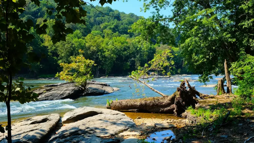
The photo at the top of this page is not French Broad River.
It is a regional stand-in, honestly captioned but generic — we will not put a name to a river we cannot prove. Send us a photograph you took here and it replaces the stand-in, with your credit on it.
Pioneer badgeUnclaimed
Add a photo of this water
Landscape, not fish — the water itself. Reviewed by hand before it appears. The first one published here earns the Pioneer badge.
Fished this water? Add a photo
Reviewed by hand before it appears. Pick the water, not the spot — we never publish exact locations.
Access
Rosman and Brevard: upper river access, cooler water, the top of the float.
Hap Simpson and Penrose: Transylvania County ramps above Asheville.
Bent Creek River Park: the standard put-in above the Biltmore water.
Amboy Road and French Broad River Park, Asheville: town ramps and greenway access near the gauge.
Woodfin, Alexander and Marshall: ramps on the middle river north of Asheville.
Hot Springs: lower river access near the Tennessee line.
Seasons
March through May: pre-spawn smallmouth and musky, higher water, big fish.
June through August: the main float season, topwater smallmouth early and late, heavy tubing traffic midday on some reaches.
September through November: the best fishing of the year, falling water and aggressive fish.
December through February: musky season; smallmouth hold deep and slow.
From the water
No logged trips yet. Be the first to put this water on your map.
Log this water
Fished it or cleaned it? Log in or create a free account to log a trip with photos and earn the waterway badge.
Questions
What is the current flow on the French Broad River?
As of Oct 19, 1:30 am, the USGS gauge FRENCH BROAD RIVER AT ASHEVILLE, NC reads 1,020 cfs, the 49th percentile for this date, with water temperature 58.1 F. Conditions update every 15 minutes.
What species can you catch on the French Broad River?
Anglers target Brown Trout, Channel Catfish, Muskellunge, Rainbow Trout, Redbreast Sunfish, Smallmouth Bass on the French Broad River in North Carolina.
Are there fishing guides on the French Broad River?
GuidedFloats lists 3 guides and outfitters on the French Broad River. Claimed profiles accept booking requests; unclaimed profiles are built from public records and link to the business.
Where can you access the French Broad River?
Rosman and Brevard: upper river access, cooler water, the top of the float. Hap Simpson and Penrose: Transylvania County ramps above Asheville. Bent Creek River Park: the standard put-in above the Biltmore water. Amboy Road and French Broad River Park, Asheville: town ramps and greenway access near the gauge. Woodfin, Alexander and Marshall: ramps on the middle river north of Asheville. Hot Springs: lower river access near the Tennessee line.
When is the best time to fish the French Broad River?
March through May: pre-spawn smallmouth and musky, higher water, big fish. June through August: the main float season, topwater smallmouth early and late, heavy tubing traffic midday on some reaches. September through November: the best fishing of the year, falling water and aggressive fish. December through February: musky season; smallmouth hold deep and slow.
Where are the fishing regulations for the French Broad River?
Regulations change by season and section. Read the current rules on the North Carolina agency site: https://www.ncwildlife.gov/fishing/regulations