Fishes Brazos River
River · Central and southeast Texas, running from the Waco and College Station country down past Hempstead toward the Gulf coastal plain · Texas
Brazos River Fishing Guides
The longest river entirely inside Texas, and the state's best big-catfish and alligator gar float, with a lower reach near Hempstead that guides run hard from spring through fall.
Map of the Brazos River
21 numbered points: 10 bridges, 8 parks and conservation areas, 1 agency office, 2 USGS gauges. Tap a marker for details. Reviewed Oct 22, 2026.
- Bridge crossing (10)
- Park / conservation area (8)
- Agency / conservation office (1)
- USGS gauge (2)
Map data © OpenStreetMap contributors. Points are curated from OpenStreetMap and state agency sources; confirm access and hours before you go.
Print it. Bag it. Bring it.Phones die, screens crack, and most of this water has no signal. Print this map, fold it into a zip-top bag or dry bag with your license, and you have a backup your electronics can’t give you. Every marker is numbered so you can say exactly where you are.
Open the printable mapAll 21 points on this map
| # | Point | Type | Lat, Lon | Notes |
|---|---|---|---|---|
| 1 | BNSF Conroe Subdivision rail bridge BNSF Railway | Bridge crossing | 30.39920, -96.30160 | Uppermost crossing on this sheet, 3.1 km below the chain start above Navasota. Rail only - no road, no parking, not an access point. |
| 2 | Former 105 Bridge Old SH 105 crossing | Bridge crossing | 30.36168, -96.15474 | OSM carries this as the former SH 105 bridge. The stream gauge below sits on it, which is why it ships as a landmark rather than an access. |
| 3 | Brazos River at Washington stream gauge At the old SH 105 bridge | USGS gauge | 30.35918, -96.15490 | A second, upstream stage gauge mapped in OSM 5 m off the centreline - not the station this water page links. Useful for reading what is coming down before you put in at Washington. |
| 4 | Washington-on-the-Brazos State Historic Site Texas Historical Commission | Park / conservation area | 30.33653, -96.15894 | The uppermost substantial public bank on this reach and the top of the useful float. Pin sits on the boundary vertex nearest the river, 29 m off the centreline, not the park centroid. |
| 5 | Washington-on-the-Brazos Visitor Center Texas Historical Commission | Agency / conservation office | 30.32627, -96.15498 | Staffed visitor centre inside the historic site - the one place on the upper half of this reach to ask about river conditions and bank access. |
| 6 | USGS 08111500 Brazos Rv nr Hempstead, TX USGS - the gauge this page links | USGS gauge | 30.12911, -96.18774 | The water page's own gauge. It sits at the US 290 crossing below, 93 m off the centreline, and anchors the middle of this reach. Coordinates taken from the site roster, not typed by hand. |
| 7 | US 290 bridge at Hempstead US 290 | Bridge crossing | 30.12918, -96.18600 | The main highway crossing of the reach and the gauge's location. Shoulder parking only - it is a landmark and a river-km reference, not a ramp. |
| 8 | Stephen F. Austin State Park TPWD - day use and camping, fee | Park / conservation area | 29.82522, -96.11035 | The best public river frontage on the reach: state park camping and river bank within the park. Pin is the boundary vertex 33 m off the centreline; the park centroid scored 687 m and would have misplaced it. |
| 9 | San Felipe de Austin State Historic Site Texas Historical Commission | Park / conservation area | 29.80786, -96.09391 | Public frontage at the historic San Felipe crossing, 3.7 km below the state park. Pin is the boundary vertex 71 m off the centreline. The adjacent generic City Park node was dropped as a duplicate of this place. |
| 10 | Brazos River Railroad Bridge UP Smithville Subdivision | Bridge crossing | 29.77174, -96.03634 | Named rail bridge - the only crossing in the 26 km between San Felipe and FM 1093. Rail only, no access. |
| 11 | FM 1093 bridge Farm to Market 1093 | Bridge crossing | 29.67185, -96.02117 | The single road crossing in the long rural reach between San Felipe and Rosenberg. No mapped ramp or parking here. |
| 12 | Brazos Park, Rosenberg City of Rosenberg | Park / conservation area | 29.56650, -95.81062 | First city river park on the lower reach, 32 m off the centreline and named for the river. Riverside park land; OSM maps no ramp here. |
| 13 | Houston Street bridge, Rosenberg Houston Street | Bridge crossing | 29.56707, -95.81044 | Town crossing immediately beside Brazos Park - the two sit about 65 m apart. |
| 14 | River Bend Park, Rosenberg City of Rosenberg | Park / conservation area | 29.56835, -95.79987 | Riverside city park about 1 km below Brazos Park, 79 m off the centreline. |
| 15 | UP Glidden Subdivision rail bridge, Richmond Union Pacific | Bridge crossing | 29.58514, -95.75861 | Richmond rail crossing. The Jackson Street and Liberty Street road bridges sit on the same cluster and were merged into this one pin. |
| 16 | Keith A Crawford Memorial Park, Richmond City of Richmond | Park / conservation area | 29.58279, -95.75855 | Richmond riverside park at the rail crossing, 61 m off the centreline. |
| 17 | Grand Parkway (SH 99) bridge SH 99 Grand Parkway | Bridge crossing | 29.58196, -95.67828 | Tollway crossing on the suburban lower reach. |
| 18 | US 59 Southwest Freeway bridge US 59 / I-69 | Bridge crossing | 29.56784, -95.66798 | The busiest crossing on the river and the practical bottom of the rural float; below here the Brazos runs through Sugar Land suburbia. |
| 19 | Sugar Land Memorial Park City of Sugar Land | Park / conservation area | 29.55878, -95.64332 | Large riverside city park with trails along the bank, 37 m off the centreline. |
| 20 | BNSF Galveston Subdivision rail bridge BNSF Railway | Bridge crossing | 29.49858, -95.55588 | Lowest crossing on this sheet. |
| 21 | Sienna (Brazos River) Park Sienna / Fort Bend County | Park / conservation area | 29.49070, -95.55138 | Last riverside park before this sheet ends. Brazos Bend State Park lies further downstream and is off this reach - see the notes. |
Guides on the Brazos River
Claimed profiles take booking requests. Unclaimed profiles are built from public records so the river is never empty; the guide can claim or remove one any time.
Order on this page: premium and outfitter plans first (labelled Premium placement), then claimed free profiles, then unclaimed — one published price, no bidding for position. How placement works
About the Brazos River
The Brazos is the longest river contained entirely within Texas, and the stretch that guides work most often runs from the Highway 21 crossing near Bryan down through Washington and Hempstead toward the coastal plain. This is not a clear Hill Country stream. It is a broad, sand-bottomed, tea-colored prairie river that carries a heavy sediment load and rebuilds its own sandbars every high-water year. What that shifting bed produces is habitat: deep outside bends scoured against clay banks, long shallow sand flats, and log jams stacked against every point bar. Those three features hold nearly everything that swims here, and reading them is most of the job.
The fishery is a warmwater one and it is genuinely strong. Blue and flathead catfish reach serious size in the deeper bends, and the lower Brazos is one of the more reliable places in the country to put a client on an alligator gar over six feet. White bass push far upriver in late winter and early spring and stack below any shoal or riffle that slows them down. Largemouth hold tight to the wood, and freshwater drum are a constant. Most guided trips here run from a jet boat or a shallow-draft flat-bottom, because the sand shifts and a prop boat that ran a channel last season may not find it this one.
Access is the practical constraint rather than fish. Public ramps are spread thin along this reach, so a guided trip usually means a long run up or down from a single launch rather than a shuttle float. Flow matters as much as season: the river is dam-influenced from upstream and can move from clear and low to high and moving in a day. The gauge near Hempstead is the number that decides whether the trip runs.
This water needs a real photo
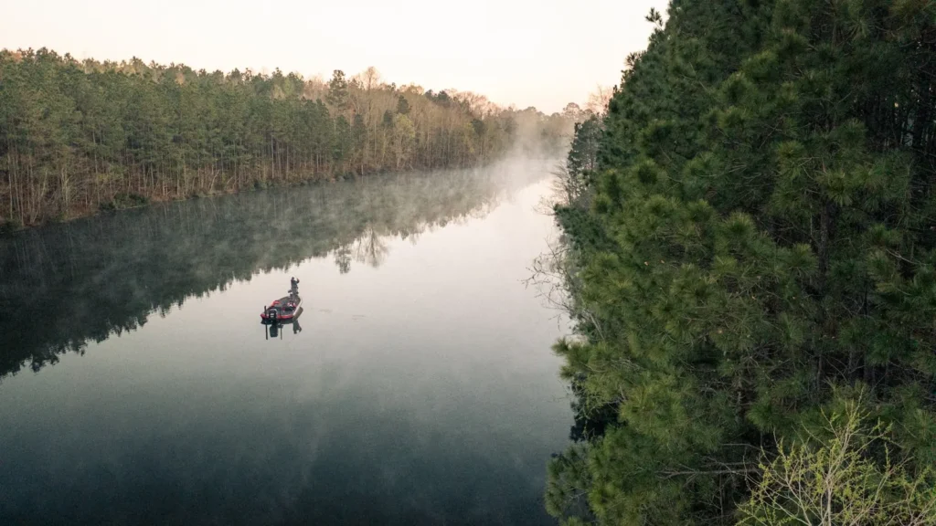
The photo at the top of this page is not Brazos River.
It is a regional stand-in, honestly captioned but generic — we will not put a name to a river we cannot prove. Send us a photograph you took here and it replaces the stand-in, with your credit on it.
Pioneer badgeUnclaimed
Add a photo of this water
Landscape, not fish — the water itself. Reviewed by hand before it appears. The first one published here earns the Pioneer badge.
Fished this water? Add a photo
Reviewed by hand before it appears. Pick the water, not the spot — we never publish exact locations.
Access
Highway 21 crossing near Bryan - upstream launch for the clearer, narrower reach above Navasota.
Washington-on-the-Brazos State Historic Site - park access with a ramp and the most-used mid-river put-in.
Highway 105 bridge at Navasota - convenient ramp for the middle reach and shuttle floats down toward Hempstead.
Hempstead at the Highway 290 crossing - the main lower-reach ramp and the gauge location.
San Felipe and Stephen F. Austin State Park - lower-river bank access and a launch below Sealy.
Richmond and the Highway 90 bridge - tidal-influence country, gar and big blue catfish water.
Brazos Bend State Park - bank fishing on the oxbow lakes rather than the main channel, useful in high water.
Seasons
Spring: white bass run upriver, the river runs high and colored, and gar move onto the flats as water warms.
Summer: low, clear and hot, the best alligator gar sight-fishing of the year and steady flathead nights.
Fall: falling water concentrates catfish in the deep bends and largemouth push back onto the wood.
Winter: cold and often high, the quietest season here, though big blues feed well in the deepest holes.
From the water
No logged trips yet. Be the first to put this water on your map.
Log this water
Fished it or cleaned it? Log in or create a free account to log a trip with photos and earn the waterway badge.
Questions
What is the current flow on the Brazos River?
As of Nov 2, 6:15 am, the USGS gauge Brazos Rv nr Hempstead, TX reads 618 cfs. Conditions update every 15 minutes.
What species can you catch on the Brazos River?
Anglers target Alligator Gar, Blue Catfish, Flathead Catfish, Freshwater Drum, Largemouth Bass, Longnose Gar, White Bass on the Brazos River in Texas.
Are there fishing guides on the Brazos River?
GuidedFloats lists 2 guides and outfitters on the Brazos River. Claimed profiles accept booking requests; unclaimed profiles are built from public records and link to the business.
Where can you access the Brazos River?
Highway 21 crossing near Bryan - upstream launch for the clearer, narrower reach above Navasota. Washington-on-the-Brazos State Historic Site - park access with a ramp and the most-used mid-river put-in. Highway 105 bridge at Navasota - convenient ramp for the middle reach and shuttle floats down toward Hempstead. Hempstead at the Highway 290 crossing - the main lower-reach ramp and the gauge location. San Felipe and Stephen F. Austin State Park - lower-river bank access and a launch below Sealy. Richmond and the Highway 90 bridge - tidal-influence country, gar and big blue catfish water. Braz...
When is the best time to fish the Brazos River?
Spring: white bass run upriver, the river runs high and colored, and gar move onto the flats as water warms. Summer: low, clear and hot, the best alligator gar sight-fishing of the year and steady flathead nights. Fall: falling water concentrates catfish in the deep bends and largemouth push back onto the wood. Winter: cold and often high, the quietest season here, though big blues feed well in the deepest holes.
Where are the fishing regulations for the Brazos River?
Regulations change by season and section. Read the current rules on the Texas agency site: https://tpwd.texas.gov/regulations/outdoor-annual/fishing