Fishes Salmon River
River · Central Idaho · Idaho
Salmon River Fishing Guides
The River of No Return, running 425 miles through the largest wilderness in the lower 48, with summer cutthroat fishing and a fall and spring steelhead season that defines Idaho angling.
Map of the Salmon River
62 numbered points: 33 access points, 18 campsites, 1 bait & fly shop, 2 parks and conservation areas, 2 agency offices, 1 hazard, 3 springs, 1 USGS gauge, 1 point of interest. Tap a marker for details. Reviewed Sep 15, 2026.
- Access / boat ramp (33)
- Campsite (18)
- Bait, tackle & fly shop (1)
- Park / conservation area (2)
- Agency / conservation office (2)
- Dam / hazard (1)
- Spring (3)
- USGS gauge (1)
- Point of interest (1)
Map data © OpenStreetMap contributors. Points are curated from OpenStreetMap and state agency sources; confirm access and hours before you go.
Print it. Bag it. Bring it.Phones die, screens crack, and most of this water has no signal. Print this map, fold it into a zip-top bag or dry bag with your license, and you have a backup your electronics can’t give you. Every marker is numbered so you can say exactly where you are.
Open the printable mapAll 62 points on this map
| # | Point | Type | Lat, Lon | Notes |
|---|---|---|---|---|
| 1 | Sunny Gulch Campground Sawtooth NRA | Campsite | 44.17495, -114.91004 | Forest Service campground on the highway just below Redfish Lake road. |
| 2 | Salmon River Bridge Access Stanley | Access / boat ramp | 44.22353, -114.92768 | First ramp below Stanley — the usual put-in for the upper canyon. |
| 3 | Salmon River Campground Sawtooth NRA | Campsite | 44.24941, -114.87004 | Forest Service campground on the highway below Stanley. |
| 4 | Casino Creek Campground Sawtooth NRA | Campsite | 44.25395, -114.85742 | Small Forest Service campground on the river bench. |
| 5 | Riverside Campground Sawtooth NRA | Campsite | 44.26596, -114.85044 | Forest Service campground right on the water above Mormon Bend. |
| 6 | Mormon Bend Boat Ramp Sawtooth NRA · campground at the ramp | Access / boat ramp | 44.26257, -114.84386 | Ramp and Forest Service campground at the same bend — a standard take-out for the Stanley run. |
| 7 | Cove Hot Springs Riverside | Spring | 44.26354, -114.81303 | Hot spring on the bank between Mormon Bend and Sunbeam. |
| 8 | Sunbeam Hot Springs Sawtooth NRA | Spring | 44.26767, -114.74977 | Roadside hot spring with a stone bathhouse; pools are on the river's edge below the highway. |
| 9 | Sunbeam Dam Breached 1934 | Dam / hazard | 44.27069, -114.73588 | The old dam is breached but the river runs fast through the notch — scout it before you run it. |
| 10 | Elk Creek Boat Launch Sawtooth NRA | Access / boat ramp | 44.26582, -114.72258 | Launch just below Sunbeam Dam. |
| 11 | Dutchman Flat Dispersed Campground Sawtooth NRA · dispersed | Campsite | 44.26577, -114.72044 | Dispersed camping on the flat below Sunbeam — no services. |
| 12 | Upper O'Brien Campground Sawtooth NRA | Campsite | 44.25939, -114.69809 | Forest Service campground on the river below Sunbeam. |
| 13 | Lower O'Brien Campground Sawtooth NRA | Campsite | 44.25748, -114.69448 | Forest Service campground on the river below Sunbeam. |
| 14 | Marshall Creek Campground Sawtooth NRA | Campsite | 44.25518, -114.68765 | Small campground at Marshall Creek. |
| 15 | Torrey's RV Park Private | Campsite | 44.25275, -114.60321 | Riverside RV park at Torrey's, beside the boat ramp of the same name. |
| 16 | Torrey's Hole Boat Ramp Sawtooth NRA | Access / boat ramp | 44.25561, -114.59350 | Ramp at Torrey's, on the run down to Clayton. |
| 17 | Whiskey Campground Sawtooth NRA | Campsite | 44.25480, -114.55240 | Forest Service campground above Holman Creek. |
| 18 | Holman Creek Campground Sawtooth NRA | Campsite | 44.24909, -114.53018 | Forest Service campground on the river above Clayton. |
| 19 | Clayton Ranger Station US Forest Service | Agency / conservation office | 44.25775, -114.49121 | Ranger station at Clayton — river, road and fire information. |
| 20 | South Butte Boat Ramp Below Clayton | Access / boat ramp | 44.24933, -114.45420 | Ramp below Clayton on the run toward the East Fork. |
| 21 | East Fork Campground Salmon-Challis NF | Campsite | 44.26750, -114.32662 | Campground near the East Fork confluence. |
| 22 | Deadman Hole Boat Ramp BLM · campground at the ramp | Access / boat ramp | 44.34714, -114.26590 | Ramp and campground at Deadman Hole, above Challis. |
| 23 | Bayhorse Campground BLM | Campsite | 44.38556, -114.26041 | Campground on the river below Deadman Hole. |
| 24 | Dugway River Access BLM | Access / boat ramp | 44.39356, -114.26332 | Access on the Challis reach. |
| 25 | Challis Bridge Boat Ramp Challis | Access / boat ramp | 44.47081, -114.20026 | Ramp at the Challis highway bridge. |
| 26 | Land of the Yankee Fork State Park Idaho Parks and Recreation | Park / conservation area | 44.50742, -114.18201 | State park and mining history area at the Yankee Fork, on the river road below Challis. |
| 27 | Challis Hot Springs Private · RV park and pools | Spring | 44.52317, -114.17434 | Hot springs and RV park on the river bench below Challis. |
| 28 | Watts Bridge Boat Ramp BLM · campground at the ramp | Access / boat ramp | 44.63199, -114.14546 | Ramp and campground at Watts Bridge, on the long canyon run to Salmon. |
| 29 | Cottonwood Campground Boat Ramp BLM · campground at the ramp | Access / boat ramp | 44.66852, -114.08052 | Ramp at Cottonwood Campground, the busiest BLM site on this reach. |
| 30 | Deer Gulch Boat Access BLM | Access / boat ramp | 44.69982, -114.04377 | Access in the canyon below Cottonwood. |
| 31 | Cronk's Canyon Boat Access BLM | Access / boat ramp | 44.72943, -114.00390 | Canyon access above Colston Creek. |
| 32 | Colston Creek Boat Access BLM | Access / boat ramp | 44.75261, -113.99533 | Canyon access below Cronk's. |
| 33 | McKim Boat Access BLM | Access / boat ramp | 44.79733, -114.00417 | Access on the run down to Elk Bend. |
| 34 | Kilpatrick Boat Ramp BLM | Access / boat ramp | 44.83010, -113.98724 | Ramp above Elk Bend. |
| 35 | Elk Bend Boat Ramp Elk Bend | Access / boat ramp | 44.90433, -113.96889 | Ramp at Elk Bend, on the highway south of Salmon. |
| 36 | Salmon River R.V. Park Private | Campsite | 44.90258, -113.96808 | RV park at Elk Bend, beside the ramp. |
| 37 | Waddington Creek Campground BLM | Campsite | 44.93221, -113.96177 | Small campground on the highway below Elk Bend. |
| 38 | Elevenmile Boat Ramp BLM | Access / boat ramp | 45.02621, -113.91831 | Ramp eleven miles above Salmon. |
| 39 | Eightmile River Access BLM | Access / boat ramp | 45.07221, -113.90804 | Access eight miles above Salmon. |
| 40 | Shoup Bridge Boat Ramp BLM · campground at the ramp | Access / boat ramp | 45.09809, -113.89394 | Ramp and campground at Shoup Bridge, the usual put-in for the float into town. |
| 41 | Salmon River Fly Box Salmon | Bait, tackle & fly shop | 45.17623, -113.89500 | Fly shop in Salmon — flies, licences and current river information. |
| 42 | Island Park City of Salmon | Park / conservation area | 45.17756, -113.89956 | Riverside park in the middle of Salmon, beside the whitewater park. |
| 43 | Salmon Whitewater Park City of Salmon | Point of interest | 45.17656, -113.89853 | Engineered wave features in town — surfable at higher flows, and a hazard for loaded boats. |
| 44 | USGS gauge — Salmon River at Salmon Site 13302500 | USGS gauge | 45.18361, -113.89528 | The flow reading the whole upper river is run on. Check it before you commit. |
| 45 | Bureau of Land Management, Salmon Field Office BLM | Agency / conservation office | 45.17056, -113.88917 | Field office in Salmon — river permits, access and campground information. |
| 46 | Carmen Bridge Boat Ramp BLM | Access / boat ramp | 45.23120, -113.89448 | Ramp at Carmen, below Salmon. |
| 47 | Morgan Bar Boat Ramp BLM · campground at the ramp | Access / boat ramp | 45.25390, -113.90719 | Ramp and campground at Morgan Bar. |
| 48 | Tower Rock Boat Ramp BLM · campground at the ramp | Access / boat ramp | 45.31147, -113.90700 | Ramp and campground at Tower Rock, on the run to North Fork. |
| 49 | Red Rock Boat Ramp BLM | Access / boat ramp | 45.34815, -113.92007 | Ramp below Tower Rock. |
| 50 | Fourth of July Creek Boat Access BLM | Access / boat ramp | 45.36041, -113.94486 | Access above Bobcat Gulch. |
| 51 | Bobcat Gulch Boat Ramp BLM | Access / boat ramp | 45.36604, -113.96552 | Ramp just above North Fork. |
| 52 | Wagonhammer RV Park Private | Campsite | 45.38552, -113.96187 | RV park and campground at North Fork. |
| 53 | North Fork Boat Ramp North Fork | Access / boat ramp | 45.40503, -113.99535 | Ramp at North Fork, where the highway leaves the river and the wilderness road begins. |
| 54 | Dead Water Boat Ramp Salmon-Challis NF | Access / boat ramp | 45.38720, -114.05165 | Ramp on the Corn Creek road below North Fork. |
| 55 | Spring Creek Boat Ramp Salmon-Challis NF | Access / boat ramp | 45.39069, -114.25648 | Ramp on the road down to Corn Creek. |
| 56 | Duncans Outpost Boat Ramp Salmon-Challis NF | Access / boat ramp | 45.31588, -114.40682 | Ramp on the lower road above Cove Creek. |
| 57 | Cove Creek Boat Ramp Salmon-Challis NF | Access / boat ramp | 45.32610, -114.42841 | Ramp at Cove Creek. |
| 58 | Ebenezer Bar Salmon-Challis NF | Campsite | 45.30441, -114.51581 | Campground on the road below Cove Creek. |
| 59 | Confluence Takeout Salmon-Challis NF | Access / boat ramp | 45.29907, -114.59561 | Take-out at the Middle Fork confluence — the end of a Middle Fork trip. |
| 60 | Cache Bar Boat Ramp Salmon-Challis NF | Access / boat ramp | 45.31856, -114.63671 | Ramp at Cache Bar, below the Middle Fork confluence. |
| 61 | Corn Creek Campground Salmon-Challis NF | Campsite | 45.36934, -114.68525 | Campground at the end of the road, beside the wilderness launch. |
| 62 | Corn Creek Boat Ramp Salmon-Challis NF · permit launch | Access / boat ramp | 45.36995, -114.68775 | The Main Salmon put-in at the end of the road. Below here the river runs through the Frank Church wilderness on a permit. |
Guides on the Salmon River
Claimed profiles take booking requests. Unclaimed profiles are built from public records so the river is never empty; the guide can claim or remove one any time.
About the Salmon River
The Salmon rises in the Sawtooths, runs east then north past Stanley, Challis and Salmon, then turns west through the Frank Church River of No Return Wilderness to the Snake at the Oregon line. It is the longest river contained entirely within a single state outside Alaska, and it drains the largest roadless area in the lower forty-eight.
Two fisheries matter. In summer the river and its tributaries are a westslope cutthroat and rainbow fishery, best from Stanley down through Challis, fished on foot from the highway and by raft on the multi-day wilderness stretches. Cutthroat here rise freely to attractor dries and the fishing is as much about the setting as the size of the fish. In fall and spring the river becomes a steelhead river, and the runs of B-run fish that travel eight hundred miles from the Pacific to reach Idaho are the reason many anglers know the name at all. Chinook seasons open in some years depending on returns.
Steelhead and salmon seasons on the Salmon are set annually from run forecasts and change from year to year, sometimes substantially. Anyone planning a trip needs the current rules, and a permit is required for the wilderness float sections.
The Salmon-town gauge reads the upper and middle river. Snowmelt drives a large spring peak that makes the river unfishable for wading and demanding for boats; by midsummer it drops into good shape, and fall flows are low, clear and ideal for swinging flies.
Stanley, Challis, Salmon and Riggins are the towns. Riggins is the steelhead center; Stanley is the summer trout base.
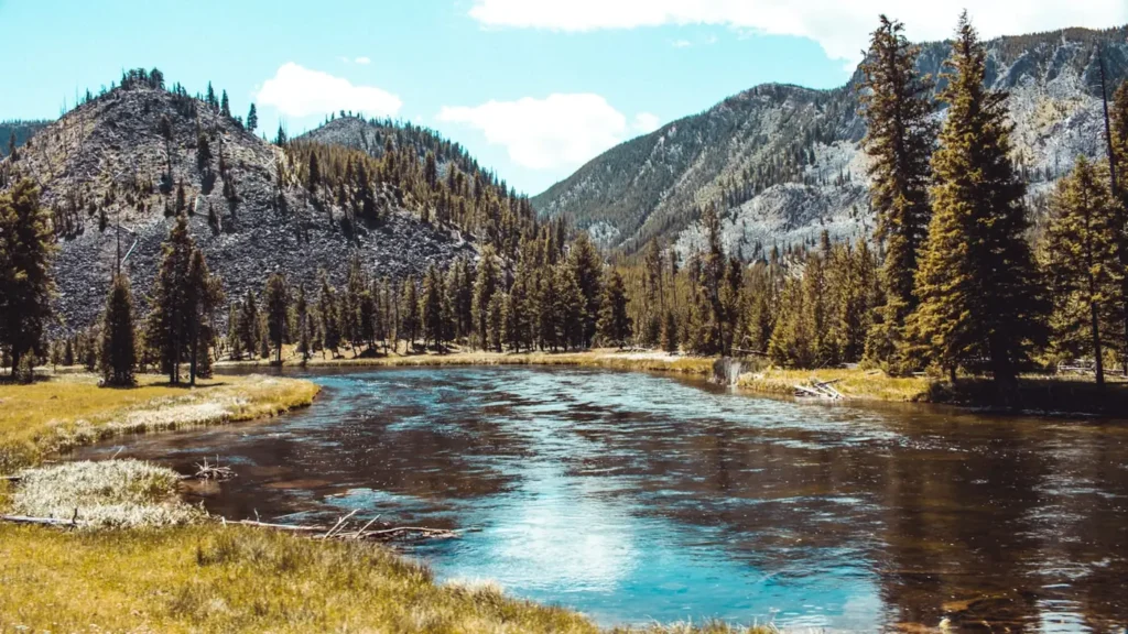
This water needs a real photo
The photo at the top of this page is not Salmon River.
It is a regional stand-in, honestly captioned but generic — we will not put a name to a river we cannot prove. Send us a photograph you took here and it replaces the stand-in, with your credit on it.
Pioneer badgeUnclaimed
Add a photo of this water
Landscape, not fish — the water itself. Reviewed by hand before it appears. The first one published here earns the Pioneer badge.
Fished this water? Add a photo
Reviewed by hand before it appears. Pick the water, not the spot — we never publish exact locations.
Access
Stanley and the Sawtooth Valley: upper river access and the top of the trout water.
Sunbeam and Torrey's: middle upper river accesses on Highway 75.
Challis and the Highway 93 corridor: numerous pullouts and boat ramps.
Salmon: town access near the gauge, outfitters and lodging.
Corn Creek: the launch for the Middle Fork and Main Salmon wilderness floats, permit required.
Riggins and the lower river: the center of the fall and spring steelhead fishery.
Seasons
March through May: spring steelhead on the lower river; runoff builds on the upper.
June and July: high snowmelt, wilderness raft season begins as it drops.
August and September: prime cutthroat fishing, low clear water, the best wading of the year.
October through December: fall steelhead, cold mornings, the classic Idaho swing season.
From the water
No logged trips yet. Be the first to put this water on your map.
Log this water
Fished it or cleaned it? Log in or create a free account to log a trip with photos and earn the waterway badge.
Questions
What is the current flow on the Salmon River?
As of Oct 19, 3:45 am, the USGS gauge SALMON RIVER AT SALMON ID reads 1,120 cfs, the 30th percentile for this date. Conditions update every 15 minutes.
What species can you catch on the Salmon River?
Anglers target Bull Trout, Chinook Salmon, Mountain Whitefish, Rainbow Trout, Steelhead, Westslope Cutthroat Trout on the Salmon River in Idaho.
Are there fishing guides on the Salmon River?
GuidedFloats lists 2 guides and outfitters on the Salmon River. Claimed profiles accept booking requests; unclaimed profiles are built from public records and link to the business.
Where can you access the Salmon River?
Stanley and the Sawtooth Valley: upper river access and the top of the trout water. Sunbeam and Torrey's: middle upper river accesses on Highway 75. Challis and the Highway 93 corridor: numerous pullouts and boat ramps. Salmon: town access near the gauge, outfitters and lodging. Corn Creek: the launch for the Middle Fork and Main Salmon wilderness floats, permit required. Riggins and the lower river: the center of the fall and spring steelhead fishery.
When is the best time to fish the Salmon River?
March through May: spring steelhead on the lower river; runoff builds on the upper. June and July: high snowmelt, wilderness raft season begins as it drops. August and September: prime cutthroat fishing, low clear water, the best wading of the year. October through December: fall steelhead, cold mornings, the classic Idaho swing season.
Where are the fishing regulations for the Salmon River?
Regulations change by season and section. Read the current rules on the Idaho agency site: https://idfg.idaho.gov/rules/fish