Fishes Pere Marquette River
River · Great Lakes · Michigan
Pere Marquette River Fishing Guides
A National Wild and Scenic river in west Michigan, the first American river stocked with brown trout and the home of the flies-only water above Baldwin.
Map of the Pere Marquette River
37 numbered points: 14 access points, 10 campsites, 4 bridges, 5 parks and conservation areas, 1 agency office, 2 regulation section limits, 1 USGS gauge. Tap a marker for details. Reviewed Sep 25, 2026.
- Access / boat ramp (14)
- Campsite (10)
- Bridge crossing (4)
- Park / conservation area (5)
- Agency / conservation office (1)
- Regulation section limit (2)
- USGS gauge (1)
Map data © OpenStreetMap contributors. Points are curated from OpenStreetMap and state agency sources; confirm access and hours before you go.
Print it. Bag it. Bring it.Phones die, screens crack, and most of this water has no signal. Print this map, fold it into a zip-top bag or dry bag with your license, and you have a backup your electronics can’t give you. Every marker is numbered so you can say exactly where you are.
Open the printable mapAll 37 points on this map
| # | Point | Type | Lat, Lon | Notes |
|---|---|---|---|---|
| 1 | The Forks Access Michigan DNR boating access site | Access / boat ramp | 43.85299, -85.84218 | Uppermost access on the named main stem, at the forks where the Middle Branch and Baldwin River come together. Tagged as a park in OSM; it is a boating access site. |
| 2 | Whispering Oaks Campground Private campground · Baldwin | Campsite | 43.86343, -85.85090 | Campground just off the river north of the M-37 crossing. |
| 3 | M-37 Bridge Access Michigan DNR · launch at the M-37 bridge | Access / boat ramp | 43.85743, -85.85026 | The standard put-in for the gear-restricted water and the busiest access on the upper river. |
| 4 | Flies-Only Water — upper limit at M-37 Michigan DNR gear-restricted reach | Regulation section limit | 43.85757, -85.85137 | Upstream end of the roughly eight-mile flies-only reach, which runs from the M-37 bridge down to Gleason's Landing. Read the current rules on the DNR's own page; this sheet marks the boundary only. |
| 5 | Marquette Rail Bridge Active railroad crossing | Bridge crossing | 43.86026, -85.85774 | Railroad bridge a short way below the M-37 launch. |
| 6 | Baldwin/White Cloud Ranger Station Huron-Manistee National Forests | Agency / conservation office | 43.89303, -85.85064 | Ranger district office for the national forest land the river runs through; the place to ask about campground and landing status. |
| 7 | Claybanks Campground National forest campground | Campsite | 43.87085, -85.88234 | Walk-in forest campground inside the flies-only water. |
| 8 | Gleason's Landing Campground National forest campground | Campsite | 43.87171, -85.92017 | Forest campground at the landing; OSM writes it without the apostrophe. |
| 9 | Gleason's Landing Michigan DNR · canoe and wade access | Access / boat ramp | 43.87084, -85.91973 | Well-known landing and the downstream end of the flies-only reach. |
| 10 | Flies-Only Water — lower limit at Gleason's Landing Michigan DNR gear-restricted reach | Regulation section limit | 43.87060, -85.91976 | Downstream end of the flies-only reach that starts at the M-37 bridge, about eight river miles above. |
| 11 | West 56th Street Bridge (Bowman Bridge) Bowman Bridge crossing | Bridge crossing | 43.88706, -85.93710 | The 56th Street crossing at Bowman Bridge, one of the river's main reference points for float lengths. |
| 12 | Bowman Bridge Campground National forest campground | Campsite | 43.88884, -85.94361 | Forest campground and canoe launch at the Bowman Bridge crossing. |
| 13 | Bowman Lake Campground National forest campground · walk-in | Campsite | 43.89133, -85.96784 | Small walk-in forest campground on Bowman Lake, under a kilometre north of the river. |
| 14 | Rainbow Rapids River access | Access / boat ramp | 43.92172, -85.97600 | Access at the Rainbow Rapids reach, the fastest water on the middle river. |
| 15 | Sulak Landing National forest landing | Access / boat ramp | 43.92611, -86.00565 | Landing beside the Sulak forest campground. |
| 16 | Sulak Campground National forest campground | Campsite | 43.92440, -86.01222 | Walk-in forest campground at Sulak. |
| 17 | Upper Branch Bridge Landing Landing at the South Branch Road bridge | Access / boat ramp | 43.92978, -86.02146 | Landing at the Upper Branch Bridge crossing; a second unnamed access node sits 30 m away and is the same site. |
| 18 | Elk Canoe Campground National forest canoe camp | Campsite | 43.92825, -86.02968 | Canoe-in forest campground below Upper Branch Bridge. |
| 19 | South Landon Road Access Roadside access at the bridge | Access / boat ramp | 43.93520, -86.05077 | Unnamed in OSM; it is the access at the South Landon Road crossing, 25 m from the bridge. |
| 20 | Log Mark Canoe and Fishing Landing Rest stop, canoe and fishing landing | Access / boat ramp | 43.93751, -86.07429 | Tagged as a campsite in OSM but signed as a rest stop and landing, so it is mapped as an access. |
| 21 | Walhalla Bridge River Access Access at the South Walhalla Road bridge | Access / boat ramp | 43.93298, -86.11551 | Access at the Walhalla crossing on the lower river. |
| 22 | Indian Bridge River Access Access at the South Reek Road bridge | Access / boat ramp | 43.93756, -86.18237 | Access at the Indian Bridge crossing. |
| 23 | Custer Bridge River Access Access at the South Custer Road bridge | Access / boat ramp | 43.93719, -86.21861 | Access at the Custer crossing, the last one above Scottville. |
| 24 | Riverside Park City of Scottville · riverside park | Park / conservation area | 43.94409, -86.27428 | Scottville's river park, with the city campground beside it. |
| 25 | Riverside Park Campground City of Scottville campground | Campsite | 43.94292, -86.27661 | Municipal campground on the river in Scottville. |
| 26 | South Scottville Road Bridge Scottville crossing | Bridge crossing | 43.94481, -86.27931 | The Scottville Road crossing; the river's reference gauge sits at this bridge. |
| 27 | USGS 04122500 — Pere Marquette River at Scottville Real-time stage and discharge | USGS gauge | 43.94501, -86.27869 | The gauge float levels on this river are read from, at the Scottville crossing. |
| 28 | Henry's Landing Access Launch at Henry's Landing | Access / boat ramp | 43.94516, -86.28200 | Unnamed in OSM; it is the launch belonging to Henry's Landing campground, 150 m away. |
| 29 | Henry's Landing Campground Private campground · Scottville | Campsite | 43.94422, -86.28081 | Campground and canoe livery on the river at Scottville. |
| 30 | Pere Marquette Highway Bridge South Pere Marquette Highway | Bridge crossing | 43.93246, -86.41722 | Last road crossing above Pere Marquette Lake. |
| 31 | Pere Marquette Highway Access Riverside access | Access / boat ramp | 43.93390, -86.42134 | Unnamed in OSM; access on the river just below the Pere Marquette Highway bridge. |
| 32 | Pere Marquette Conservation Park Mason County | Park / conservation area | 43.92765, -86.43933 | Wooded park on the south side of the river above Pere Marquette Lake. |
| 33 | Buttersville Park Pere Marquette Charter Township | Park / conservation area | 43.93577, -86.45153 | Township park on the Buttersville peninsula between the lake and Lake Michigan. |
| 34 | Buttersville Campground Township campground | Campsite | 43.93469, -86.45084 | Campground inside Buttersville Park. |
| 35 | Copeyon Park Boat Launch Launch in Copeyon Park · Ludington | Access / boat ramp | 43.94511, -86.44215 | Unnamed launch node inside Copeyon Park; the park's ramp onto Pere Marquette Lake. |
| 36 | Father Marquette Park and Shrine Ludington | Park / conservation area | 43.94183, -86.45305 | Memorial park at the river's mouth on Pere Marquette Lake. |
| 37 | Waterfront Park City of Ludington | Park / conservation area | 43.95206, -86.45194 | Ludington's waterfront park on the north shore of Pere Marquette Lake. |
Guides on the Pere Marquette River
Claimed profiles take booking requests. Unclaimed profiles are built from public records so the river is never empty; the guide can claim or remove one any time.
About the Pere Marquette River
The Pere Marquette carries more history than any other Michigan trout stream. Brown trout were introduced to North America here in 1884, and the river has been a destination ever since. It runs undammed from the branches above Baldwin west to Ludington and Lake Michigan, and the middle section is designated National Wild and Scenic, which has kept the corridor undeveloped and the water clean.
Two fisheries share it. The flies-only, catch-and-release water from M-37 downstream to Gleasons Landing holds resident brown trout and gets the classic hatch calendar, with a hex hatch in June that draws anglers who fish it at midnight. From late summer through winter the river fills with chinook salmon and then steelhead running up from Lake Michigan, and the guided drift boat business shifts entirely to those fish. Fall on the PM is crowded, productive and worth planning around.
The Scottville gauge reads the lower river. Readings in the roughly 300 to 800 cfs range are normal working water for floats. This is a sand-bottomed river fed by groundwater, so it holds a steadier flow than a surface-runoff stream and clears quickly after rain; big spring events can push it up and color it for a few days. Water temperature stays cold enough for trout through the summer in the upper reaches.
Baldwin is the base town, with a fly shop, guides and lodges, and Ludington sits at the mouth. Access is a series of designated landings along the Wild and Scenic corridor, and the Forest Service manages a launch permit system during the busy season.
This water needs a real photo
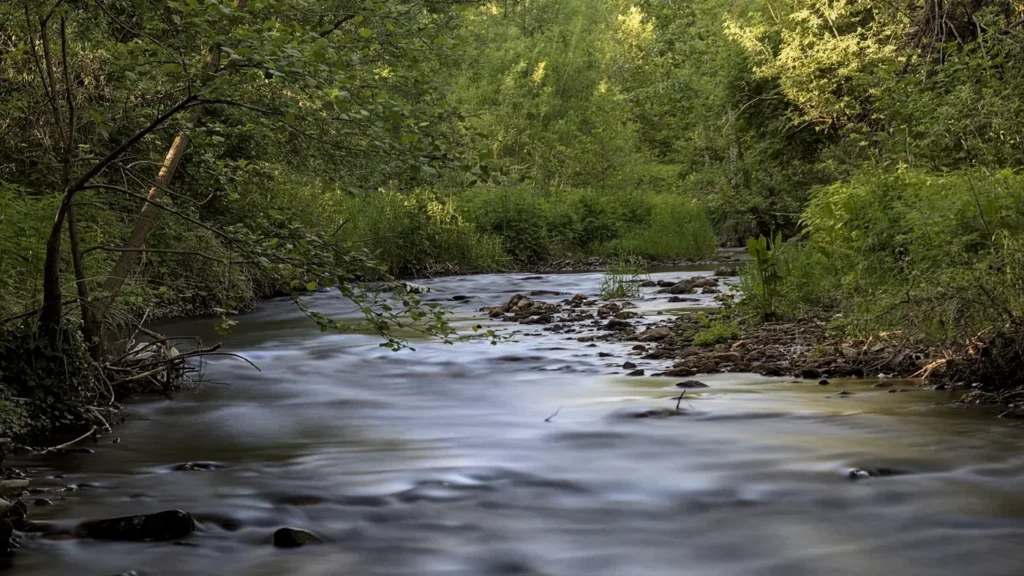
The photo at the top of this page is not Pere Marquette River.
It is a regional stand-in, honestly captioned but generic — we will not put a name to a river we cannot prove. Send us a photograph you took here and it replaces the stand-in, with your credit on it.
Pioneer badgeUnclaimed
Add a photo of this water
Landscape, not fish — the water itself. Reviewed by hand before it appears. The first one published here earns the Pioneer badge.
Fished this water? Add a photo
Reviewed by hand before it appears. Pick the water, not the spot — we never publish exact locations.
Access
M-37 Bridge: the top of the flies-only, catch-and-release section.
Gleasons Landing: the bottom of the flies-only water and a popular launch.
Bowman Bridge: the main Forest Service access and campground.
Sulak and Upper Branch Bridge: middle river landings.
Walhalla and Indian Bridge: lower river access toward Scottville.
Scottville and Custer: access near the gauge on the lower river.
Launch permits are required on the Wild and Scenic section during the busy season.
Seasons
April through June: trout season, caddis and sulphurs, then the June hex hatch at night.
July and August: terrestrials and low clear water; night fishing for the largest browns.
September through November: chinook first, then fresh fall steelhead; the busiest float weeks.
December through April: winter and spring steelhead, cold rowing and very good fishing.
From the water
No logged trips yet. Be the first to put this water on your map.
Log this water
Fished it or cleaned it? Log in or create a free account to log a trip with photos and earn the waterway badge.
Questions
What is the current flow on the Pere Marquette River?
As of Oct 18, 6:00 pm, the USGS gauge PERE MARQUETTE RIVER AT SCOTTVILLE, MI reads 608 cfs, the 61st percentile for this date. Conditions update every 15 minutes.
What species can you catch on the Pere Marquette River?
Anglers target Brook Trout, Brown Trout, Chinook Salmon, Rainbow Trout, Steelhead on the Pere Marquette River in Michigan.
Are there fishing guides on the Pere Marquette River?
GuidedFloats lists 5 guides and outfitters on the Pere Marquette River. Claimed profiles accept booking requests; unclaimed profiles are built from public records and link to the business.
Where can you access the Pere Marquette River?
M-37 Bridge: the top of the flies-only, catch-and-release section. Gleasons Landing: the bottom of the flies-only water and a popular launch. Bowman Bridge: the main Forest Service access and campground. Sulak and Upper Branch Bridge: middle river landings. Walhalla and Indian Bridge: lower river access toward Scottville. Scottville and Custer: access near the gauge on the lower river. Launch permits are required on the Wild and Scenic section during the busy season.
When is the best time to fish the Pere Marquette River?
April through June: trout season, caddis and sulphurs, then the June hex hatch at night. July and August: terrestrials and low clear water; night fishing for the largest browns. September through November: chinook first, then fresh fall steelhead; the busiest float weeks. December through April: winter and spring steelhead, cold rowing and very good fishing.
Where are the fishing regulations for the Pere Marquette River?
Regulations change by season and section. Read the current rules on the Michigan agency site: https://www.michigan.gov/dnr/things-to-do/fishing/fishing-regulations