Dolores River Fishing Guides
A San Juan Mountains freestone above McPhee Reservoir with good wild brown trout water around Rico, and a spectacular but release-dependent canyon float below the dam.
Map of the Dolores River
29 numbered points: 4 access points, 10 campsites, 8 parks and conservation areas, 3 agency offices, 1 regulation section limit, 2 hazards, 1 USGS gauge. Tap a marker for details. Reviewed Sep 24, 2026.
- Access / boat ramp (4)
- Campsite (10)
- Park / conservation area (8)
- Agency / conservation office (3)
- Regulation section limit (1)
- Dam / hazard (2)
- USGS gauge (1)
Print it. Bag it. Bring it.Phones die, screens crack, and most of this water has no signal. Print this map, fold it into a zip-top bag or dry bag with your license, and you have a backup your electronics can’t give you. Every marker is numbered so you can say exactly where you are.
Open the printable mapAll 29 points on this map
| # | Point | Type | Lat, Lon | Notes |
|---|---|---|---|---|
| 1 | Cayton Campground USFS · CO 145 above Rico | Campsite | 37.77153, -107.97673 | Highest campground on the Dolores; the river here is a small freestone stream in the San Juans. |
| 2 | Louis M Jones Memorial Park Town of Rico | Park / conservation area | 37.69044, -108.03237 | Riverside town park in Rico, on the upper river well above McPhee Reservoir. |
| 3 | Twin Spruce Ponds State Wildlife Area CPW · upper Dolores | Park / conservation area | 37.55269, -108.37742 | CPW property with a river-side lot; the lot is unnamed on CPW's own facilities map. |
| 4 | Dolores River State Wildlife Area CPW · above McPhee Reservoir | Park / conservation area | 37.49573, -108.40777 | CPW river frontage above the reservoir; its parking lot is unnamed on CPW's own map. |
| 5 | Dolores River Campground Private · CO 145 east of Dolores | Campsite | 37.47582, -108.45348 | Private riverside campground east of town; OSM carries two nodes for the same site. |
| 6 | Dolores City Park Town of Dolores | Park / conservation area | 37.47486, -108.49119 | |
| 7 | Lone Mesa State Park Visitor Center CPW · Dolores | Agency / conservation office | 37.47483, -108.49253 | CPW's office in Dolores; OSM's address data labels the same building 'Dept Of Wildlife Office'. |
| 8 | USGS 09166500 — Dolores River at Dolores USGS · Dolores, CO | USGS gauge | 37.47250, -108.49760 | The gauge the water page reads; it sits on the river in town, above McPhee Reservoir. |
| 9 | Joe Rowell Park Town of Dolores | Park / conservation area | 37.47079, -108.50934 | Main riverside park in Dolores. Flanders Park and Wagner Rotary Park are two smaller town lots nearby, not separately marked. |
| 10 | Dolores Ranger District / Tres Rios Field Office USFS & BLM · Dolores | Agency / conservation office | 37.46132, -108.51719 | Shared Forest Service and BLM field office; the permit and river-information desk for the lower canyon. |
| 11 | Canyons of the Ancients Visitor Center & Museum BLM · above McPhee Reservoir | Agency / conservation office | 37.47616, -108.54606 | BLM visitor centre and museum; OSM still carries its former name, Anasazi Heritage Center. |
| 12 | McPhee Campground USFS · McPhee Reservoir | Campsite | 37.49695, -108.55306 | Largest campground on the reservoir; the adjoining McPhee Group Area is not marked separately. |
| 13 | McPhee Recreation Area USFS · boat ramp, McPhee Reservoir | Access / boat ramp | 37.50027, -108.55343 | Main ramp on McPhee. It reads 1.0 km off the line because the line here is the drowned river channel, not the shore. |
| 14 | House Creek Campground USFS · House Creek arm, McPhee | Campsite | 37.51651, -108.53678 | Campground and ramp on the north arm; the House Creek Recreation Area node is the same site. |
| 15 | McPhee Dam Dolores Water Conservancy District | Dam / hazard | 37.57688, -108.57273 | Head of the tailwater — releases here set the river below. The unnamed weir just downstream is the outlet works and is not marked. |
| 16 | Metaska Recreation Site USFS · first site below the dam | Park / conservation area | 37.57721, -108.58371 | First river site below McPhee Dam, inside the reach CPW bounds at the Bradfield Bridge. |
| 17 | Ferris Canyon Campground USFS · Lone Dome SWA | Campsite | 37.61549, -108.63541 | Tent campground in the tailwater; CPW files the same ground under Lone Dome State Wildlife Area. |
| 18 | Dolores River State Wildlife Area — lower tract CPW / USFS · tailwater | Park / conservation area | 37.62221, -108.67982 | CPW maps the tailwater ground from Ferris Canyon to Bradfield as Lone Dome SWA; OSM marks two nodes under the Dolores River name, of which this is the lower. |
| 19 | Lone Dome Recreation Area USFS · tailwater | Park / conservation area | 37.62853, -108.67989 | |
| 20 | Cabin Canyon Campground USFS · tailwater | Campsite | 37.62943, -108.69343 | Recreation site and campground; CPW's Lone Dome SWA layer maps a tent campground at the same spot. |
| 21 | Bradfield boat launch USFS · Bradfield Bridge | Access / boat ramp | 37.65645, -108.73582 | Unnamed slipway in OSM; this is the put-in for the Lower Dolores run below McPhee, at the Bradfield Bridge. |
| 22 | Section limit — Bradfield Bridge CPW special-regulation reach | Regulation section limit | 37.65832, -108.73677 | Lower limit of the CPW reach that runs about 11 miles down from McPhee Dam. Check Colorado's regulations for what applies inside it. |
| 23 | Bradfield Campground USFS · Bradfield Bridge | Campsite | 37.65905, -108.73713 | Campground and picnic area at the bridge, beside the launch. |
| 24 | Mountain Sheep Point Boat Ramp BLM · upper Dolores Canyon | Access / boat ramp | 37.79538, -108.82598 | Ramp in the upper canyon; OSM also carries a separate 'Boat Launch' node for the same site. |
| 25 | Box Elder Campground BLM · upper Dolores Canyon | Campsite | 37.80401, -108.81927 | |
| 26 | Gypsum Valley Boat Ramp BLM · CO 141 at Gypsum Valley | Access / boat ramp | 38.13388, -108.88074 | |
| 27 | Gypsum Valley Camping Area BLM · CO 141 at Gypsum Valley | Campsite | 38.13443, -108.88019 | |
| 28 | Bedrock Campground BLM · Bedrock | Campsite | 38.30376, -108.89437 | |
| 29 | Stateline Rapids Lower canyon, just inside Utah | Dam / hazard | 38.75170, -109.06060 | Named rapid about 1.3 km west of the Colorado–Utah line, so it actually lies in Utah. |
Guides on the Dolores River
Claimed profiles take booking requests. Unclaimed profiles are built from public records so the river is never empty; the guide can claim or remove one any time.
Order on this page: premium and outfitter plans first (labelled Premium placement), then claimed free profiles, then unclaimed — one published price, no bidding for position. How placement works
About the Dolores River
The Dolores is really two rivers separated by a dam, and anglers need to know which one they are being sold. Above McPhee Reservoir the river is a classic southwestern Colorado freestone, dropping out of the San Juan Mountains through Rico and running down a narrowing valley to the town of Dolores. It is wadeable, wild and pleasantly uncrowded, with brown trout through the lower reaches, rainbows and cuttbows in the middle water and brook trout in the high tributaries. This gauge sits at the town of Dolores and reads that upper river.
Below McPhee Dam the river becomes something else entirely. The canyon downstream is one of the most beautiful stretches of water in the interior West, cutting through red sandstone toward the Utah line, and when there is water in it the float is extraordinary. The problem is that McPhee is an irrigation reservoir serving the Montezuma Valley, and in dry years the downstream release is cut to a trickle for months at a time. Boating releases happen in wet springs and not at all in dry ones, and the trout fishery below the dam has suffered badly through repeated low-water years.
Plan accordingly. The upper river above the reservoir fishes on a normal snowmelt schedule and is a dependable summer and fall trip. The canyon below the dam requires watching the release forecast, which is published by the water district in spring, and being ready to move quickly when a release is announced. This gauge reports discharge and stage but no water temperature. It describes the upper river only and tells you nothing about what is coming out of the dam, which is a separate and much more variable number.
This water needs a real photo
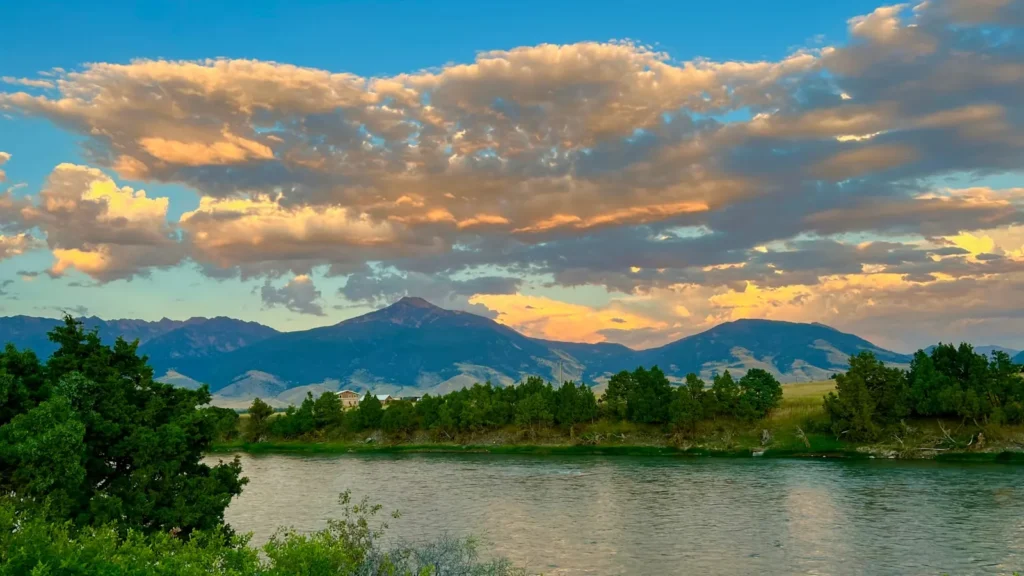
The photo at the top of this page is not Dolores River.
It is a regional stand-in, honestly captioned but generic — we will not put a name to a river we cannot prove. Send us a photograph you took here and it replaces the stand-in, with your credit on it.
Add a photo of this water
Landscape, not fish — the water itself. Reviewed by hand before it appears. The first one published here earns the Pioneer badge.
Fished this water? Add a photo
Reviewed by hand before it appears. Pick the water, not the spot — we never publish exact locations.
Access
Rico and the upper Highway 145 pull-offs - small-stream freestone water in the San Juans.
Stoner and the middle valley - roadside access on the upper river.
Town of Dolores river park - the reach this gauge reads, with easy bank access.
McPhee Reservoir boat ramps - still-water launching above the dam.
Bradfield Bridge - the standard put-in for the canyon float below McPhee Dam.
Dove Creek Pumps - a common canyon take-out on shorter floats.
Slick Rock - the lower canyon access toward the Utah line.
Seasons
Spring: snowmelt on the upper river, and the annual decision on whether a canyon boating release will happen.
Summer: good wading and dry-fly fishing above the reservoir as the upper river drops and clears.
Fall: low clear water, strong brown trout fishing around Rico and Stoner, and very few anglers.
Winter: cold and quiet, with the upper valley snowed in and limited access.
From the water
No logged trips yet. Be the first to put this water on your map.
Log this water
Fished it or cleaned it? Log in or create a free account to log a trip with photos and earn the waterway badge.
Questions
What is the current flow on the Dolores River?
As of Nov 2, 6:45 am, the USGS gauge DOLORES RIVER AT DOLORES, CO. reads 9,270 cfs. Conditions update every 15 minutes.
What species can you catch on the Dolores River?
Anglers target Brook Trout, Brown Trout, Cutthroat Trout, Rainbow Trout, Smallmouth Bass on the Dolores River in Colorado.
Are there fishing guides on the Dolores River?
GuidedFloats lists 3 guides and outfitters on the Dolores River. Claimed profiles accept booking requests; unclaimed profiles are built from public records and link to the business.
Where can you access the Dolores River?
Rico and the upper Highway 145 pull-offs - small-stream freestone water in the San Juans. Stoner and the middle valley - roadside access on the upper river. Town of Dolores river park - the reach this gauge reads, with easy bank access. McPhee Reservoir boat ramps - still-water launching above the dam. Bradfield Bridge - the standard put-in for the canyon float below McPhee Dam. Dove Creek Pumps - a common canyon take-out on shorter floats. Slick Rock - the lower canyon access toward the Utah line.
When is the best time to fish the Dolores River?
Spring: snowmelt on the upper river, and the annual decision on whether a canyon boating release will happen. Summer: good wading and dry-fly fishing above the reservoir as the upper river drops and clears. Fall: low clear water, strong brown trout fishing around Rico and Stoner, and very few anglers. Winter: cold and quiet, with the upper valley snowed in and limited access.
Where are the fishing regulations for the Dolores River?
Regulations change by season and section. Read the current rules on the Colorado agency site: https://cpw.state.co.us/rules-and-regulations