Altamaha River Fishing Guides
Georgia's largest river, draining a quarter of the state through undeveloped swamp forest, guided for bass, bream, catfish and a spring shad run.
Map of the Altamaha River
20 numbered points: 18 access points, 1 park or conservation area, 1 USGS gauge. Tap a marker for details. Reviewed Sep 28, 2026.
- Access / boat ramp (18)
- Park / conservation area (1)
- USGS gauge (1)
Print it. Bag it. Bring it.Phones die, screens crack, and most of this water has no signal. Print this map, fold it into a zip-top bag or dry bag with your license, and you have a backup your electronics can’t give you. Every marker is numbered so you can say exactly where you are.
Open the printable mapAll 20 points on this map
| # | Point | Type | Lat, Lon | Notes |
|---|---|---|---|---|
| 1 | State Highway 135 Landing GA-DOT ramp, Montgomery County, river km 3 | Access / boat ramp | 31.95848, -82.51718 | Paved ramp at the GA 135 bridge, the first public put-in below the Oconee-Ocmulgee confluence. Twin of Town Bluff on the opposite bank. |
| 2 | Town Bluff (SR 135) GA-DOT ramp, Jeff Davis County, river km 5 | Access / boat ramp | 31.95056, -82.50721 | Paved ramp on the south bank at the GA 135 crossing, 1.5 km below the Montgomery County landing. |
| 3 | McNatt Falls Toombs County, river km 13 | Access / boat ramp | 31.96846, -82.46823 | Paved landing on the Toombs bank. The shoal it is named for is the only real drop in the upper river. |
| 4 | Grays Landing Toombs County, river km 17 | Access / boat ramp | 31.96645, -82.42894 | Paved ramp, the usual take-out for a short float down from the GA 135 bridges. |
| 5 | Deen's Landing Appling County, river km 24 | Access / boat ramp | 31.94104, -82.37384 | Paved ramp on the Appling bank, 333 m off the mapped centreline down an access cut. |
| 6 | US Highway 1 Landing GA-DOT ramp, Toombs County, river km 27 | Access / boat ramp | 31.94011, -82.35496 | Paved ramp at the US 1 crossing. The bridge is the main landmark on the upper river. |
| 7 | Morris Landing Appling County, river km 36 | Access / boat ramp | 31.93830, -82.28093 | Paved ramp, the next public access below US 1. |
| 8 | Eason Bluff Appling County, river km 49 | Access / boat ramp | 31.90049, -82.19342 | Paved ramp under a cut bank on the Appling side. |
| 9 | Big Hammock WMA Georgia DNR, Tattnall County, river km 61 | Park / conservation area | 31.89746, -82.10929 | State wildlife management area on the Tattnall bank; the Big Hammock Natural Area sandhill sits inside it. Boat access is at the Stanfield ramp. |
| 10 | J.E. Stanfield Landing Big Hammock WMA, Tattnall County, river km 61 | Access / boat ramp | 31.88570, -82.10690 | Paved ramp inside Big Hammock WMA and the access point for that stretch. |
| 11 | Carter Bight Appling County, river km 64 | Access / boat ramp | 31.86195, -82.11485 | Paved ramp opposite the Big Hammock bend. |
| 12 | Upper Wayne County Landing Wayne County, river km 84 | Access / boat ramp | 31.78478, -81.98426 | Paved ramp, the first public access in Wayne County and a long 20 km run down from Carter Bight. |
| 13 | Oglethorpe Bluff Landing Wayne County, river km 99 | Access / boat ramp | 31.72085, -81.89966 | Paved ramp on a bluff bank, 338 m off the centreline down its approach. |
| 14 | Jaycee Landing Wayne County, river km 109 | Access / boat ramp | 31.66679, -81.84485 | Paved ramp just above the US 301 corridor at Doctortown - the busiest access on the middle river. |
| 15 | Johnston Station Long County, river km 110 | Access / boat ramp | 31.66711, -81.83738 | Paved ramp on the Long County bank, 800 m below Jaycee Landing and the usual pair with it. |
| 16 | Williamsburg Landing Sansavilla WMA, Wayne County, river km 155 | Access / boat ramp | 31.50847, -81.65898 | Paved ramp inside Sansavilla WMA, the last public access before the river opens into its delta. |
| 17 | Barrington Park McIntosh County, river km 162 | Access / boat ramp | 31.47151, -81.60694 | County park and paved ramp at the old Barrington Ferry crossing, 592 m off the centreline. |
| 18 | Altamaha Regional Park Glynn County, river km 169 | Access / boat ramp | 31.42678, -81.60615 | Regional park with a paved ramp, campground and fishing pier on the lower river. |
| 19 | Two-Way Fish Camp Glynn County, delta reach | Access / boat ramp | 31.32693, -81.44565 | Hoist and marina on the South Altamaha in the delta, about 1.7 km off the mapped main channel because the river braids below Altamaha Park. The standard saltwater-side launch. |
| 20 | USGS gauge - Altamaha River Roster gauge coordinate | USGS gauge | 31.95786, -82.51703 | River stage for the upper Altamaha at the GA 135 crossing. The river is big and slow; stage decides which sandbars are campable. |
Guides on the Altamaha River
Claimed profiles take booking requests. Unclaimed profiles are built from public records so the river is never empty; the guide can claim or remove one any time.
No guides listed yet
Guide or outfit this water? Create your profile. Listing is free, the commission is 10% or 7% with a premium profile, and premium profiles list first on this water.
About the Altamaha River
The Altamaha is Georgia’s biggest river and one of the largest undammed rivers on the Atlantic coast. It begins where the Oconee and the Ocmulgee join near Lumber City and runs about a hundred and forty miles southeast through the coastal plain to the sea at Darien, draining better than a quarter of the state on the way. There is no dam on the mainstem, which is the fact that shapes everything else: the river rises and falls on rainfall across an enormous basin, and the floodplain beside it is a continuous corridor of cypress, tupelo and bottomland hardwood, much of it in conservation ownership and almost none of it developed.
The fishery is as broad as the river. Largemouth bass hold on the cypress, the laydowns and the mouths of the countless oxbows and sloughs that peel off the main channel. Redbreast sunfish and bluegill fill the same cover and are the summer staple for local anglers. The catfishing is genuinely serious, with channel, blue and flathead catfish all present and flatheads reaching large sizes in the deep bends. American shad run up from the sound in late winter and early spring and are a real seasonal fishery, and striped bass and hybrids use the lower river. Guiding runs out of Jesup, Darien and the Baxley area, mostly in jon boats, and a guide earns their fee here purely on knowing which sloughs are worth entering at a given stage.
The gauge at the US 221 crossing near Charlotteville reads the upper mainstem and is the number to plan against. Because the Altamaha is undammed and its basin is huge, rain far upstream in the Oconee or Ocmulgee arrives here days later, so the trace can be climbing under a clear local sky. High water pushes fish out into the flooded timber and makes them very hard to find; a falling stage pulling fish back to the channel edge is the condition to look for. No temperature sensor publishes at this site.
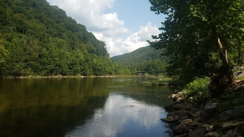
This water needs a real photo
The photo at the top of this page is not Altamaha River.
It is a regional stand-in, honestly captioned but generic — we will not put a name to a river we cannot prove. Send us a photograph you took here and it replaces the stand-in, with your credit on it.
Add a photo of this water
Landscape, not fish — the water itself. Reviewed by hand before it appears. The first one published here earns the Pioneer badge.
Fished this water? Add a photo
Reviewed by hand before it appears. Pick the water, not the spot — we never publish exact locations.
Access
US 221 crossing near Charlotteville - the closest public access to the gauge.
Altamaha Regional Park near Baxley - a developed ramp on the upper river.
Jesup area landings - the main mid-river boat access.
Morgan Lake landing - access to the lower river and its oxbows.
US 301 crossing near Jesup - a bridge access with parking.
Altamaha Wildlife Management Area near Darien - lower river and delta access.
Paradise Park in Darien - tidal reach access near the mouth.
Seasons
Spring: the shad run in the lower river and strong bass fishing as the water warms and drops.
Summer: low, clear and the best bream fishing of the year on the sandbars and cypress.
Fall: excellent all-round fishing with light traffic and comfortable weather.
Winter: high and cold, with catfish and crappie the most dependable targets.
From the water
No logged trips yet. Be the first to put this water on your map.
Log this water
Fished it or cleaned it? Log in or create a free account to log a trip with photos and earn the waterway badge.
Questions
What is the current flow on the Altamaha River?
As of Nov 2, 6:45 am, the USGS gauge ALTAMAHA RIVER AT US 221, NR CHARLOTTEVILLE, GA reads 2,160 cfs. Conditions update every 15 minutes.
What species can you catch on the Altamaha River?
Anglers target American Shad, Black Crappie, Blue Catfish, Bluegill, Bowfin, Channel Catfish, Flathead Catfish, Hybrid Striped Bass, Largemouth Bass, Longnose Gar, Redbreast Sunfish, Striped Bass, White Crappie on the Altamaha River in Georgia.
Where can you access the Altamaha River?
US 221 crossing near Charlotteville - the closest public access to the gauge. Altamaha Regional Park near Baxley - a developed ramp on the upper river. Jesup area landings - the main mid-river boat access. Morgan Lake landing - access to the lower river and its oxbows. US 301 crossing near Jesup - a bridge access with parking. Altamaha Wildlife Management Area near Darien - lower river and delta access. Paradise Park in Darien - tidal reach access near the mouth.
When is the best time to fish the Altamaha River?
Spring: the shad run in the lower river and strong bass fishing as the water warms and drops. Summer: low, clear and the best bream fishing of the year on the sandbars and cypress. Fall: excellent all-round fishing with light traffic and comfortable weather. Winter: high and cold, with catfish and crappie the most dependable targets.
Where are the fishing regulations for the Altamaha River?
Regulations change by season and section. Read the current rules on the Georgia agency site: https://georgiawildlife.com/fishing-regulations