Fishes Flint River, Ocmulgee River
River · Central and south Georgia, from Macon down through Hawkinsville and Abbeville toward the Altamaha · Georgia
Ocmulgee River Fishing Guides
A big, sandy coastal-plain river below Macon with heavy flathead catfish, strong redbreast sunfish and a spring shad run that reaches well upstream.
Map of the Ocmulgee River
40 numbered points: 33 access points, 2 campsites, 2 parks and conservation areas, 2 hazards, 1 USGS gauge. Tap a marker for details. Reviewed Sep 26, 2026.
- Access / boat ramp (33)
- Campsite (2)
- Park / conservation area (2)
- Dam / hazard (2)
- USGS gauge (1)
Map data © OpenStreetMap contributors. Points are curated from OpenStreetMap and state agency sources; confirm access and hours before you go.
Print it. Bag it. Bring it.Phones die, screens crack, and most of this water has no signal. Print this map, fold it into a zip-top bag or dry bag with your license, and you have a backup your electronics can’t give you. Every marker is numbered so you can say exactly where you are.
Open the printable mapAll 40 points on this map
| # | Point | Type | Lat, Lon | Notes |
|---|---|---|---|---|
| 1 | Lloyd Shoals Dam Georgia Power, Lake Jackson | Dam / hazard | 33.32061, -83.84101 | The dam that makes Lake Jackson and starts the river. Everything above it is lake water. |
| 2 | Lloyd Shoals Dam (Georgia Power ramp) Georgia Power, Jasper County | Access / boat ramp | 33.31608, -83.84033 | Tailrace ramp immediately below the dam - the top put-in on the Ocmulgee. |
| 3 | Marjorie Kahn Popper Hand Launch DNR-WRD, Jasper County | Access / boat ramp | 33.26439, -83.82477 | Hand launch on the Oconee National Forest frontage, signed as a kayak launch in OSM. |
| 4 | Wise Creek Canoe Launch USFS, Jasper County | Access / boat ramp | 33.24358, -83.81411 | Forest Service canoe launch, mapped in OSM as the Wise Creek take-out. |
| 5 | Ocmulgee Flats Camp US Forest Service, Jasper County | Campsite | 33.17835, -83.81754 | Forest Service riverside campsite on the Ocmulgee Bluff tract, about 500 m off the water. |
| 6 | Key Bridge (SR83) DNR-WRD, Jasper County | Access / boat ramp | 33.15963, -83.82347 | DNR ramp at the GA 83 crossing. |
| 7 | East Juliette Dam Monroe County | Access / boat ramp | 33.10730, -83.79633 | County ramp on the Monroe County bank at the Juliette dam. |
| 8 | Juliette Dam Juliette, Monroe-Jones county line | Dam / hazard | 33.10607, -83.79507 | Low dam across the mainstem at Juliette. Take out above it; ramps sit on both banks. |
| 9 | Below Juliette Dam Private, Jones County | Access / boat ramp | 33.10492, -83.79358 | Privately run access on the Jones County bank below the dam; fee. |
| 10 | Popes Ferry DNR-WRD, Monroe County | Access / boat ramp | 32.99374, -83.72533 | Bank access. The DNR record shows no canoe slide here. |
| 11 | Jay Hall North River Access Amerson River Park, Macon | Access / boat ramp | 32.88158, -83.65813 | Upper of the two launches in Amerson River Park, carried by DNR as Amerson Water Works Park. |
| 12 | Bragg Jam South River Access Amerson River Park, Macon | Access / boat ramp | 32.86913, -83.65457 | Lower Amerson River Park launch, about 3 km below the north access. |
| 13 | Riverview Park (Spring St Bridge) City of Macon | Access / boat ramp | 32.84583, -83.62738 | Canoe and kayak only on the city's record. Mapped in OSM as Spring Street Landing. |
| 14 | Ocmulgee Riverwalk City of Macon | Park / conservation area | 32.83349, -83.61401 | Riverwalk park through downtown Macon between the Spring Street and Georgia Central crossings. |
| 15 | Bullards Landing Twiggs County | Access / boat ramp | 32.62585, -83.54251 | County ramp below Macon. |
| 16 | Knowles (SR96) DNR-WRD, Houston County | Access / boat ramp | 32.54213, -83.53728 | DNR ramp at the GA 96 crossing. |
| 17 | Westlake Landing Twiggs County bank | Access / boat ramp | 32.48581, -83.48819 | Ramp confirmed by an OSM slipway of the same name. |
| 18 | Dykes Landing Bleckley County | Access / boat ramp | 32.41459, -83.48299 | County ramp just below Stephens Bluff. |
| 19 | Uchee Shoals (Downtown Hawkinsville) Pulaski County, Hawkinsville | Access / boat ramp | 32.28383, -83.46261 | Town ramp at Uchee Shoals. The USGS gauge sits within 100 m of it. |
| 20 | USGS gauge - Ocmulgee River at Hawkinsville USGS streamgage | USGS gauge | 32.28300, -83.46231 | The stage and discharge gauge the water page reads. Coordinates come from the site roster. |
| 21 | Hawkinsville (Mile Branch Park) DNR-WRD, Pulaski County | Access / boat ramp | 32.27068, -83.46117 | DNR ramp in Mile Branch Park, about 1.3 km below the Uchee Shoals ramp. |
| 22 | Mile Branch Park Pulaski County, Hawkinsville | Campsite | 32.27063, -83.46231 | Camping in the same park as the DNR ramp - the only mapped campground on the middle river. |
| 23 | Sandy Hammock (SR230) DNR-WRD, Pulaski County | Access / boat ramp | 32.13977, -83.36745 | DNR ramp at the GA 230 crossing; OSM also maps the landing as a park. |
| 24 | Ochise Landing Dodge County | Access / boat ramp | 32.08335, -83.30030 | County ramp at the end of Ochise Bubbling Water Landing Road. |
| 25 | Dodge County Landing Dodge County | Access / boat ramp | 32.07487, -83.29562 | Second Dodge County ramp, about 1 km below Ochise. |
| 26 | Half Moon Landing DNR-WRD, Wilcox County | Access / boat ramp | 32.00088, -83.29570 | DNR ramp above the Rhine-Abbeville crossing. |
| 27 | Statham Shoals Landing DNR-WRD, Wilcox County | Access / boat ramp | 31.96835, -83.27982 | DNR ramp at Statham Shoals. |
| 28 | McCranie's Landing Private, Telfair County | Access / boat ramp | 31.95165, -83.23635 | Privately operated but carried as free on the DNR record. |
| 29 | Dodge Lake Landing Telfair County | Access / boat ramp | 31.87558, -83.17528 | County ramp on the Telfair bank. |
| 30 | Ben Hill County Landing DNR-WRD, Ben Hill County | Access / boat ramp | 31.77456, -83.00753 | DNR ramp on the lower river below Abbeville. |
| 31 | Coffee County Landing Coffee County | Access / boat ramp | 31.77653, -82.99325 | County ramp about 1.5 km below the Ben Hill ramp. |
| 32 | Barr's Bluff Landing DNR-WRD, Coffee County | Access / boat ramp | 31.77858, -82.91925 | DNR ramp at Barr's Bluff. |
| 33 | Flat Tub Landing DNR, Coffee County | Access / boat ramp | 31.78875, -82.85748 | DNR ramp at Flat Tub on the Horse Creek WMA reach. |
| 34 | Scuffle Bluff DNR-WRD, Telfair County | Access / boat ramp | 31.81585, -82.83935 | DNR ramp at Scuffle Bluff; OSM maps the landing as a park too. |
| 35 | Rocky Hammock Landing DNR, Jeff Davis County | Access / boat ramp | 31.81461, -82.82381 | DNR ramp on the Jeff Davis bank. |
| 36 | Horse Creek WMA DNR, Telfair County | Park / conservation area | 31.83261, -82.80522 | Wildlife management area frontage on the lower river. The DNR record does not say whether a ramp or bank fishing is available. |
| 37 | Burkett's Ferry Landing DNR-WRD, Jeff Davis County | Access / boat ramp | 31.86818, -82.75144 | DNR ramp at the old Burkett's Ferry crossing. |
| 38 | McRae's Landing Telfair County | Access / boat ramp | 31.90399, -82.70020 | County ramp above Lumber City. |
| 39 | Lumber City Landing City of Lumber City | Access / boat ramp | 31.92036, -82.67501 | Town ramp at Lumber City, beside the Norfolk Southern swing bridge and the US 341 crossings. |
| 40 | Hinsons Landing DNR-WRD, Jeff Davis County | Access / boat ramp | 31.93474, -82.58944 | The lowest DNR ramp on the Ocmulgee, a short way above the Altamaha confluence. |
Guides on the Ocmulgee River
Claimed profiles take booking requests. Unclaimed profiles are built from public records so the river is never empty; the guide can claim or remove one any time.
Order on this page: premium and outfitter plans first (labelled Premium placement), then claimed free profiles, then unclaimed — one published price, no bidding for position. How placement works
About the Ocmulgee River
The Ocmulgee forms at Lake Jackson southeast of Atlanta, runs through Macon, and then settles into its real character on the coastal plain: a wide, sand-bottomed river of long bends, clean white sandbars and heavy standing timber along the cut banks. Below Hawkinsville and Abbeville it is genuinely big water, and it joins the Oconee to form the Altamaha, the largest river system in Georgia. The sandbars are a defining feature and they are why this river is as popular for camping and paddling as it is for fishing.
The fishery leans hard toward catfish and panfish. Flathead catfish, introduced and now thoroughly established, reach very large sizes in the deep bends and around submerged wood, and they are the target of most serious guided trips. Blue and channel catfish fill in around them. Redbreast sunfish, called redbellies locally, are a genuine tradition on this river and are fished with small spinners and crickets along the banks. Largemouth and spotted bass hold on the wood, and in late winter and early spring American shad and striped bass run upriver from the Altamaha, sometimes as far as the Macon area.
Practically, this is boat water. Guided fishing runs from jon boats and small center consoles working up and down from public landings, and the sand shifts enough that local knowledge of the channel is worth paying for. Deadfall and sandbars move every high-water year. Levels swing with releases from upstream and with rainfall across a large basin, and the gauge at Hawkinsville, which reports both flow and water temperature, is the standard reference for planning a day here. The sandbars also make this one of the best rivers in Georgia for a multi-day trip, and several guided operations combine a catfish float with an overnight camp on the bars rather than running back to a ramp each evening.
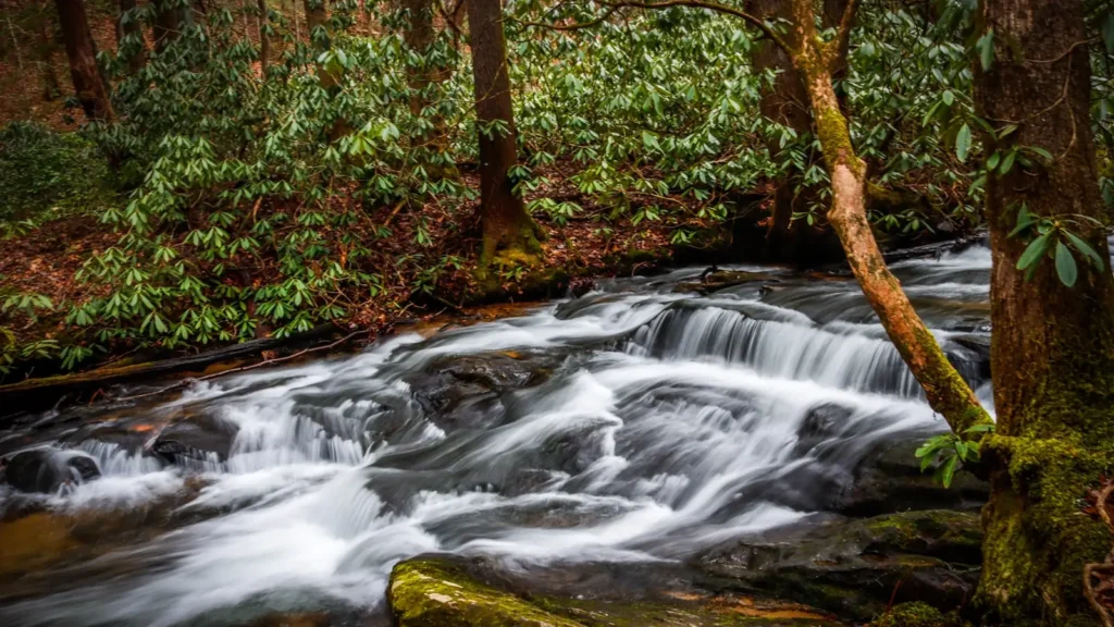
This water needs a real photo
The photo at the top of this page is not Ocmulgee River.
It is a regional stand-in, honestly captioned but generic — we will not put a name to a river we cannot prove. Send us a photograph you took here and it replaces the stand-in, with your credit on it.
Pioneer badgeUnclaimed
Add a photo of this water
Landscape, not fish — the water itself. Reviewed by hand before it appears. The first one published here earns the Pioneer badge.
Fished this water? Add a photo
Reviewed by hand before it appears. Pick the water, not the spot — we never publish exact locations.
Access
Macon riverfront and Amerson River Park - upper access with a launch and city bank fishing.
Bond Swamp National Wildlife Refuge - protected bottomland frontage below Macon.
Hawkinsville landing at the US 341 bridge - the gauge site and the most-used mid-river ramp.
Abbeville landing - lower-river public ramp with good access to the big catfish bends.
Horse Creek and Highway 280 access - mid-river launch used by paddlers and bank anglers.
Ocmulgee Wildlife Management Area - public land river frontage south of Abbeville.
Lumber City at the Oconee confluence - the bottom of the river where the Altamaha begins.
Seasons
Spring: shad and striped bass run upriver, flows are high, and redbreast fishing begins in earnest.
Summer: low clear water and warm nights, the prime season for big flathead catfish.
Fall: falling water concentrates fish on the bends and bass move back onto the timber.
Winter: cold and often high, slow for panfish but dependable for blue catfish in the deep holes.
From the water
No logged trips yet. Be the first to put this water on your map.
Log this water
Fished it or cleaned it? Log in or create a free account to log a trip with photos and earn the waterway badge.
Questions
What is the current flow on the Ocmulgee River?
As of Nov 2, 5:45 am, the USGS gauge OCMULGEE RIVER AT US 341, AT HAWKINSVILLE, GA reads 733 cfs. Conditions update every 15 minutes.
What species can you catch on the Ocmulgee River?
Anglers target American Shad, Blue Catfish, Bluegill, Channel Catfish, Flathead Catfish, Largemouth Bass, Redbreast Sunfish, Spotted Bass, Striped Bass on the Ocmulgee River in Georgia.
Are there fishing guides on the Ocmulgee River?
GuidedFloats lists 1 guide and outfitters on the Ocmulgee River. Claimed profiles accept booking requests; unclaimed profiles are built from public records and link to the business.
Where can you access the Ocmulgee River?
Macon riverfront and Amerson River Park - upper access with a launch and city bank fishing. Bond Swamp National Wildlife Refuge - protected bottomland frontage below Macon. Hawkinsville landing at the US 341 bridge - the gauge site and the most-used mid-river ramp. Abbeville landing - lower-river public ramp with good access to the big catfish bends. Horse Creek and Highway 280 access - mid-river launch used by paddlers and bank anglers. Ocmulgee Wildlife Management Area - public land river frontage south of Abbeville. Lumber City at the Oconee confluence - the bottom of the river where the Al...
When is the best time to fish the Ocmulgee River?
Spring: shad and striped bass run upriver, flows are high, and redbreast fishing begins in earnest. Summer: low clear water and warm nights, the prime season for big flathead catfish. Fall: falling water concentrates fish on the bends and bass move back onto the timber. Winter: cold and often high, slow for panfish but dependable for blue catfish in the deep holes.
Where are the fishing regulations for the Ocmulgee River?
Regulations change by season and section. Read the current rules on the Georgia agency site: https://georgiawildlife.com/fishing-regulations