Beta

GuidedFloats is in beta. The full site launches March 1, 2027. The mobile app follows.

Guides: claim before March 1, 2027 and your first full season of Premium is free. Claim your founding spot →

Home › Waters › Idaho › Henrys Lake
Lake · Eastern Idaho, Fremont County, a high basin at 6,470 feet below Targhee Pass near the Montana line and Yellowstone · Idaho

Henrys Lake Fishing Guides

A shallow, fertile, high-elevation stillwater below Targhee Pass, famous for outsized cutthroat and cuttbow hybrids and one of the most heavily guided lakes in the Rocky Mountain West.
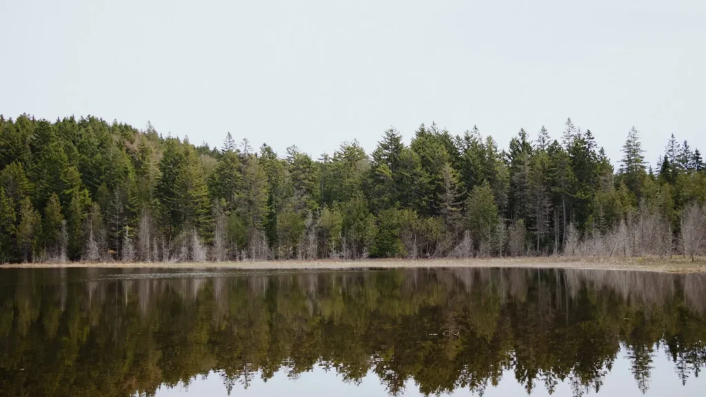
A dense forest shoreline reflected in dead-calm lake water

Map of the Henrys Lake

9 numbered points: 5 access points, 1 campsite, 1 regulation section limit, 1 hazard, 1 USGS gauge. Tap a marker for details. Reviewed Sep 23, 2026.

Printable version →
  • Access / boat ramp (5)
  • Campsite (1)
  • Regulation section limit (1)
  • Dam / hazard (1)
  • USGS gauge (1)
Map data © OpenStreetMap contributors. Points are curated from OpenStreetMap and state agency sources; confirm access and hours before you go.

Print it. Bag it. Bring it.Phones die, screens crack, and most of this water has no signal. Print this map, fold it into a zip-top bag or dry bag with your license, and you have a backup your electronics can’t give you. Every marker is numbered so you can say exactly where you are.

Open the printable map
All 9 points on this map
#PointTypeLat, LonNotes
1Henrys Lake Dam
Outlet dam · National Inventory of Dams ID00008
Dam / hazard44.59725, -111.35341The lake's only outlet structure, at the southeast corner. Below it the water is Henrys Lake Outlet and then the Henrys Fork, each with its own Idaho season - not part of this sheet.
2USGS 13039000 — Henrys Lake near Lake, Idaho
USGS · lake level and storage
USGS gauge44.59722, -111.35361Lake-stage gauge on the shoreline at the outlet, 25 m from the dam. Matched on ref to the OSM monitoring station 4 m away; the station 0.42 km downstream is 13039500 on the Henrys Fork, not this one.
3Henrys Lake — South Shore
BLM · ramp and dispersed camping
Access / boat ramp44.61558, -111.41715IDFG access site on BLM ground; no ramp is tagged here in OSM. IDFG warns the access roads turn very slick when wet or snow-covered, and caps camping at 10 days in any 30.
4William Frome County Park
Fremont County · ramp, dock, camping
Access / boat ramp44.65028, -111.43705Northwest shore. IDFG and IDPR publish this site 19 m apart and an unnamed OSM slipway sits 35 m away, so three sources agree on it.
5Staley Springs closed water
Idaho closed-water boundary
Regulation section limit44.65998, -111.43407Idaho closes the portion of Henrys Lake inside the posted Staley Springs boundaries. Those boundaries are posted on the water and are not published as coordinates, so this marker sits on the IDPR-inventoried Staley Springs site.
6Jared's Wild Rose Ranch Resort
Two concrete ramps · fee, open to non-guests
Access / boat ramp44.66807, -111.40148North shore. The resort states both ramps and their protected marinas are open to everyone, not only guests, for a launch-and-park fee, and its mini-store carries flies, lures and live bait. OSM maps two slipways and four piers here.
7Lakeshore Lodge
IDPR ramp inventory · access unconfirmed
Access / boat ramp44.66240, -111.38354Listed for Henrys Lake in Idaho Parks & Recreation's boat-ramp survey, 51 m off the shoreline. OSM carries no ramp here and no website for the business could be reached this run, so treat public access as unconfirmed.
8Henrys Lake State Park Campground
IDPR · 83 serviced sites, 3 cabins
Campsite44.61930, -111.37021Adam's and Caddis loops, $7 vehicle entry fee. The park stays open and staffed in winter with about a dozen dry RV sites and three heated cabins, and no water. The dump station is closed for the 2025/26 season.
9Henrys Lake State Park boat ramp
IDPR · paved two-lane ramp, launch dock
Access / boat ramp44.62019, -111.37322Southeast shore, ADA ramp. An unnamed OSM slipway sits 9 m away. Coordinate is IDPR's boat-ramp survey; the park page's own coordinate is the entrance kiosk, 456 m inland.

Guides on the Henrys Lake

Claimed profiles take booking requests. Unclaimed profiles are built from public records so the river is never empty; the guide can claim or remove one any time.

About the Henrys Lake

Henrys Lake sits at about 6,470 feet in a basin below Targhee Pass in eastern Idaho, minutes from the Montana line and the west side of Yellowstone. It covers roughly six and a half thousand acres and drains about ninety-four square miles, and the gauge near the lake reads stage. What makes it extraordinary is not size but fertility: the lake is shallow, weedy and extremely rich, and it grows trout to weights that a water of this elevation has no business producing.

Depth is the governing fact, in the opposite direction from most famous trout lakes. Henrys averages roughly twelve feet and rarely exceeds twenty, so sunlight reaches most of the bottom and the weed growth is prolific. That vegetation supports enormous populations of damselflies, leeches, scuds and midges, and the trout feed on invertebrates rather than on baitfish for most of the year. Springs enter around the shoreline and the inlet creeks matter disproportionately, because in a shallow lake that can warm sharply in midsummer the cold water is where fish concentrate. Wind is a constant and a genuine safety consideration in a small boat.

Yellowstone cutthroat trout are the signature fish and run large. Cuttbow hybrids, the cross between cutthroat and rainbow, are abundant and often the heaviest fish in the lake. Brook trout are present and also reach unusual size here. The fishery is sustained by a long-running state hatchery and trapping programme on the inlet streams. Most of the fishing is done from a boat, float tube or pram rather than from the bank, and the productive water is often surprisingly close to shore.

Idaho applies special regulations to Henrys Lake, including a distinct season and gear rules, and reading them before arriving is essential.

This water needs a real photo

The photo at the top of this page is not Henrys Lake.

It is a regional stand-in, honestly captioned but generic — we will not put a name to a river we cannot prove. Send us a photograph you took here and it replaces the stand-in, with your credit on it.

Add a photo of this water See the badges

Pioneer badgeUnclaimed

Add a photo of this water

Landscape, not fish — the water itself. Reviewed by hand before it appears. The first one published here earns the Pioneer badge.

Never published. It is how the badge is held for you until member accounts open.

Posting to Henrys Lake.

JPG, PNG or WebP, up to 12 MB. Landscape orientation looks best at the top of the page. We resize it and strip the location data out of the file.

The name printed under the photo and on your badge. Leave blank to stay anonymous.

Reader photo license v1.0 — the short version:

  • You grant Guided Floats, LLC a non-exclusive, royalty-free license to publish, resize and crop your photo on guidedfloats.com and in GuidedFloats’ own social posts and apps. You keep the copyright and can use the photo anywhere else.
  • You confirm that you took the photo yourself, that publishing it does not infringe anyone else’s rights, and that anyone recognisable in it (or a parent or guardian, if they are under 18) is happy for it to appear here.
  • Credit is printed beside the photo wherever it appears on the site, using the credit name you give us. Leave it blank and we use your name; write “Anonymous” for no name. Your email address is never published.
  • Withdrawing is one email to hello@guidedfloats.com naming the photo. It comes off the site within 7 days.
Read the full license

Version 1.0, dated 6 September 2026. Applies to every photograph submitted to GuidedFloats through the contact form, a species page, or the community board.

1. What you give us

By ticking the box on the form you grant Guided Floats, LLC (“GuidedFloats”, “we”) a non-exclusive, worldwide, royalty-free license to store, copy, resize, crop and display your photograph on guidedfloats.com, in GuidedFloats’ own social media accounts and mobile apps, and in material that promotes the site itself, in connection with the fish, water or community feature you sent it in for. The license lasts until you withdraw it (section 4).

You keep the copyright. The license is not exclusive, so you can use the photo anywhere else and license it to anyone else. We will not sell your photo, license it on to anyone else on its own, or use it in paid advertising for a third party.

2. What you confirm

You confirm that you took the photograph yourself (or otherwise own the rights to it), that you have the right to grant this license, and that publishing the photo does not infringe anyone else’s copyright, privacy or other rights.

If any person is recognisable in the photo, you confirm that they have agreed to its being published here, and that a parent or guardian has agreed on behalf of anyone under 18. Please do not send photographs of other people’s catches, screenshots, or pictures copied from other websites or social media.

3. Credit

We print the credit name you give us beside the photo wherever it appears on the site, and record it as the photo’s creator in the page’s structured data. If you leave the credit blank we use the name you gave us on the form. Write “Anonymous” if you prefer no name at all. Your email address, phone number and the exact spot the photo was taken are never published.

4. Withdrawing the license

You can withdraw the license at any time by emailing hello@guidedfloats.com, or by using the contact form, and telling us which photo you mean. We will remove the photo from guidedfloats.com within 7 days of receiving your message and stop using it in anything new. Copies that are already outside our control — search-engine caches, social posts that have already gone out, printed material already produced — may take longer to disappear or may not be recallable, and we are not responsible for those.

5. What we may do

We choose which photos to publish and may decline any submission without giving a reason. We may crop, resize, sharpen or colour-correct a photo for display, and we may remove a photo at any time. We will not alter a photo in a way that misrepresents the fish, the water or you.

6. Your details

We keep your name, email address, the credit name, the water and date you gave us, and the network address the submission came from, with the submission record, as our evidence of this license. We hold that record for as long as the photo is published and for the retention period described in our privacy policy. Location data that your camera or phone embedded in the file is removed before the photo is published.

7. Versions

The version of this license you accepted is stored with your submission and printed with the photo. A later version does not apply to a photo you have already sent unless you agree to it.

Fished this water? Add a photo

Reviewed by hand before it appears. Pick the water, not the spot — we never publish exact locations.

Never published. We use it only if we need to ask about the photo.

Posting to Henrys Lake.

JPG, PNG or WebP, up to 12 MB. We resize it and strip the location data out of the file.

The name shown under the photo. Leave blank to stay anonymous.

Reader photo license v1.0 — the short version:

  • You grant Guided Floats, LLC a non-exclusive, royalty-free license to publish, resize and crop your photo on guidedfloats.com and in GuidedFloats’ own social posts and apps. You keep the copyright and can use the photo anywhere else.
  • You confirm that you took the photo yourself, that publishing it does not infringe anyone else’s rights, and that anyone recognisable in it (or a parent or guardian, if they are under 18) is happy for it to appear here.
  • Credit is printed beside the photo wherever it appears on the site, using the credit name you give us. Leave it blank and we use your name; write “Anonymous” for no name. Your email address is never published.
  • Withdrawing is one email to hello@guidedfloats.com naming the photo. It comes off the site within 7 days.
Read the full license

Version 1.0, dated 6 September 2026. Applies to every photograph submitted to GuidedFloats through the contact form, a species page, or the community board.

1. What you give us

By ticking the box on the form you grant Guided Floats, LLC (“GuidedFloats”, “we”) a non-exclusive, worldwide, royalty-free license to store, copy, resize, crop and display your photograph on guidedfloats.com, in GuidedFloats’ own social media accounts and mobile apps, and in material that promotes the site itself, in connection with the fish, water or community feature you sent it in for. The license lasts until you withdraw it (section 4).

You keep the copyright. The license is not exclusive, so you can use the photo anywhere else and license it to anyone else. We will not sell your photo, license it on to anyone else on its own, or use it in paid advertising for a third party.

2. What you confirm

You confirm that you took the photograph yourself (or otherwise own the rights to it), that you have the right to grant this license, and that publishing the photo does not infringe anyone else’s copyright, privacy or other rights.

If any person is recognisable in the photo, you confirm that they have agreed to its being published here, and that a parent or guardian has agreed on behalf of anyone under 18. Please do not send photographs of other people’s catches, screenshots, or pictures copied from other websites or social media.

3. Credit

We print the credit name you give us beside the photo wherever it appears on the site, and record it as the photo’s creator in the page’s structured data. If you leave the credit blank we use the name you gave us on the form. Write “Anonymous” if you prefer no name at all. Your email address, phone number and the exact spot the photo was taken are never published.

4. Withdrawing the license

You can withdraw the license at any time by emailing hello@guidedfloats.com, or by using the contact form, and telling us which photo you mean. We will remove the photo from guidedfloats.com within 7 days of receiving your message and stop using it in anything new. Copies that are already outside our control — search-engine caches, social posts that have already gone out, printed material already produced — may take longer to disappear or may not be recallable, and we are not responsible for those.

5. What we may do

We choose which photos to publish and may decline any submission without giving a reason. We may crop, resize, sharpen or colour-correct a photo for display, and we may remove a photo at any time. We will not alter a photo in a way that misrepresents the fish, the water or you.

6. Your details

We keep your name, email address, the credit name, the water and date you gave us, and the network address the submission came from, with the submission record, as our evidence of this license. We hold that record for as long as the photo is published and for the retention period described in our privacy policy. Location data that your camera or phone embedded in the file is removed before the photo is published.

7. Versions

The version of this license you accepted is stored with your submission and printed with the photo. A later version does not apply to a photo you have already sent unless you agree to it.

Access

Henrys Lake State Park - the developed access on the southeast shore, with a ramp, camping and parking.
Idaho Fish and Game access areas - several public launches and shoreline points around the lake.
Island Park - the nearest service centre, with lodging, fuel, fly shops and guides.
Targhee Pass - the route east to West Yellowstone, minutes away.
West Yellowstone, Montana - the regional hub for guides, shops and lodging.
Henrys Fork of the Snake River - the celebrated river fishery immediately south.
Hebgen Lake - the large Montana stillwater over the pass, a good alternative in wind.

Seasons

Spring: the season opens with cold, clear water and cruising fish in the shallows, and this is prime time for the largest trout.
Summer: weed growth peaks and damselfly and leech patterns fished over the vegetation do the work, with early and late the best hours.
Fall: cooling water brings fish back shallow and aggressive, and the autumn fishing rivals the spring.
Winter: the lake freezes hard and the regular season is closed, so check the current rules before planning anything.

From the water

No logged trips yet. Be the first to put this water on your map.

Log this water

Fished it or cleaned it? Log in or create a free account to log a trip with photos and earn the waterway badge.

Questions

What species can you catch on the Henrys Lake?

Anglers target Brook Trout, Cuttbow, Cutthroat Trout, Rainbow Trout, Yellowstone Cutthroat Trout on the Henrys Lake in Idaho.

Are there fishing guides on the Henrys Lake?

GuidedFloats lists 1 guide and outfitters on the Henrys Lake. Claimed profiles accept booking requests; unclaimed profiles are built from public records and link to the business.

Where can you access the Henrys Lake?

Henrys Lake State Park - the developed access on the southeast shore, with a ramp, camping and parking. Idaho Fish and Game access areas - several public launches and shoreline points around the lake. Island Park - the nearest service centre, with lodging, fuel, fly shops and guides. Targhee Pass - the route east to West Yellowstone, minutes away. West Yellowstone, Montana - the regional hub for guides, shops and lodging. Henrys Fork of the Snake River - the celebrated river fishery immediately south. Hebgen Lake - the large Montana stillwater over the pass, a good alternative in wind.

When is the best time to fish the Henrys Lake?

Spring: the season opens with cold, clear water and cruising fish in the shallows, and this is prime time for the largest trout. Summer: weed growth peaks and damselfly and leech patterns fished over the vegetation do the work, with early and late the best hours. Fall: cooling water brings fish back shallow and aggressive, and the autumn fishing rivals the spring. Winter: the lake freezes hard and the regular season is closed, so check the current rules before planning anything.

Where are the fishing regulations for the Henrys Lake?

Regulations change by season and section. Read the current rules on the Idaho agency site: https://idfg.idaho.gov/rules/fish