Fishes Bull Shoals Lake
Reservoir · Ozarks · Arkansas
Bull Shoals Lake Fishing Guides
48,195 acres and 820 miles of shoreline across the Arkansas and Missouri line, the largest of the White River lakes and the source of the trout water below it.
Map of the Bull Shoals Lake
26 numbered points: 11 access points, 12 parks and conservation areas, 2 hazards, 1 USGS gauge. Tap a marker for details. Reviewed Sep 23, 2026.
- Access / boat ramp (11)
- Park / conservation area (12)
- Dam / hazard (2)
- USGS gauge (1)
Map data © OpenStreetMap contributors. Points are curated from OpenStreetMap and state agency sources; confirm access and hours before you go.
Print it. Bag it. Bring it.Phones die, screens crack, and most of this water has no signal. Print this map, fold it into a zip-top bag or dry bag with your license, and you have a backup your electronics can’t give you. Every marker is numbered so you can say exactly where you are.
Open the printable mapAll 26 points on this map
| # | Point | Type | Lat, Lon | Notes |
|---|---|---|---|---|
| 1 | Bull Shoals Dam USACE · White River | Dam / hazard | 36.36605, -92.57507 | Concrete gravity dam that forms the lake. The White River tailwater below it is a different fishery from the lake above, and is a separate water on this site. |
| 2 | USGS gauge — White River at Bull Shoals Dam USGS · at the dam | USGS gauge | 36.36572, -92.57485 | Lake level and dam release. Point is the roster coordinate; an OSM USGS monitoring-station node of the same name sits about 80 m away and confirms it. |
| 3 | Bull Shoals Natural Park day use · above the dam | Park / conservation area | 36.37118, -92.57655 | Day-use park on the shore just above the dam. OSM carries only the GNIS name (61083) and no facility detail, so nothing further is claimed for it. |
| 4 | Boat ramp at Bull Shoals Dam Boulevard Bull Shoals Dam Boulevard, Bull Shoals | Access / boat ramp | 36.37341, -92.57231 | Unnamed slipway about 0.9 km above the dam on the city of Bull Shoals side. No operator is mapped; the road is the whole of the identification. |
| 5 | Point Return Public Use Area USACE · Point Return | Park / conservation area | 36.38868, -92.56433 | Corps public use area on the point below Lakeview. OSM maps no ramp lane here, so it ships as a park rather than an access. |
| 6 | Bull Shoals Public Use Area — park and boat dock USACE · 140 Boat Dock Cove | Access / boat ramp | 36.38146, -92.59628 | Corps park at the city of Bull Shoals. Bull Shoals Lake Boat Dock, the concession marina, is on Boat Dock Cove 0.2 km away and is not separately mapped in OSM, so the two ship as one point. |
| 7 | Highway 125 Public Use Area and Marina USACE · AR 125 at the Peel Ferry | Access / boat ramp | 36.48979, -92.77295 | Corps park at the Highway 125 crossing, where the free Peel Ferry carries the road over the lake. Highway 125 Marina is mapped 50 m away and ships as part of this point. |
| 8 | Boat ramp at Shore Line Drive Shore Line Drive, Diamond City | Access / boat ramp | 36.47552, -92.91927 | Ramp on the Diamond City shore, mapped as both a node and a way at the same spot. A second unnamed ramp lane is mapped 0.7 km south-west at 36.4731/-92.9251. |
| 9 | Lead Hill Public Use Area and Sugarloaf Harbor Marina USACE · Lead Hill | Access / boat ramp | 36.47479, -92.92212 | Corps park with the Sugarloaf Harbor Marina concession mapped 40 m away; the two are one facility and ship as one point. |
| 10 | Tucker Hollow Recreation Area USACE · Cedar Creek arm | Access / boat ramp | 36.47618, -93.00712 | Corps recreation area on the Cedar Creek arm; an unnamed slipway is mapped at the same place and is this area's ramp. |
| 11 | Drury-Mincy Conservation Area Missouri Dept of Conservation | Park / conservation area | 36.56463, -93.07740 | MDC conservation area fronting the lake's Missouri arms. OSM maps it as two adjoining nature reserves, Drury and Mincy; point is the Drury tract, about 0.9 km back from the water. |
| 12 | River Run Public Use Area USACE · Forsyth, Missouri | Access / boat ramp | 36.67451, -93.11268 | Corps park at the head of the lake in Forsyth, below the Powersite dam. A second GNIS record for the same area sits 0.4 km east and was merged into this point. |
| 13 | Ozark Beach (Powersite) Dam head of the lake · Taney County | Dam / hazard | 36.65938, -93.12482 | The upstream limit of Bull Shoals Lake. Above it is Lake Taneycomo, a different water with its own regulations; a USGS gauge sits at the dam. |
| 14 | Shadow Rock Public Use Area Forsyth, Missouri · Swan Creek | Park / conservation area | 36.68478, -93.10157 | Public use area where Swan Creek meets the head of the lake at Forsyth. OSM carries only the GNIS name and no facility detail. |
| 15 | Beaver Creek Public Use Area USACE · Beaver Creek arm | Park / conservation area | 36.63951, -93.04379 | Corps area on the Beaver Creek arm. A second GNIS record under the same name sits 1.1 km east and was merged into this point. |
| 16 | Kissee Mills Public Use Area USACE · Kissee Mills, Missouri | Park / conservation area | 36.67284, -93.02462 | Corps area on the upper Beaver Creek arm, about 0.6 km back from the water at normal pool. |
| 17 | Woodard Launching Area Taney County, Missouri | Access / boat ramp | 36.59895, -93.09990 | The name is the only evidence of a launch here: OSM maps no ramp lane and names no operator. Worth a call before hauling a trailer to it. |
| 18 | Buck Creek Public Use Area USACE · Buck Creek, Missouri side | Park / conservation area | 36.48673, -92.79461 | Corps park opposite the Highway 125 ferry crossing. Buck Creek Marina operates on this arm but is not in OpenStreetMap and could not be placed, so it is left off rather than guessed. |
| 19 | Jones Point State Wildlife Management Area Arkansas · Marion County | Park / conservation area | 36.44562, -92.70433 | Wildlife management area on a point of the Arkansas shore, re-typed here from conservation area to park. OSM carries only the GNIS name. |
| 20 | Spring Creek Public Use Area USACE · Spring Creek arm | Park / conservation area | 36.53618, -92.61322 | Corps area on the Spring Creek arm, on the Missouri side of the state line. OSM maps no ramp lane here. |
| 21 | Boat ramp at Missouri Route HH Route HH, Ozark County, Missouri | Access / boat ramp | 36.53204, -92.60467 | Unnamed slipway between the Spring Creek and Pontiac areas. No operator is mapped; the state route is the whole of the identification. |
| 22 | Pontiac Public Use Area USACE · Pontiac, Missouri | Park / conservation area | 36.51006, -92.60822 | Corps area at Pontiac on the lake's long eastern arm. OSM carries only the GNIS name and no facility detail. |
| 23 | Oakland Public Use Area USACE · Oakland, Arkansas | Park / conservation area | 36.44396, -92.63044 | Corps area at Oakland on the Arkansas shore. OSM maps no ramp lane here. |
| 24 | Ozark Isle Public Use Area USACE · Oakland | Park / conservation area | 36.43062, -92.64878 | Corps area on the isle below Oakland. GNIS carries a second record for it misspelled 'Ozard Isle' 0.25 km north-west; the correct spelling is used and the two are one place. |
| 25 | Boat ramp at Howard Creek Road Howard Creek Road, Baxter County | Access / boat ramp | 36.40379, -92.51064 | Ramp on the Howard Creek arm above Lakeview. The slipway is unnamed in OSM and the reverse geocode returns only the road. |
| 26 | Lakeview Public Use Area USACE · Boat Dock Road, Lakeview | Access / boat ramp | 36.37673, -92.54711 | Corps park at Lakeview, the closest access to Mountain Home. A slipway is mapped on Boat Dock Road 0.3 km north-east and is this park's ramp. |
Guides on the Bull Shoals Lake
Claimed profiles take booking requests. Unclaimed profiles are built from public records so the river is never empty; the guide can claim or remove one any time.
About the Bull Shoals Lake
Bull Shoals is the biggest of the White River impoundments: 48,195 surface acres and more than 820 miles of shoreline behind a 252-foot dam near Mountain Home, spread across the Arkansas and Missouri line. It is also the oldest of the group, and the lake most people picture when they picture an Ozark reservoir. Long timbered arms reach back into the hills, the main lake is wide and deep and clear, and there is enough water that a boat can fish all day without seeing the same bank twice.
Black bass are the mainstay. Largemouth use the brush and buckbrush of the creek arms, smallmouth work the clear main-lake rock and are the fish that brings anglers here from a long way off, and spotted bass fill the middle ground on points and channel swings. Walleye are a serious fishery on Bull Shoals rather than an afterthought, taken on the spring runs into the upper arms and by trolling flats and points through the warm months. White bass school hard in spring and again in autumn, and striped bass hold in the deeper open water of the lower lake.
Crappie work the standing timber and sunk brush, bluegill are everywhere along the shoreline, and channel and flathead catfish hold in the old river channel.
Everything about Bull Shoals is tied to the pool. It has one of the widest operating ranges of any lake in the region, and over the last thirty years the first week of September alone has seen the pool anywhere from roughly 644 to 685 feet. That is a forty-foot spread, and it changes which arms are fishable, which ramps are usable, and where the fish live. Check the live reading below before you plan a day here.
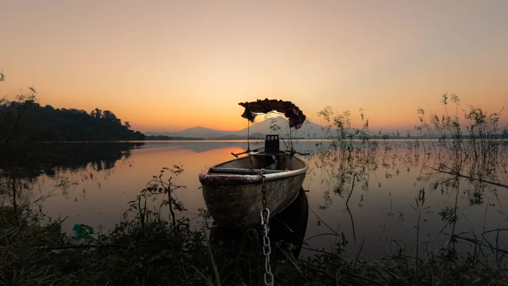
This water needs a real photo
The photo at the top of this page is not Bull Shoals Lake.
It is a regional stand-in, honestly captioned but generic — we will not put a name to a river we cannot prove. Send us a photograph you took here and it replaces the stand-in, with your credit on it.
Pioneer badgeUnclaimed
Add a photo of this water
Landscape, not fish — the water itself. Reviewed by hand before it appears. The first one published here earns the Pioneer badge.
Pool right now
653.02ft NGVD29
- 24 hours-0.14 ft ↓ falling
- Storage3,003,900 acre-ft
- For the dateAbout normal for the date
Reading taken 2h ago at the US Army Corps of Engineers gauge at Bull Shoals Dam (SWL). Elevation is the surface of the lake above the survey datum, not depth. Source.
Fished this water? Add a photo
Reviewed by hand before it appears. Pick the water, not the spot — we never publish exact locations.
Access
Nine Corps of Engineers parks serve the lake: Beaver Creek, Buck Creek, Highway 125, Lakeview, Lead Hill, Oakland, River Run, Theodosia and Tucker Hollow, all booked through Recreation.gov.
Bull Shoals-White River State Park sits at the dam on the Arkansas side and has camping, a ramp and river access.
Mountain Home and Bull Shoals are the Arkansas service towns; Theodosia and Isabella serve the Missouri end of the lake.
Concessionaire marinas around the lake sell fuel and rent boats and slips.
The lake's operating range is wide, so ramp usability genuinely varies through the year; confirm the pool before hauling a big boat to a back-arm ramp.
The White River below the dam is a cold tailwater trout fishery under separate regulations, and generation schedules govern it.
Mountain Home Project Office handles shoreline permits, closures and current park status.
Seasons
Spring: black bass move shallow into the brush and walleye and white bass run the upper arms; this is the busiest and often the best stretch of the year.
Summer: smallmouth and spotted bass hold on deep main-lake rock, stripers work open water in the lower lake, and early and late are the productive hours.
Autumn: shad move back into the creeks, drawdown concentrates fish, and surface activity picks up through October and November.
Winter: clear cold water and deep, slow presentations for smallmouth and spotted bass; crowds disappear entirely.
From the water
No logged trips yet. Be the first to put this water on your map.
Log this water
Fished it or cleaned it? Log in or create a free account to log a trip with photos and earn the waterway badge.
Questions
What species can you catch on the Bull Shoals Lake?
Anglers target Black Crappie, Bluegill, Channel Catfish, Flathead Catfish, Largemouth Bass, Smallmouth Bass, Spotted Bass, Striped Bass, Walleye, White Bass, White Crappie on the Bull Shoals Lake in Arkansas.
Are there fishing guides on the Bull Shoals Lake?
GuidedFloats lists 2 guides and outfitters on the Bull Shoals Lake. Claimed profiles accept booking requests; unclaimed profiles are built from public records and link to the business.
Where can you access the Bull Shoals Lake?
Nine Corps of Engineers parks serve the lake: Beaver Creek, Buck Creek, Highway 125, Lakeview, Lead Hill, Oakland, River Run, Theodosia and Tucker Hollow, all booked through Recreation.gov. Bull Shoals-White River State Park sits at the dam on the Arkansas side and has camping, a ramp and river access. Mountain Home and Bull Shoals are the Arkansas service towns; Theodosia and Isabella serve the Missouri end of the lake. Concessionaire marinas around the lake sell fuel and rent boats and slips. The lake's operating range is wide, so ramp usability genuinely varies through the year; confirm the...
When is the best time to fish the Bull Shoals Lake?
Spring: black bass move shallow into the brush and walleye and white bass run the upper arms; this is the busiest and often the best stretch of the year. Summer: smallmouth and spotted bass hold on deep main-lake rock, stripers work open water in the lower lake, and early and late are the productive hours. Autumn: shad move back into the creeks, drawdown concentrates fish, and surface activity picks up through October and November. Winter: clear cold water and deep, slow presentations for smallmouth and spotted bass; crowds disappear entirely.
Where are the fishing regulations for the Bull Shoals Lake?
Regulations change by season and section. Read the current rules on the Arkansas agency site: https://www.agfc.com/regulations/general-fishing-regulations/