Saline River Fishing Guides
Arkansas's longest undammed river, running free from the Ouachitas through south Arkansas bottomlands to the Ouachita River.
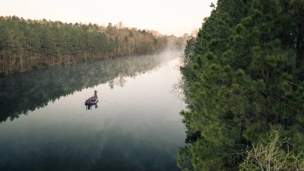
Guides on the Saline River
Claimed profiles take booking requests. Unclaimed profiles are built from public records so the river is never empty; the guide can claim or remove one any time.
No guides listed yet
Guide or outfit this water? Create your profile. Listing is free, the commission is 10% or 7% with a premium profile, and premium profiles list first on this water.
About the Saline River
The Saline River is the longest free-flowing river in Arkansas, running without a single dam from its forks in the Ouachita Mountains all the way to its confluence with the Ouachita River in the south of the state. That fact alone makes it significant, and it means the river passes through a full sequence of landscapes: mountain headwaters, Gulf coastal plain, and finally the hardwood bottoms of the lower reach near Rye.
The lower river, which the gauge at Rye measures, is bottomland water. It runs slow and stained through Bradley and Drew Counties, winding between banks of cypress, tupelo and mixed hardwood, with sandbars on the inside of the bends and deep holes against the cut banks. Woody structure is constant and is where most of the fish are. The floodplain is extensive and the river spreads into it readily during winter and spring high water.
Largemouth and spotted bass dominate the lower river, with smallmouth more of an upstream fish. Crappie are good in the deeper bends and around brush. Bluegill and longear sunfish are abundant. Catfish are a serious fishery here, with channel, flathead and blue catfish all present and the deep holes worth working. Bowfin, longnose gar and freshwater drum are part of any full day on this water.
Access is spread out and often informal, and a kayak or jon boat opens up far more of the river than bank fishing does. Because nothing regulates the flow, the gauge is the whole story: the Saline rises quickly on rain and drops to a lazy summer trickle in the shallower reaches. Conservation interest in the Saline is high precisely because it is undammed, and stretches of the lower river run through wildlife management areas and protected bottomland. Those reaches offer the best combination of public access and undisturbed habitat on the river.
This water needs a real photo
The photo at the top of this page is not Saline River.
It is a regional stand-in, honestly captioned but generic — we will not put a name to a river we cannot prove. Send us a photograph you took here and it replaces the stand-in, with your credit on it.
Add a photo of this water
Landscape, not fish — the water itself. Reviewed by hand before it appears. The first one published here earns the Pioneer badge.
Fished this water? Add a photo
Reviewed by hand before it appears. Pick the water, not the spot — we never publish exact locations.
Access
Rye - the gauge reach and the main access on the lower river.
Warren area crossings - access in Bradley County.
Moro Bay State Park, downstream - access near the Ouachita confluence.
Benton and the upper river - access to the Ouachita Mountain reach.
US 63 and US 278 crossings - highway access on the middle and lower river.
Drew County road crossings - informal launches through the bottomlands.
Saline River confluence with the Ouachita - the downstream end of the river.
Seasons
Spring: high water through the bottoms, then excellent bass and crappie fishing as it drops.
Summer: low and warm, with catfish steady and bass holding on the deeper wood.
Fall: strong bass fishing as water cools and clears through the bends.
Winter: high water is common, with crappie deep and catfish still taking bait in the holes.
From the water
No logged trips yet. Be the first to put this water on your map.
Log this water
Fished it or cleaned it? Log in or create a free account to log a trip with photos and earn the waterway badge.
Questions
What is the current flow on the Saline River?
As of Sep 17, 6:15 am, the USGS gauge Saline River near Rye, AR reads 15 cfs. Conditions update every 15 minutes.
What species can you catch on the Saline River?
Anglers target Black Crappie, Blue Catfish, Bluegill, Bowfin, Channel Catfish, Flathead Catfish, Freshwater Drum, Largemouth Bass, Longear Sunfish, Longnose Gar, Smallmouth Bass, Spotted Bass, White Crappie on the Saline River in Arkansas.
Where can you access the Saline River?
Rye - the gauge reach and the main access on the lower river. Warren area crossings - access in Bradley County. Moro Bay State Park, downstream - access near the Ouachita confluence. Benton and the upper river - access to the Ouachita Mountain reach. US 63 and US 278 crossings - highway access on the middle and lower river. Drew County road crossings - informal launches through the bottomlands. Saline River confluence with the Ouachita - the downstream end of the river.
When is the best time to fish the Saline River?
Spring: high water through the bottoms, then excellent bass and crappie fishing as it drops. Summer: low and warm, with catfish steady and bass holding on the deeper wood. Fall: strong bass fishing as water cools and clears through the bends. Winter: high water is common, with crappie deep and catfish still taking bait in the holes.
Where are the fishing regulations for the Saline River?
Regulations change by season and section. Read the current rules on the Arkansas agency site: https://www.agfc.com/regulations/general-fishing-regulations/