Fishes Payette River
River · Southwest Idaho, Boise County, the main Payette River canyon at Horseshoe Bend between Banks and Emmett north of Boise · Idaho
Payette River Fishing Guides
The main Payette River in the canyon at Horseshoe Bend, gauged for flow and stage, draining twenty-two hundred square miles of central Idaho and the most heavily guided whitewater river in the state.
Map of the Payette River
30 numbered points: 17 access points, 3 bait & fly shops, 1 outfitter, 4 parks and conservation areas, 3 hazards, 1 USGS gauge, 1 point of interest. Tap a marker for details. Reviewed Sep 25, 2026.
- Access / boat ramp (17)
- Bait, tackle & fly shop (3)
- Outfitter / canoe rental (1)
- Park / conservation area (4)
- Dam / hazard (3)
- USGS gauge (1)
- Point of interest (1)
Map data © OpenStreetMap contributors. Points are curated from OpenStreetMap and state agency sources; confirm access and hours before you go.
Print it. Bag it. Bring it.Phones die, screens crack, and most of this water has no signal. Print this map, fold it into a zip-top bag or dry bag with your license, and you have a backup your electronics can’t give you. Every marker is numbered so you can say exactly where you are.
Open the printable mapAll 30 points on this map
| # | Point | Type | Lat, Lon | Notes |
|---|---|---|---|---|
| 1 | Banks River Access Put-in at Banks - head of the main stem, river mile 0 | Access / boat ramp | 44.08438, -116.11650 | Where the North Fork joins the South Fork and the main Payette begins. Every commercial Main Payette trip starts here. No agency publishes a coordinate for it; this is the mapped launch node. |
| 2 | Banks Beach Picnic area and alternate put-in - 1.0 mi below Banks | Park / conservation area | 44.07390, -116.11973 | The BLM boater guide calls it Banks Beach Picnic Area and American Whitewater lists it as an alternate access at mile 1. Useful if the Banks ramp is stacked with rafts. |
| 3 | Payette River: Chief Parrish BLM Four Rivers - gravel parking, hand launch - $5/day | Access / boat ramp | 44.02611, -116.13889 | Mostly a kayak put-in and take-out, 4.6 mi below Banks. No constructed ramp. Cooperatively run by BLM and Boise National Forest; a Boise NF annual day-use pass covers the fee. The Class II wave train of the same name is right here. |
| 4 | Payette River: Beehive Bend BLM Four Rivers - concrete take-out ramp - $5/day | Access / boat ramp | 44.00444, -116.18028 | Take-out for the Class III+ upper main and put-in for the milder lower main, 7.4 mi below Banks. Concrete ramp, raft drying area, two vault toilets and a changing room. AMF Rafting meets its trips here; it has no storefront anywhere. |
| 5 | Cascade Raft & Kayak 7050 Highway 55, Horseshoe Bend - trading since 1985 | Outfitter / canoe rental | 43.99147, -116.18777 | Guided day trips on the main stem plus both forks, kayak classes and guided fly-fishing floats. Worth knowing: their fishing float launches from here but fishes the North and South Forks, not this reach. Office 8-5 daily year round. |
| 6 | Ponderosa Sports & Mercantile Bait, flies and tackle - 6854 Highway 55, Gardena | Bait, tackle & fly shop | 43.96674, -116.18902 | The only shop on the whole 75 miles confirmed to sell bait, flies AND tackle. Four miles north of Horseshoe Bend, beside the river. Its own site says Thu-Sun 10-4 but three sources disagree - ring 208-793-3121 first. |
| 7 | USGS 13247500 - Payette River near Horseshoe Bend The gauge this page reads | USGS gauge | 43.94333, -116.19667 | Sits 12.3 mi below Banks, above every diversion, so it reads the free-flowing upper river. American Whitewater gives 2,000-10,000 cfs as the good range above it. Three more USGS stations sit downstream - see the notes. |
| 8 | Climax Class III wave train - position measured, not published | Dam / hazard | 43.93960, -116.19535 | The biggest water on the lower main and the last thing above the Horseshoe Bend take-out. American Whitewater warns the first two waves can flip new kayakers. Parnell Beach, 0.5 mi up, is the bail-out that skips it. |
| 9 | Horseshoe Dam Boat Ramp Standard take-out for the lower main - 12.7 mi below Banks | Access / boat ramp | 43.93805, -116.19336 | Also called the jet boat ramp. This is where the commercial half-day trips come off the water, just below Climax and just above the diversion. No agency publishes a coordinate; this is the mapped ramp node. |
| 10 | Horseshoe Bend Mill Pond IDFG - ramp, dock, ADA restroom - closed sunset to sunrise | Access / boat ramp | 43.93439, -116.18556 | A mill pond on the south bank a mile north of Horseshoe Bend, not a through-river launch. IDFG publishes this coordinate itself. Gate closes at sunset, so it is no use as a late take-out. |
| 11 | Horseshoe Bend Diversion River-wide weir 15.5 mi below Banks - portage | Dam / hazard | 43.90856, -116.19081 | The first structure below Banks and the reason floats end at the ramp above it. OSM maps the complex as five weir segments across about 70 m of channel; this is the named one. Nothing downstream of here is commercially run. |
| 12 | Church Creek Bridge River Access Mapped launch 25.8 mi below Banks - Montour reach | Access / boat ramp | 43.93106, -116.33604 | Named in the BLM Payette River Boater Guide as Church Creek Bridge and mapped here as a launch. It is the only access between Horseshoe Bend and the Reclamation parks, on a 17-mile stretch with nothing else. |
| 13 | Triangle Park Reclamation - boat ramp, ADA - group campground by reservation | Access / boat ramp | 43.92761, -116.39030 | Reclamation places it 3.4 mi above Black Canyon Dam; measured down the channel from the dam this point lands 3.4 mi above it too, which is as good a corroboration as this reach offers. Whole-site rental only, booked ahead. |
| 14 | Black Canyon Park Reclamation - two ADA boat ramps on the reservoir | Access / boat ramp | 43.92510, -116.41728 | The main launch on Black Canyon Reservoir. Reclamation publishes no coordinate and says the park is about 1.5 mi above the dam; this point is the mapped park, which measures 1.0 mi above it. Reclamation parks office: 986-256-4973. |
| 15 | Black Canyon Diversion Dam Reclamation concrete gravity dam - NID ID00282 - portage | Dam / hazard | 43.93050, -116.43711 | Built 1922-24, rebuilt 1951-55, with a powerplant and two canal headgates. It splits the river: reservoir above, irrigation-controlled flow below. Reclamation publishes two coordinates 100 m apart; this is the closer RISE value. |
| 16 | Wild Rose Park Reclamation - day use, view of the dam from below | Park / conservation area | 43.93087, -116.44040 | Just below the dam on the same side as the powerplant. Gazebos and lawn, no ramp. Worth a stop if you want to see what the release is actually doing before you commit to the lower river. |
| 17 | Cobblestone Park & Gazebo Reclamation - 8.4 acres, no ramp - reached off Plaza Road | Park / conservation area | 43.92827, -116.44282 | Downstream of the dam on the opposite bank from Wild Rose. Shaded seating and covered eating areas; a shore-fishing and picnic spot rather than a launch. |
| 18 | Plaza Road Bridge IDFG - NO ramp, day use only, restroom | Access / boat ramp | 43.92196, -116.44378 | Bank access to the first mile of river below the dam, 36 mi below Banks. IDFG publishes this coordinate and is explicit that there is no ramp here - it is a walk-in, not a launch. East bank, 3 mi northeast of Emmett. |
| 19 | KingFisher Sporting Goods & Pawn Rods, reels and tackle - 143 W Main St, Emmett | Bait, tackle & fly shop | 43.87537, -116.50122 | Tackle yes; no evidence it carries live bait or flies, so do not drive here for either. Tue-Fri 10-6, Sat 10-4, closed Sun and Mon. Its federal firearms licence is current, which is how the shop was confirmed still trading. 208-365-9881. |
| 20 | Gem Island Ramp IDFG - boat ramp at Emmett - 40.5 mi below Banks | Access / boat ramp | 43.88185, -116.50516 | Built by IDFG with Gem County using Reclamation mitigation money and opened in 2020. The first real launch below Black Canyon Dam and the usual start for the lower river. |
| 21 | D&B Supply - Emmett 111 ID-16 - fishing licences, general sporting goods | Bait, tackle & fly shop | 43.86050, -116.49953 | The store page lists hunting and fishing licences and there is a firearm counter; a tackle department is not itemised and live bait is unconfirmed. Treat it as the place to buy a licence on the lower river. Mon-Sat 8-8, Sun 9-6. |
| 22 | Sevenmile Slough IDFG - concrete ramp, gravel parking, restroom | Access / boat ramp | 43.86999, -116.56799 | At Cascade Road and Star Lane west of Emmett, 44.1 mi below Banks. Opened 2019. The mapped ramp node sits 20 m from IDFG’s published point, so both sources agree on where it is. |
| 23 | Sheep Camp Landing IDFG - small boat ramp, parking, temporary restroom | Access / boat ramp | 43.90099, -116.63199 | Just east of Letha and, in IDFG’s own words, five river miles below Sevenmile Slough - the chained channel measures 5.1. The coordinate looks hand-entered rather than surveyed, so treat it as approximate. |
| 24 | Falk Bridge IDFG - boat ramp, portable restroom - south bank | Access / boat ramp | 43.95267, -116.71759 | Five miles east of New Plymouth on SH 52, 55.8 mi below Banks. One of the four bridge ramps that carry the whole lower river. |
| 25 | Fifty-two Bridge IDFG - boat ramp, portable restroom - north bank | Access / boat ramp | 43.97815, -116.77662 | Two miles east of New Plymouth on SH 52, 59.7 mi below Banks. |
| 26 | Blacks Bridge IDFG - boat ramp - south bank on US 30 | Access / boat ramp | 43.98924, -116.79676 | Three miles north of New Plymouth, 61.2 mi below Banks. A short 1.5-mile float from Fifty-two Bridge if you want an easy afternoon. |
| 27 | Birding Island North IDFG - concrete ramp, 58 x 16 ft - Payette River WMA | Access / boat ramp | 44.00856, -116.81276 | IDFG’s own press release says the concrete ramp is in and the site is open; the agency GIS layer still says no ramp, so the layer is stale. Built with Payette County. 63.0 mi below Banks. |
| 28 | Birding Island West IDFG - foot access only, no ramp - Payette River WMA | Access / boat ramp | 44.00892, -116.83146 | Walk-in bank fishing 1.4 mi below the north ramp. IDFG’s published point sits about 400 m back from the channel, so expect a short walk to the water. |
| 29 | Payette Greenbelt Pond City of Payette - pond, NOT a river launch - 73.5 mi down | Park / conservation area | 44.08242, -116.95098 | On the greenbelt a mile above the mouth. IDFG lists it as an access site but records no ramp, and the City of Payette manages it. Shore fishing on still water; do not plan to take a boat out here. |
| 30 | Snake River confluence Foot of the river - 74.6 mi below Banks | Point of interest | 44.09278, -116.95218 | The Payette ends here at the Snake, on the Idaho-Oregon state line. There is no developed take-out at the mouth itself; the last ramp is Birding Island North, 7.1 mi up. |
Guides on the Payette River
Claimed profiles take booking requests. Unclaimed profiles are built from public records so the river is never empty; the guide can claim or remove one any time.
About the Payette River
The main Payette River forms at Banks where the North and South forks meet, and runs south through a basalt canyon past Horseshoe Bend toward Emmett and the Snake. By the time it reaches the gauge it is draining twenty-two hundred and twenty square miles of central Idaho mountains, and it is a substantial river. The stretch from Banks down through Horseshoe Bend is the busiest guided whitewater in Idaho, close enough to Boise that it runs commercial trips all summer, and that traffic is part of the character of the place.
The gauge reads discharge and stage, and on a snowmelt river of this size discharge is the number that governs everything. The Payette peaks in late spring as the high country melts, running big, cold and brown, and then drops steadily through summer into a clear, low autumn flow. Both the rafting and the fishing key off that curve: the whitewater is at its best on the high water, and the fishing is at its best once the river has dropped and cleared in late summer and autumn.
The main river is a rainbow trout and mountain whitefish fishery first, with wild rainbows in the pockets, seams and tailouts through the canyon and whitefish abundant enough to be a genuine target in winter. Brown trout are present, smallmouth bass take over in the warmer lower river toward Emmett, and bull trout occur in the system and are protected, so know them and release them. The North Fork and South Fork above Banks offer their own, colder fisheries.
Access is easy and that is much of the appeal. Highway 55 follows the river the whole way with pullouts, and Banks, Horseshoe Bend and Beehive Bend are the recognised put-ins and take-outs. Boise is forty minutes away, so guides, shuttles and tackle are all close at hand.
This water needs a real photo
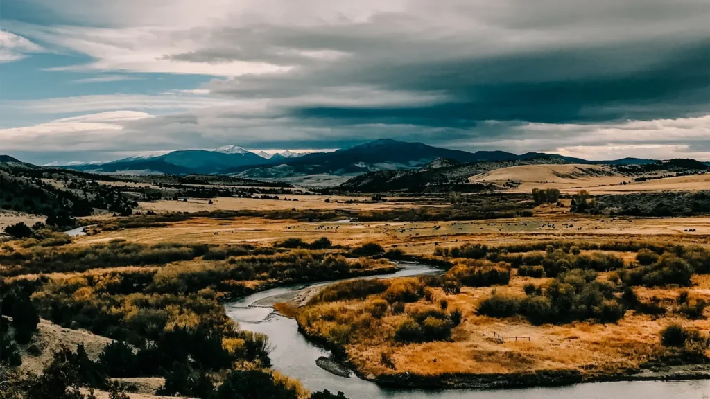
The photo at the top of this page is not Payette River.
It is a regional stand-in, honestly captioned but generic — we will not put a name to a river we cannot prove. Send us a photograph you took here and it replaces the stand-in, with your credit on it.
Pioneer badgeUnclaimed
Add a photo of this water
Landscape, not fish — the water itself. Reviewed by hand before it appears. The first one published here earns the Pioneer badge.
Fished this water? Add a photo
Reviewed by hand before it appears. Pick the water, not the spot — we never publish exact locations.
Access
Horseshoe Bend - the town at the gauge on Highway 55, the nearest services on the main river.
Banks - the confluence of the North and South forks upstream, and the main whitewater put-in.
Boise - the state capital forty minutes south, with guides, outfitters, tackle and air service.
Emmett - the town downstream where the river leaves the canyon, with lower river access.
Cascade - the town up the North Fork, with the reservoir and additional fishing.
Garden Valley - the community on the South Fork, the gateway to that fork's water.
Black Canyon Reservoir - the impoundment below Emmett, with warmwater fishing and developed ramps.
Seasons
Spring: peak snowmelt, running high, cold and coloured, and the premier season for whitewater rather than fishing.
Summer: dropping and clearing through the season, with rafting busy and the fishing improving week by week.
Fall: the best fishing of the year, with low clear water, feeding rainbows and the commercial traffic gone.
Winter: cold and low, with mountain whitefish the dependable target and access along the highway generally good.
From the water
No logged trips yet. Be the first to put this water on your map.
Log this water
Fished it or cleaned it? Log in or create a free account to log a trip with photos and earn the waterway badge.
Questions
What is the current flow on the Payette River?
As of Oct 18, 5:30 pm, the USGS gauge PAYETTE RIVER NR HORSESHOE BEND ID reads 803 cfs. Conditions update every 15 minutes.
What species can you catch on the Payette River?
Anglers target Black Crappie, Bluegill, Brown Trout, Bull Trout, Channel Catfish, Common Carp, Largemouth Bass, Mountain Whitefish, Northern Pike, Rainbow Trout, Smallmouth Bass, White Sturgeon on the Payette River in Idaho.
Are there fishing guides on the Payette River?
GuidedFloats lists 2 guides and outfitters on the Payette River. Claimed profiles accept booking requests; unclaimed profiles are built from public records and link to the business.
Where can you access the Payette River?
Horseshoe Bend - the town at the gauge on Highway 55, the nearest services on the main river. Banks - the confluence of the North and South forks upstream, and the main whitewater put-in. Boise - the state capital forty minutes south, with guides, outfitters, tackle and air service. Emmett - the town downstream where the river leaves the canyon, with lower river access. Cascade - the town up the North Fork, with the reservoir and additional fishing. Garden Valley - the community on the South Fork, the gateway to that fork's water. Black Canyon Reservoir - the impoundment below Emmett, with war...
When is the best time to fish the Payette River?
Spring: peak snowmelt, running high, cold and coloured, and the premier season for whitewater rather than fishing. Summer: dropping and clearing through the season, with rafting busy and the fishing improving week by week. Fall: the best fishing of the year, with low clear water, feeding rainbows and the commercial traffic gone. Winter: cold and low, with mountain whitefish the dependable target and access along the highway generally good.
Where are the fishing regulations for the Payette River?
Regulations change by season and section. Read the current rules on the Idaho agency site: https://idfg.idaho.gov/rules/fish