Fishes Arkansas River
River · Central Colorado · Colorado
Arkansas River Fishing Guides
A hundred miles of Gold Medal freestone from Leadville through Buena Vista and Browns Canyon to Salida, the most-rafted and most-fished river in Colorado.
Map of the Arkansas River
19 numbered points: 14 access points, 1 bait & fly shop, 2 parks and conservation areas, 1 hazard, 1 USGS gauge. Tap a marker for details. Reviewed Sep 8, 2026.
- Access / boat ramp (14)
- Bait, tackle & fly shop (1)
- Park / conservation area (2)
- Dam / hazard (1)
- USGS gauge (1)
Map data © OpenStreetMap contributors. Points are curated from OpenStreetMap and state agency sources; confirm access and hours before you go.
Print it. Bag it. Bring it.Phones die, screens crack, and most of this water has no signal. Print this map, fold it into a zip-top bag or dry bag with your license, and you have a backup your electronics can’t give you. Every marker is numbered so you can say exactly where you are.
Open the printable mapAll 19 points on this map
| # | Point | Type | Lat, Lon | Notes |
|---|---|---|---|---|
| 1 | Railroad Bridge Recreation Area AHRA · Chaffee County | Park / conservation area | 38.92326, -106.16997 | State-park river site above Buena Vista. |
| 2 | Boat ramp on the Arkansas River Trail, Buena Vista Unnamed slipway · OSM 'Arkansas River Trail' | Access / boat ramp | 38.84717, -106.12225 | Mapped ramp in Buena Vista at the whitewater park. |
| 3 | The Trailhead Outdoor shop · East Main Street, Buena Vista | Bait, tackle & fly shop | 38.84295, -106.12919 | Gear and tackle shop two blocks off the river in Buena Vista. |
| 4 | Boat ramp on County Road 300 at Nathrop Unnamed slipway · OSM 'CR 300' | Access / boat ramp | 38.75221, -106.07085 | Mapped ramp on CR 300 at Nathrop, at the head of Browns Canyon. |
| 5 | USGS 07091200 — Arkansas River near Nathrop USGS streamgage · at Hecla Junction | USGS gauge | 38.65222, -106.05113 | The Browns Canyon gauge; read it before you commit to the canyon. |
| 6 | Hecla Junction AHRA · County Road 194 | Access / boat ramp | 38.65185, -106.05127 | State-park take-out at the foot of Browns Canyon. |
| 7 | Stone Bridge Takeout AHRA · Road 191 | Access / boat ramp | 38.61153, -106.06339 | Named take-out below Hecla Junction. |
| 8 | Boat ramp on the Salida River Trail Unnamed slipway · Salida | Access / boat ramp | 38.53805, -105.99107 | Mapped ramp in Salida at the town whitewater park. |
| 9 | Boat ramp on US 50 below Salida Unnamed slipway · OSM 'US 50' | Access / boat ramp | 38.50960, -105.96343 | Mapped ramp on the highway below Salida. |
| 10 | Arkansas Headwaters Recreation Area — Point Bar AHRA · Howard | Access / boat ramp | 38.47144, -105.87084 | State-park river site at Howard. |
| 11 | Boat ramp on County Road 45 at Howard Unnamed slipway · OSM 'County Road 45' | Access / boat ramp | 38.47270, -105.86602 | Mapped ramp at Howard beside the Point Bar site. |
| 12 | Boat ramp on County Road 45 below Howard Unnamed slipway · OSM 'CR 45' | Access / boat ramp | 38.39155, -105.77440 | A second mapped ramp on the river road, downstream of Howard. |
| 13 | Trading Post River Access AHRA · Trading Post Road | Access / boat ramp | 38.36762, -105.71533 | Named state-park access with parking and toilets on site. |
| 14 | Lone Pine River Access AHRA · US 50 | Access / boat ramp | 38.39106, -105.65192 | Named state-park access above Texas Creek. |
| 15 | Ford's Landing River Access AHRA · US 50, Texas Creek | Access / boat ramp | 38.40970, -105.59084 | Named state-park access at Texas Creek. |
| 16 | Texas Creek River Access AHRA · County Road 27 | Access / boat ramp | 38.41056, -105.58451 | Named state-park access at the CR 27 bridge. |
| 17 | Arkansas Headwaters Recreation Area Colorado Parks and Wildlife with the BLM | Park / conservation area | 38.48592, -105.38890 | The state-park corridor that manages most of the accesses on this sheet; this marker is the mapped centre of the boundary near Howard, not a site. |
| 18 | Boat ramp at 4th Street, Canon City Unnamed slipway · OSM '4th Street' | Access / boat ramp | 38.43688, -105.24057 | Town ramp in Canon City below the Royal Gorge. |
| 19 | Minnequa Dam Diversion dam below Canon City | Dam / hazard | 38.41445, -105.15987 | Diversion structure on the river east of Canon City; no boat passage. |
Guides on the Arkansas River
Claimed profiles take booking requests. Unclaimed profiles are built from public records so the river is never empty; the guide can claim or remove one any time.
About the Arkansas River
The Arkansas runs south out of Leadville under the Sawatch fourteeners, through Buena Vista and Browns Canyon National Monument to Salida and on into the Royal Gorge. Colorado designates most of it Gold Medal water, which reflects a brown trout population that recovered dramatically once mine drainage upstream was cleaned up, and it is now the longest Gold Medal stretch in the state.
Brown trout dominate, wild and abundant, with rainbows filling in and whitefish throughout. The river fishes well from a boat and from foot, and the calendar is built around the caddis hatch, which starts near Canon City in April and moves upstream over several weeks in one of the great migratory events in western fly fishing. Summer brings hoppers and heavy commercial rafting traffic, and fall brings the best big-brown fishing of the year once the boats go home.
The Nathrop gauge is the reference number for the Buena Vista and Browns Canyon water. Roughly 300 to 900 cfs is comfortable wade and float water. Runoff in late May and June can push it well past 2,000, which is prime whitewater and difficult fishing; the Voluntary Flow Management Program keeps summer flows in a boat-friendly range for the rafting season, and flows drop sharply in fall when that program ends, which is exactly when the fishing gets good.
Buena Vista and Salida are the base towns and both are full of outfitters running both rafts and drift boats. Leadville sits at the top of the river, and the Royal Gorge is at the bottom, so a week here can cover a hundred miles of very different water.
This water needs a real photo
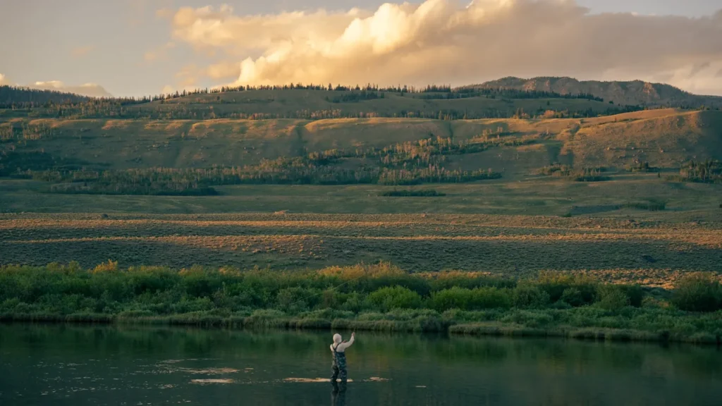
The photo at the top of this page is not Arkansas River.
It is a regional stand-in, honestly captioned but generic — we will not put a name to a river we cannot prove. Send us a photograph you took here and it replaces the stand-in, with your credit on it.
Pioneer badgeUnclaimed
Add a photo of this water
Landscape, not fish — the water itself. Reviewed by hand before it appears. The first one published here earns the Pioneer badge.
Fished this water? Add a photo
Reviewed by hand before it appears. Pick the water, not the spot — we never publish exact locations.
Access
Hayden Meadows and Leadville: the upper river, small water and cutthroat.
Granite and Clear Creek confluence: upper canyon access along Highway 24.
Buena Vista and Fisherman's Bridge: town access and popular float launches.
Nathrop and Ruby Mountain: access near the gauge and the Browns Canyon put-in.
Browns Canyon National Monument: the classic float, class III whitewater and good fishing.
Stone Bridge and Salida: mid-river ramps and town water.
Rincon and Parkdale: lower river access toward the Royal Gorge.
Seasons
Year-round on most of the river.
April and May: the caddis hatch moving upstream, the signature event of the season.
June: runoff, high water and peak rafting; fish the edges or wait.
July through October: hoppers and terrestrials, dropping flows in September, the best brown trout fishing in October.
From the water
No logged trips yet. Be the first to put this water on your map.
Log this water
Fished it or cleaned it? Log in or create a free account to log a trip with photos and earn the waterway badge.
Questions
What species can you catch on the Arkansas River?
Anglers target Brown Trout, Cutthroat Trout, Mountain Whitefish, Rainbow Trout on the Arkansas River in Colorado.
Are there fishing guides on the Arkansas River?
GuidedFloats lists 4 guides and outfitters on the Arkansas River. Claimed profiles accept booking requests; unclaimed profiles are built from public records and link to the business.
Where can you access the Arkansas River?
Hayden Meadows and Leadville: the upper river, small water and cutthroat. Granite and Clear Creek confluence: upper canyon access along Highway 24. Buena Vista and Fisherman's Bridge: town access and popular float launches. Nathrop and Ruby Mountain: access near the gauge and the Browns Canyon put-in. Browns Canyon National Monument: the classic float, class III whitewater and good fishing. Stone Bridge and Salida: mid-river ramps and town water. Rincon and Parkdale: lower river access toward the Royal Gorge.
When is the best time to fish the Arkansas River?
Year-round on most of the river. April and May: the caddis hatch moving upstream, the signature event of the season. June: runoff, high water and peak rafting; fish the edges or wait. July through October: hoppers and terrestrials, dropping flows in September, the best brown trout fishing in October.
Where are the fishing regulations for the Arkansas River?
Regulations change by season and section. Read the current rules on the Colorado agency site: https://cpw.state.co.us/rules-and-regulations