Fishes Jackson Lake
Reservoir · Northwestern Wyoming, Teton County, the Snake River reservoir inside Grand Teton National Park · Wyoming
Jackson Lake Fishing Guides
A large natural lake raised by a dam inside Grand Teton National Park, holding big lake trout and Snake River cutthroat beneath the Teton range.
Map of the Jackson Lake
15 numbered points: 4 access points, 5 campsites, 1 bait & fly shop, 1 outfitter, 1 park or conservation area, 1 agency office, 1 hazard, 1 USGS gauge. Tap a marker for details. Reviewed Sep 23, 2026.
- Access / boat ramp (4)
- Campsite (5)
- Bait, tackle & fly shop (1)
- Outfitter / canoe rental (1)
- Park / conservation area (1)
- Agency / conservation office (1)
- Dam / hazard (1)
- USGS gauge (1)
Map data © OpenStreetMap contributors. Points are curated from OpenStreetMap and state agency sources; confirm access and hours before you go.
Print it. Bag it. Bring it.Phones die, screens crack, and most of this water has no signal. Print this map, fold it into a zip-top bag or dry bag with your license, and you have a backup your electronics can’t give you. Every marker is numbered so you can say exactly where you are.
Open the printable mapAll 15 points on this map
| # | Point | Type | Lat, Lon | Notes |
|---|---|---|---|---|
| 1 | Lizard Creek Campground Boat Launch NPS · north end of the lake | Access / boat ramp | 44.00140, -110.69156 | Shoreline launch at the head of Jackson Lake, on the Lizard Creek Campground road. OSM maps it as an unnamed slipway; a reverse geocode names the road it stands on. Not one of the four sites the Park Service lists for boat-trailer parking. |
| 2 | Lizard Creek Campground National Park Service · east shore | Campsite | 44.00275, -110.68835 | The most remote of the three Jackson Lake campgrounds, at the north end. OSM maps no campground boundary here, so this point sits on the campground's own named road, 45 m from the water. |
| 3 | Sargent's Bay Picnic Area NPS · above Sargents Bay | Park / conservation area | 43.93731, -110.63017 | Roadside picnic area on the highway above Sargents Bay, 0.74 km back from the shoreline — the only developed stop between Leeks Marina and Lizard Creek. |
| 4 | Leeks Marina NPS concession · trailer launch and buoys | Access / boat ramp | 43.93002, -110.64053 | One of the four Park Service boat-trailer parking locations on Jackson Lake, with buoy moorage. Leeks Pizzeria is the only concession here and nothing published for it mentions tackle or bait; day buoys are sold at Signal Marina only. |
| 5 | Colter Bay RV Park Grand Teton Lodge Company · full hook-ups | Campsite | 43.90568, -110.64393 | RV sites behind Colter Bay Village, a few minutes' walk from the marina and the boat launch. |
| 6 | Colter Bay Visitor Center National Park Service · on the lakeshore | Agency / conservation office | 43.90317, -110.64369 | Sits on the shore at Colter Bay and sells boat permits, backcountry permits and park entrance passes. Open daily from late spring to mid-autumn. |
| 7 | Colter Bay Campground National Park Service · Colter Bay Village | Campsite | 43.90468, -110.63541 | OSM leaves this campground polygon unnamed; it is identified by position and by elimination against the Park Service's own list, which names a Campground, an RV Park and a Tent Village at Colter Bay and nothing else. |
| 8 | Colter Bay Tent Village Grand Teton Lodge Company · tent cabins | Campsite | 43.90344, -110.63907 | Canvas-and-log tent cabins beside the campground, the cheapest roof at Colter Bay. |
| 9 | Colter Bay Marina Store Grand Teton Lodge Company · licences and tackle | Bait, tackle & fly shop | 43.90184, -110.64396 | The only place on Jackson Lake whose operator publishes fishing tackle and Wyoming licence sales, and the departure point for guided fishing and boat rentals. The 2026 marina season closed early, in July — ring ahead. |
| 10 | Colter Bay Boat Launch NPS · trailer launch, Colter Bay | Access / boat ramp | 43.90068, -110.64273 | The lake's busiest ramp, sheltered inside Colter Bay beside the marina. One of the four Park Service boat-trailer parking locations. |
| 11 | Jackson Lake Dam Bureau of Reclamation · lake outlet | Dam / hazard | 43.86330, -110.59195 | The dam at the lake's south-east corner. Floating is prohibited within 1,000 ft of it, and the Snake River put-in just below it is a river access rather than a lake ramp. |
| 12 | USGS gauge 13010500 — Snake River at Moran Outflow gauge at Jackson Lake Dam | USGS gauge | 43.85778, -110.59028 | The lake's outflow gauge, at the dam. OSM carries a second USGS station 0.37 km east tagged ref 13011000; this sheet uses the site the water page links. |
| 13 | Signal Mountain Marina Aramark concession · guided trips and boat hire | Outfitter / canoe rental | 43.84391, -110.61174 | Guided lake fishing and fishing-boat rental, tackle found by the guide. Day and seasonal buoys are sold here. The 2026 fishing and rental season ran 16 May to 7 September. |
| 14 | Signal Mountain Campground National Park Service · south-east shore | Campsite | 43.84123, -110.61413 | On the lakeshore beside the lodge and marina, the closest campground to the dam and to the Snake River below it. |
| 15 | Signal Mountain Boat Ramp NPS · CLOSED per the 8 Sep 2026 notice | Access / boat ramp | 43.83865, -110.61688 | The Park Service's alert of 8 September 2026 lists this ramp as closed — check before hauling a trailer. Trailer parking is in the marina lot above it. |
Guides on the Jackson Lake
Claimed profiles take booking requests. Unclaimed profiles are built from public records so the river is never empty; the guide can claim or remove one any time.
About the Jackson Lake
Jackson Lake lies at the foot of the Teton range inside Grand Teton National Park, and it is one of the more spectacular places in North America to put a line in the water. It began as a natural glacial lake and was enlarged by Jackson Lake Dam on the Snake River, so it is a reservoir in the technical sense while retaining the depth, cold and character of a natural mountain lake. It reaches over four hundred feet deep, which is what allows it to hold the fishery it does.
Lake trout are the signature fish and the reason serious anglers come. They grow large here, living deep through the summer and coming within reach of shore and shallower trolling in the weeks after ice-out and again in autumn as they move toward spawning structure. Snake River fine-spotted cutthroat trout, the native subspecies of this drainage, are the other prize, working the shorelines, the inlets and the drop-offs, and they are the fish most fly anglers are after. Brown trout are present, and mountain whitefish are abundant and underappreciated.
Because the lake sits inside a national park, the rules are layered. Wyoming fishing regulations apply alongside park-specific rules, the lake closes to fishing for a period in the autumn to protect spawning lake trout, and there are restrictions on boating, bait and aquatic invasive species inspections. Checking both the state regulations and the park’s current fishing rules before a trip is essential rather than advisable.
The gauge reads lake elevation, and the level drops substantially through summer as water is released for downstream irrigation, which affects ramps and shoreline access. Colter Bay and Signal Mountain have marinas, and Moran and Jackson supply everything else.
This water needs a real photo
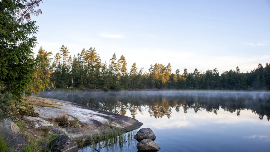
The photo at the top of this page is not Jackson Lake.
It is a regional stand-in, honestly captioned but generic — we will not put a name to a river we cannot prove. Send us a photograph you took here and it replaces the stand-in, with your credit on it.
Pioneer badgeUnclaimed
Add a photo of this water
Landscape, not fish — the water itself. Reviewed by hand before it appears. The first one published here earns the Pioneer badge.
Pool right now
6,734.22ft
- 24 hours+0.02 ft → steady
Reading taken 2h ago at USGS 13010500, Jackson Lake near Moran, WY. Elevation is the surface of the lake above the survey datum, not depth. Source.
Fished this water? Add a photo
Reviewed by hand before it appears. Pick the water, not the spot — we never publish exact locations.
Access
Colter Bay - a park marina and village with a ramp, lodging, camping and supplies.
Signal Mountain - a park marina and lodge on the southern shore with a boat ramp.
Moran - the small community near the dam at the lake outlet.
Jackson Lake Dam - the dam and gauge at the Snake River outlet.
Snake River - the river below the dam, a celebrated cutthroat float fishery.
Jackson - the regional town south of the park with full services and fly shops.
Leeks Marina - a smaller marina on the eastern shore of the lake.
Seasons
Spring: ice comes off late and lake trout are within reach of shore and shallow trolling.
Summer: lake trout hold deep while cutthroat work the shorelines and inlets.
Fall: lake trout move shallow toward spawning water, and a park closure protects them.
Winter: the lake freezes and ice fishing is permitted under park and state rules.
From the water
No logged trips yet. Be the first to put this water on your map.
Log this water
Fished it or cleaned it? Log in or create a free account to log a trip with photos and earn the waterway badge.
Questions
What species can you catch on the Jackson Lake?
Anglers target Brown Trout, Cutthroat Trout, Lake Trout, Mountain Whitefish, Utah Chub on the Jackson Lake in Wyoming.
Are there fishing guides on the Jackson Lake?
GuidedFloats lists 2 guides and outfitters on the Jackson Lake. Claimed profiles accept booking requests; unclaimed profiles are built from public records and link to the business.
Where can you access the Jackson Lake?
Colter Bay - a park marina and village with a ramp, lodging, camping and supplies. Signal Mountain - a park marina and lodge on the southern shore with a boat ramp. Moran - the small community near the dam at the lake outlet. Jackson Lake Dam - the dam and gauge at the Snake River outlet. Snake River - the river below the dam, a celebrated cutthroat float fishery. Jackson - the regional town south of the park with full services and fly shops. Leeks Marina - a smaller marina on the eastern shore of the lake.
When is the best time to fish the Jackson Lake?
Spring: ice comes off late and lake trout are within reach of shore and shallow trolling. Summer: lake trout hold deep while cutthroat work the shorelines and inlets. Fall: lake trout move shallow toward spawning water, and a park closure protects them. Winter: the lake freezes and ice fishing is permitted under park and state rules.
Where are the fishing regulations for the Jackson Lake?
Regulations change by season and section. Read the current rules on the Wyoming agency site: https://wgfd.wyo.gov/regulations