Fishes Beaver Lake
Reservoir · Ozarks · Arkansas
Beaver Lake Fishing Guides
The uppermost of the White River impoundments, 28,299 acres of clear Ozark highland water above Rogers, and one of the best striped bass fisheries in the mid-South.
Map of the Beaver Lake
23 numbered points: 15 access points, 3 campsites, 2 parks and conservation areas, 1 agency office, 1 hazard, 1 USGS gauge. Tap a marker for details. Reviewed Sep 23, 2026.
- Access / boat ramp (15)
- Campsite (3)
- Park / conservation area (2)
- Agency / conservation office (1)
- Dam / hazard (1)
- USGS gauge (1)
Map data © OpenStreetMap contributors. Points are curated from OpenStreetMap and state agency sources; confirm access and hours before you go.
Print it. Bag it. Bring it.Phones die, screens crack, and most of this water has no signal. Print this map, fold it into a zip-top bag or dry bag with your license, and you have a backup your electronics can’t give you. Every marker is numbered so you can say exactly where you are.
Open the printable mapAll 23 points on this map
| # | Point | Type | Lat, Lon | Notes |
|---|---|---|---|---|
| 1 | Beaver Dam USACE · White River | Dam / hazard | 36.42568, -93.84726 | Concrete gravity-arch dam that forms the lake; National Inventory of Dams AR00174. The tailwater below it is a different fishery from the lake above. |
| 2 | USGS gauge — White River at Beaver Dam USGS · at the dam | USGS gauge | 36.42128, -93.84762 | Lake level and dam release. The water page carries no USGS link; this point sits on the roster coordinate, which an OSM monitoring-station node of the same name confirms to within about 55 m. |
| 3 | Boat ramp at County Road 113 County Road 113, Carroll County | Access / boat ramp | 36.42070, -93.85643 | Unnamed ramp about 1.5 km around the shore from the dam, on the Carroll County side. OSM maps the slipway but not its operator; the road is the only identifier. |
| 4 | Starkey Park Starkey Park Road · Starkey Marina | Access / boat ramp | 36.39276, -93.88315 | Park and marina on the White River arm above the dam; the Corps lists Starkey Marina at 4022 Mundell Road. Point is the lakeward end of Starkey Park Road. |
| 5 | Hobbs State Park–Conservation Area Visitor Center Arkansas State Parks · AR 12 | Agency / conservation office | 36.28495, -93.93881 | Visitor center and ranger station for the 12,000-acre conservation area that fronts the lake's south shore; about 1.9 km back from the water. |
| 6 | Hobbs State Park boat-in campsites (Sites 1–5) Arkansas State Parks · boat-in only | Campsite | 36.30373, -93.94414 | Five designated primitive sites on one shoreline stretch, reachable by boat. Reservation required and no dispersed camping; point is the centre of the group, not one site. |
| 7 | Twin Coves boat ramp Twin Coves Resort Road | Access / boat ramp | 36.32827, -93.91499 | Ramp on the south shore in the Green Acres area. The slipway carries no name in OSM; the access road is what identifies it. |
| 8 | Ugly John's Rocky Branch Marina 8872 Rocky Branch Marina Road, Rogers | Access / boat ramp | 36.33926, -93.93187 | Concession marina in the Rocky Branch park area. Point is the lakeward end of Rocky Branch Marina Road, the address the Corps publishes. |
| 9 | Rocky Branch Park boat ramp USACE · Rocky Branch | Access / boat ramp | 36.34323, -93.93543 | Main ramp for the Corps' Rocky Branch park and campground. Two further unnamed ramp lanes are mapped nearby, at 36.3333/-93.9374 and 36.3338/-93.9403. |
| 10 | War Eagle Marina 23151 War Eagle Marina Road, Springdale | Access / boat ramp | 36.21954, -94.01923 | Concession marina on the War Eagle arm. Point is the lakeward end of War Eagle Marina Drive. |
| 11 | War Eagle Park USACE · swim beach | Park / conservation area | 36.21806, -94.01527 | Corps park and swim beach at the mouth of the War Eagle arm. Point is the lakeward end of War Eagle Park Road. |
| 12 | Blue Springs RV Park private · War Eagle arm | Campsite | 36.17063, -94.00263 | Private RV campground about 0.8 km back from the upper War Eagle arm — the only non-Corps camping mapped on this lake. |
| 13 | Boat ramp at Boat Ramp Road Boat Ramp Road, Benton County | Access / boat ramp | 36.16532, -94.01427 | Upper War Eagle arm ramp. No slipway is mapped here and no agency claims it in OSM; the road name is the whole of the identification. |
| 14 | Fords Rock Landing Fords Rock Landing road | Access / boat ramp | 36.23949, -94.02346 | Landing on the main lake below Hickory Creek. Named road, unnamed ramp; point is the road's lakeward end. |
| 15 | Hickory Creek Park ramp and marina 12737 Hickory Creek Road, Lowell | Access / boat ramp | 36.24382, -94.03057 | Corps park with a swim beach, campground, ramp and concession marina at the lake's south end — the closest access to Springdale and Lowell. A second slipway 0.3 km along Shore Drive is the same facility. |
| 16 | Hickory Creek Park campground USACE · Hickory Creek | Campsite | 36.24244, -94.03447 | Corps campground beside the Hickory Creek ramp and swim beach. |
| 17 | Horseshoe Bend Marina 16168 Hwy 94 East, Rogers | Access / boat ramp | 36.29199, -94.02227 | Concession marina inside the Corps' Horseshoe Bend park, which also has a campground, day-use area and swim beach. |
| 18 | Boat ramp at AR 12 AR 12 · Prairie Creek | Access / boat ramp | 36.33245, -94.02133 | Ramp beside the Highway 12 crossing. The slipway is unnamed in OSM and the reverse geocode returns only the highway and the Prairie Creek locality. |
| 19 | Prairie Creek Park and Campgrounds USACE · swim beach and camping | Park / conservation area | 36.35202, -94.05305 | Corps park on the north-west shore with camping, a swim beach and day-use areas; the marina is next door. |
| 20 | Prairie Creek Marina 1 Prairie Creek Marina Drive, Rogers | Access / boat ramp | 36.35455, -94.05062 | Concession marina beside Prairie Creek Park. Point is the lakeward end of Prairie Creek Marina Drive. |
| 21 | Fox Hollow Road boat ramp Fox Hollow Road, Benton County | Access / boat ramp | 36.35467, -93.98524 | Ramp on the north shore between Prairie Creek and Rocky Branch. Unnamed slipway; the road is the only identifier. |
| 22 | Lost Bridge North — ramp and marina 12861 Marina Road, Garfield | Access / boat ramp | 36.41358, -93.89451 | Corps park with a swim beach and campground plus Lost Bridge Marina, on the upper main lake near Garfield. Ramp and marina are 50 m apart and ship as one point. |
| 23 | Indian Creek boat ramp Indian Creek Road · USACE | Access / boat ramp | 36.41954, -93.88557 | Ramp on Indian Creek Road serving the Corps' Indian Creek park, which the Corps lists among its swim beaches and whose gatehouse it names. |
Guides on the Beaver Lake
Claimed profiles take booking requests. Unclaimed profiles are built from public records so the river is never empty; the guide can claim or remove one any time.
About the Beaver Lake
Beaver Lake is the first of the great White River impoundments, a 28,299-acre Corps of Engineers reservoir with roughly 490 miles of shoreline folded into the limestone hills above Rogers and Springdale. It is a highland lake in the truest sense: steep timbered banks, bluff walls that drop straight into deep water, long tapering points, and a clarity that runs from stained in the upper river arms to gin-clear down by the dam. That gradient is the single most useful thing to understand about the lake, because it is what decides where a given species is catchable in a given month.
Anglers come for the striped bass first. Beaver holds a genuinely strong striper population that lives out over open water for much of the year and follows shad, and a good day here means covered water, live bait, and electronics rather than banks. Behind the stripers is a full slate of black bass. Largemouth are thickest in the upper end where there is more wood and stain, smallmouth prefer the clear rock down the lake, and spotted bass are everywhere in between and account for a large share of the numbers. White bass run up the War Eagle and White River arms in spring in the kind of concentrations that make an afternoon memorable. Walleye are the quiet local specialty, taken on the same spring runs and again by trolling deeper water through summer.
Crappie, bluegill and catfish round the lake out, with brush piles and standing timber holding the panfish and the river channels holding the blue and flathead catfish.
Because Beaver is a flood-control project, the pool moves. The Corps carries it near a summer conservation level and works it down through autumn, and a foot or two of change resets where fish sit on a point. The live pool reading on this page is the number to check before you launch.
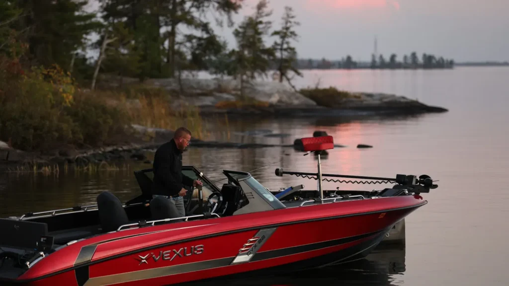
This water needs a real photo
The photo at the top of this page is not Beaver Lake.
It is a regional stand-in, honestly captioned but generic — we will not put a name to a river we cannot prove. Send us a photograph you took here and it replaces the stand-in, with your credit on it.
Pioneer badgeUnclaimed
Add a photo of this water
Landscape, not fish — the water itself. Reviewed by hand before it appears. The first one published here earns the Pioneer badge.
Pool right now
1,112.31ft NGVD29
- 24 hours-0.11 ft ↓ falling
- Storage1,444,954 acre-ft
- Water temperature50 F
- For the dateA little below normal for the date
Reading taken 2h ago at the US Army Corps of Engineers gauge at Beaver Dam (SWL). Elevation is the surface of the lake above the survey datum, not depth. Source.
Fished this water? Add a photo
Reviewed by hand before it appears. Pick the water, not the spot — we never publish exact locations.
Access
Eleven Corps of Engineers parks ring the lake, with 677 developed campsites between them; sites are booked through Recreation.gov.
Prairie Creek, Hickory Creek, Horseshoe Bend, Rocky Branch, Lost Bridge North, War Eagle and Dam Site are the main public ramp and day-use complexes.
Full-service marinas at Prairie Creek, Hickory Creek, Horseshoe Bend, Lost Bridge, Rocky Branch, Starkey and War Eagle sell fuel, rent slips and rent boats.
The nearest tackle, lodging and airport are all in the Rogers and Bentonville corridor, twenty minutes from most ramps.
Ramps at the upper end can be short of water at low pool; the ramps nearer the dam stay usable across the operating range.
Corps swim beaches have no lifeguards, and there are boat exclusion buoys around each of them.
Beaver Lake Project Office, Rogers, 479.636.1210, for closures, shoreline permits and current ramp status.
Seasons
Spring: white bass and walleye push into the War Eagle and White River arms; black bass move shallow as the water warms through the upper 50s.
Summer: stripers and white bass work open water over the main lake, best early and late; black bass hold deep on points and bluff ends.
Autumn: shad move into the creeks and the whole lake follows them, which is the most reliable topwater and jerkbait window of the year.
Winter: the lake clears further, spotted and smallmouth bass feed on deep rock, and stripers concentrate in the lower third.
From the water
No logged trips yet. Be the first to put this water on your map.
Log this water
Fished it or cleaned it? Log in or create a free account to log a trip with photos and earn the waterway badge.
Questions
What species can you catch on the Beaver Lake?
Anglers target Black Crappie, Blue Catfish, Bluegill, Channel Catfish, Flathead Catfish, Largemouth Bass, Smallmouth Bass, Spotted Bass, Striped Bass, Walleye, White Bass, White Crappie on the Beaver Lake in Arkansas.
Are there fishing guides on the Beaver Lake?
GuidedFloats lists 1 guide and outfitters on the Beaver Lake. Claimed profiles accept booking requests; unclaimed profiles are built from public records and link to the business.
Where can you access the Beaver Lake?
Eleven Corps of Engineers parks ring the lake, with 677 developed campsites between them; sites are booked through Recreation.gov. Prairie Creek, Hickory Creek, Horseshoe Bend, Rocky Branch, Lost Bridge North, War Eagle and Dam Site are the main public ramp and day-use complexes. Full-service marinas at Prairie Creek, Hickory Creek, Horseshoe Bend, Lost Bridge, Rocky Branch, Starkey and War Eagle sell fuel, rent slips and rent boats. The nearest tackle, lodging and airport are all in the Rogers and Bentonville corridor, twenty minutes from most ramps. Ramps at the upper end can be short of wat...
When is the best time to fish the Beaver Lake?
Spring: white bass and walleye push into the War Eagle and White River arms; black bass move shallow as the water warms through the upper 50s. Summer: stripers and white bass work open water over the main lake, best early and late; black bass hold deep on points and bluff ends. Autumn: shad move into the creeks and the whole lake follows them, which is the most reliable topwater and jerkbait window of the year. Winter: the lake clears further, spotted and smallmouth bass feed on deep rock, and stripers concentrate in the lower third.
Where are the fishing regulations for the Beaver Lake?
Regulations change by season and section. Read the current rules on the Arkansas agency site: https://www.agfc.com/regulations/general-fishing-regulations/